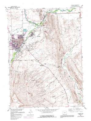
Lander Topo Map Wyoming
To zoom in, hover over the map of Lander
USGS Topo Quad 42108g6 - 1:24,000 scale
| Topo Map Name: | Lander |
| USGS Topo Quad ID: | 42108g6 |
| Print Size: | ca. 21 1/4" wide x 27" high |
| Southeast Coordinates: | 42.75° N latitude / 108.625° W longitude |
| Map Center Coordinates: | 42.8125° N latitude / 108.6875° W longitude |
| U.S. State: | WY |
| Filename: | o42108g6.jpg |
| Download Map JPG Image: | Lander topo map 1:24,000 scale |
| Map Type: | Topographic |
| Topo Series: | 7.5´ |
| Map Scale: | 1:24,000 |
| Source of Map Images: | United States Geological Survey (USGS) |
| Alternate Map Versions: |
Lander WY 1952, updated 1954 Download PDF Buy paper map Lander WY 1960, updated 1961 Download PDF Buy paper map Lander WY 1960, updated 1975 Download PDF Buy paper map Lander WY 1960, updated 1991 Download PDF Buy paper map Lander WY 1978, updated 1991 Download PDF Buy paper map Lander WY 2012 Download PDF Buy paper map Lander WY 2015 Download PDF Buy paper map |
1:24,000 Topo Quads surrounding Lander
> Back to 42108e1 at 1:100,000 scale
> Back to 42108a1 at 1:250,000 scale
> Back to U.S. Topo Maps home
Lander topo map: Gazetteer
Lander: Airports
Hunt Field elevation 1701m 5580′Lander: Canals
Cemetery Ditch elevation 1648m 5406′Dutch Flat Extension elevation 1668m 5472′
Flat Ditch elevation 1670m 5479′
Grant Young Ditch elevation 1583m 5193′
Nicol Table Mountain Ditch elevation 1750m 5741′
Paralda Ditch elevation 1721m 5646′
Table Mountain Ditch elevation 1748m 5734′
Table Mountain Ditch Extension elevation 1721m 5646′
Taylor Ditch elevation 1634m 5360′
Taylor Ditch Extension elevation 1611m 5285′
Lander: Gaps
Batrum Gap elevation 1610m 5282′Lander: Mines
Lander Area Number One Mine elevation 1649m 5410′Lander: Oilfields
Lander Hudson Oil Field elevation 1664m 5459′Lander: Parks
Fort McGraw elevation 1599m 5246′Lander: Populated Places
Lander elevation 1632m 5354′Wyopo elevation 1600m 5249′
Lander: Springs
Iron Spring elevation 1733m 5685′Lander: Streams
Baldwin Creek elevation 1600m 5249′Dickinson Creek elevation 1615m 5298′
Hornecker Creek elevation 1676m 5498′
Iiams Creek elevation 1603m 5259′
Little Dickinson Creek elevation 1608m 5275′
Middle Popo Agie River elevation 1598m 5242′
North Popo Agie River elevation 1598m 5242′
Smith Creek elevation 1601m 5252′
Squaw Creek elevation 1621m 5318′
Willow Creek elevation 1616m 5301′
Lander: Summits
Table Mountain elevation 2229m 7312′Lander: Valleys
Anesi Draw elevation 1634m 5360′Brynt Draw elevation 1620m 5314′
Chittim Gulch elevation 1605m 5265′
Coal Gulch elevation 1618m 5308′
Deadman Gulch elevation 1632m 5354′
Robinson Gulch elevation 1611m 5285′
Tonys Gulch elevation 1616m 5301′
Lander digital topo map on disk
Buy this Lander topo map showing relief, roads, GPS coordinates and other geographical features, as a high-resolution digital map file on DVD:


