Campbell Ridge Topo Map Wyoming
To zoom in, hover over the map of Campbell Ridge
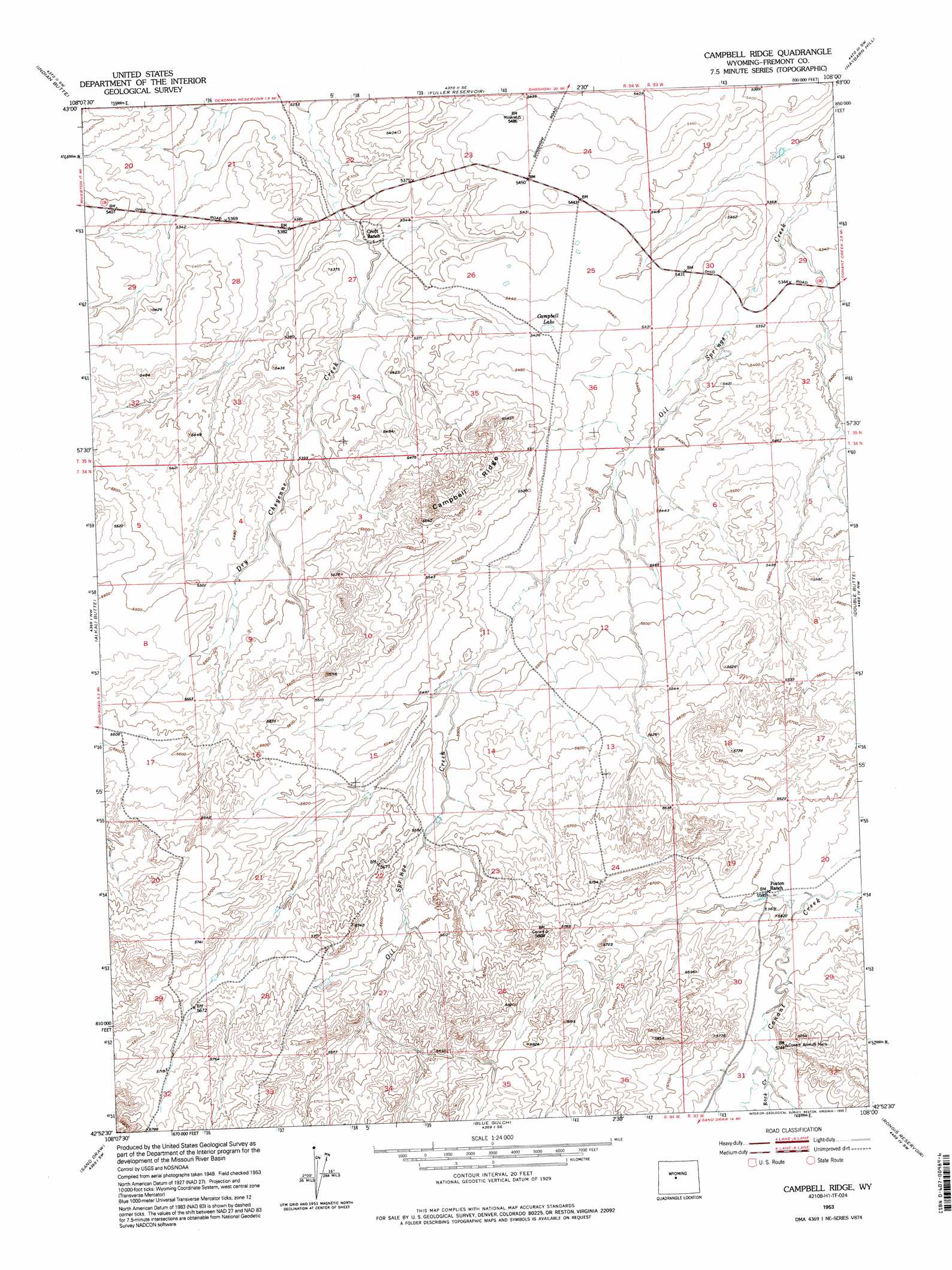
USGS Topo Quad 42108h1 - 1:24,000 scale
| Topo Map Name: | Campbell Ridge |
| USGS Topo Quad ID: | 42108h1 |
| Print Size: | ca. 21 1/4" wide x 27" high |
| Southeast Coordinates: | 42.875° N latitude / 108° W longitude |
| Map Center Coordinates: | 42.9375° N latitude / 108.0625° W longitude |
| U.S. State: | WY |
| Filename: | o42108h1.jpg |
| Download Map JPG Image: | Campbell Ridge topo map 1:24,000 scale |
| Map Type: | Topographic |
| Topo Series: | 7.5´ |
| Map Scale: | 1:24,000 |
| Source of Map Images: | United States Geological Survey (USGS) |
| Alternate Map Versions: |
Campbell Ridge WY 1953, updated 1954 Download PDF Buy paper map Campbell Ridge WY 1953, updated 1975 Download PDF Buy paper map Campbell Ridge WY 1953, updated 1995 Download PDF Buy paper map Campbell Ridge WY 2012 Download PDF Buy paper map Campbell Ridge WY 2015 Download PDF Buy paper map |
1:24,000 Topo Quads surrounding Campbell Ridge
Riverton Ne |
Hidden Valley |
Shoshoni |
Ocla Draw |
Squaw Butte Ne |
Riverton East |
Indian Butte |
Fuller Reservoir |
Haybarn Hill |
Squaw Butte |
Arapahoe Ne |
Alkali Butte |
Campbell Ridge |
Double Butte |
Butte Well |
Bringolf Ranch |
Sand Draw |
Blue Gulch |
Rongis Reservoir |
Rongis Reservoir Se |
Yellowstone Ranch |
Dishpan Butte |
Elkhorn Springs |
Tin Cup Mountain |
Muskrat Basin |
> Back to 42108e1 at 1:100,000 scale
> Back to 42108a1 at 1:250,000 scale
> Back to U.S. Topo Maps home
Campbell Ridge topo map: Gazetteer
Campbell Ridge: Lakes
Campbell Lake elevation 1658m 5439′Campbell Ridge: Ridges
Campbell Ridge elevation 1716m 5629′Campbell Ridge: Streams
Rock Creek elevation 1714m 5623′Campbell Ridge digital topo map on disk
Buy this Campbell Ridge topo map showing relief, roads, GPS coordinates and other geographical features, as a high-resolution digital map file on DVD: