Lander Nw Topo Map Wyoming
To zoom in, hover over the map of Lander Nw
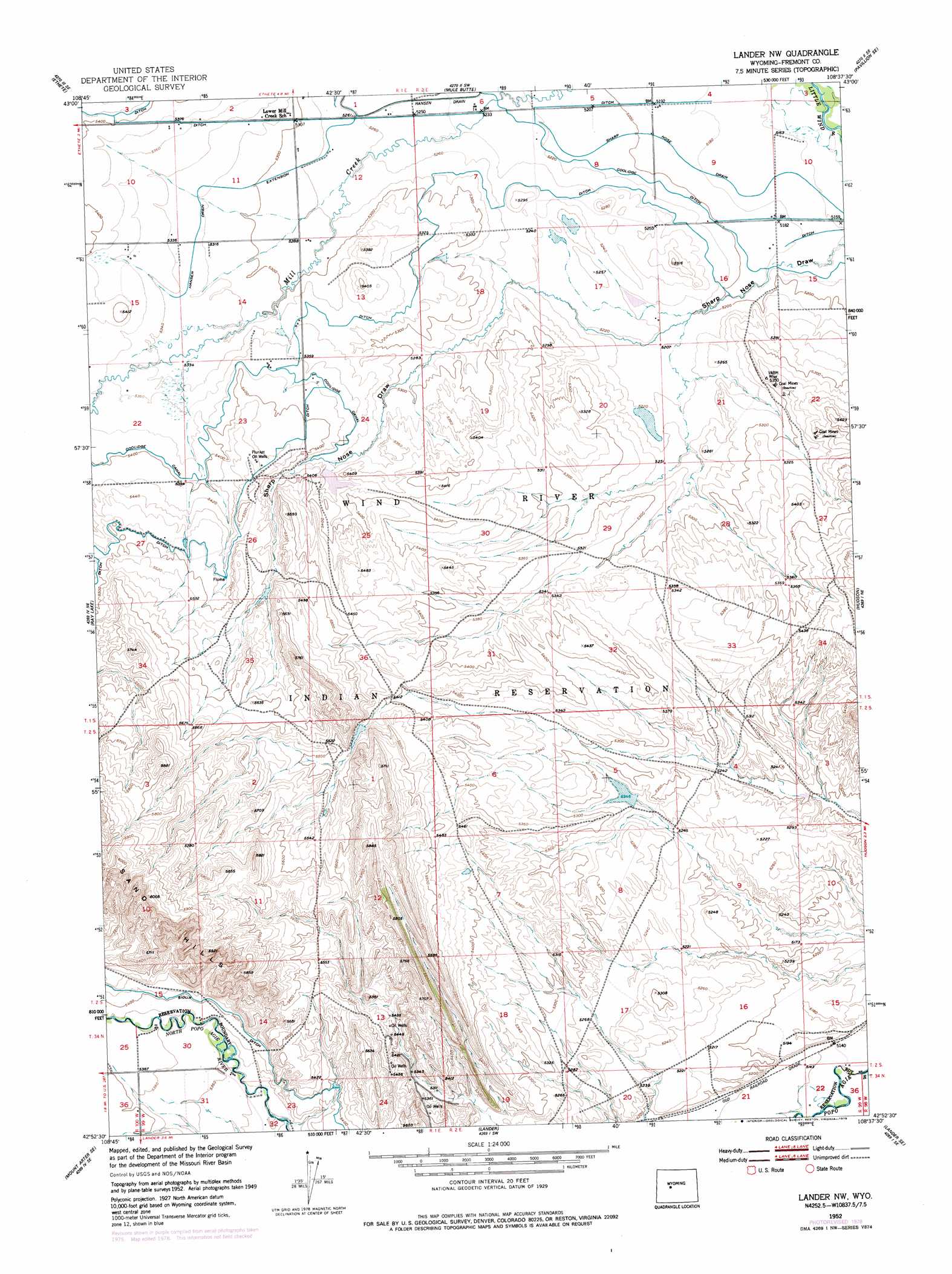
USGS Topo Quad 42108h6 - 1:24,000 scale
| Topo Map Name: | Lander Nw |
| USGS Topo Quad ID: | 42108h6 |
| Print Size: | ca. 21 1/4" wide x 27" high |
| Southeast Coordinates: | 42.875° N latitude / 108.625° W longitude |
| Map Center Coordinates: | 42.9375° N latitude / 108.6875° W longitude |
| U.S. State: | WY |
| Filename: | o42108h6.jpg |
| Download Map JPG Image: | Lander Nw topo map 1:24,000 scale |
| Map Type: | Topographic |
| Topo Series: | 7.5´ |
| Map Scale: | 1:24,000 |
| Source of Map Images: | United States Geological Survey (USGS) |
| Alternate Map Versions: |
Lander NW WY 1952, updated 1954 Download PDF Buy paper map Lander NW WY 1952, updated 1973 Download PDF Buy paper map Lander NW WY 1952, updated 1979 Download PDF Buy paper map Lander NW WY 2012 Download PDF Buy paper map Lander NW WY 2015 Download PDF Buy paper map |
1:24,000 Topo Quads surrounding Lander Nw
Argo Butte |
Morton |
Pavillion |
Ocean Lake |
Lost Wells Butte |
Fort Washakie |
Ethete |
Mule Butte |
Pavillion Se |
Riverton West |
Wind River |
Ray Lake |
Lander Nw |
Hudson |
Arapahoe |
Mount Arter |
Mount Arter Se |
Lander |
Lander Se |
Ninemile Hill |
Cony Mountain |
Fossil Hill |
Wolf Point |
Weiser Pass |
Del Monte Ridge |
> Back to 42108e1 at 1:100,000 scale
> Back to 42108a1 at 1:250,000 scale
> Back to U.S. Topo Maps home
Lander Nw topo map: Gazetteer
Lander Nw: Canals
Coolidge Ditch elevation 1587m 5206′Hansen Drain elevation 1598m 5242′
Hansen Drain Extension elevation 1624m 5328′
Sharp Nose Drain elevation 1583m 5193′
Sioux Ditch elevation 1650m 5413′
Lander Nw: Mines
Wypo Sand and Gravel Pit elevation 1635m 5364′Lander Nw: Ranges
Sand Hills elevation 1755m 5757′Lander Nw: Wells
Plunket Oil Wells elevation 1662m 5452′Lander Nw digital topo map on disk
Buy this Lander Nw topo map showing relief, roads, GPS coordinates and other geographical features, as a high-resolution digital map file on DVD: