Tule Butte Topo Map Wyoming
To zoom in, hover over the map of Tule Butte
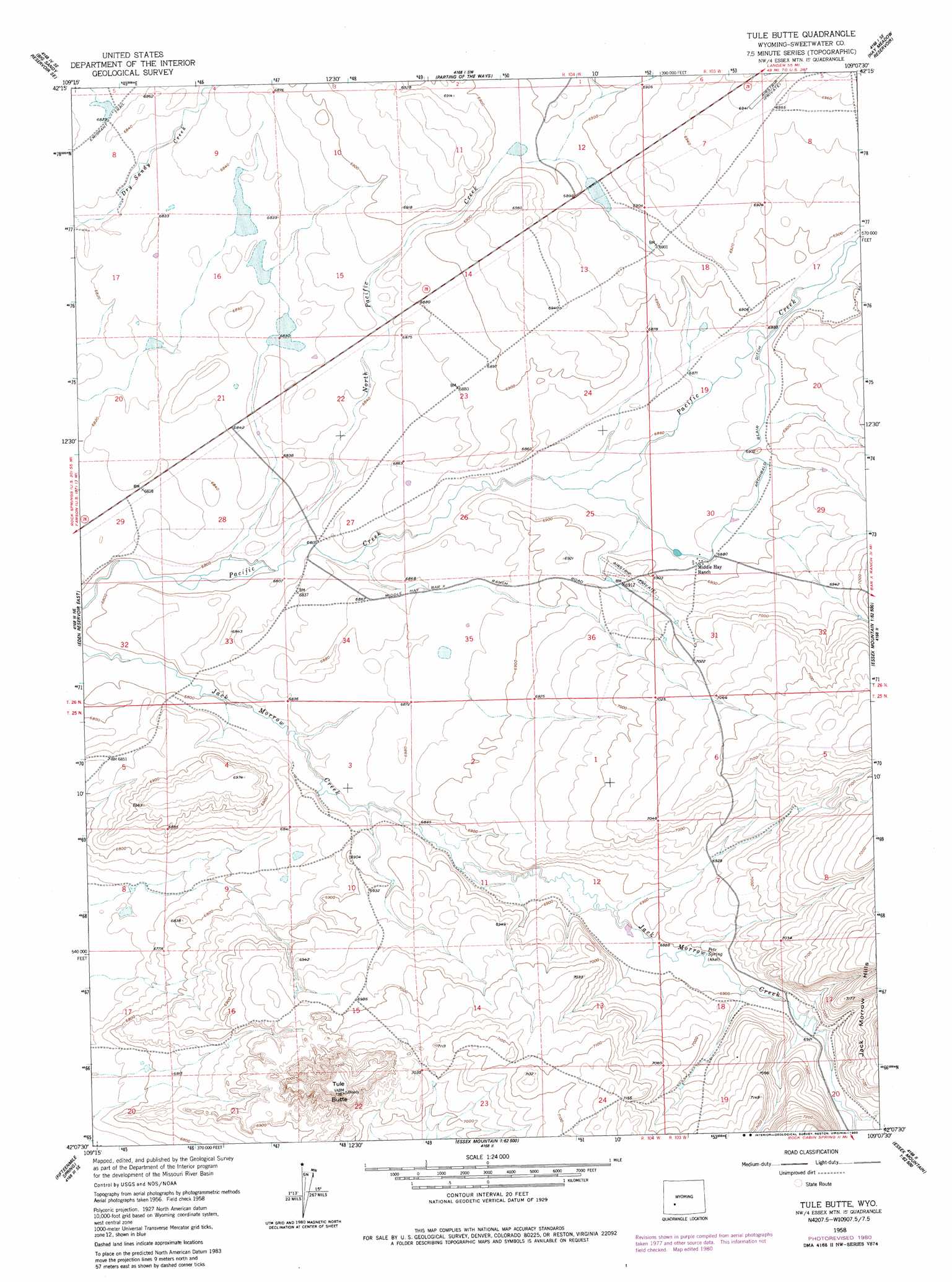
USGS Topo Quad 42109b2 - 1:24,000 scale
| Topo Map Name: | Tule Butte |
| USGS Topo Quad ID: | 42109b2 |
| Print Size: | ca. 21 1/4" wide x 27" high |
| Southeast Coordinates: | 42.125° N latitude / 109.125° W longitude |
| Map Center Coordinates: | 42.1875° N latitude / 109.1875° W longitude |
| U.S. State: | WY |
| Filename: | o42109b2.jpg |
| Download Map JPG Image: | Tule Butte topo map 1:24,000 scale |
| Map Type: | Topographic |
| Topo Series: | 7.5´ |
| Map Scale: | 1:24,000 |
| Source of Map Images: | United States Geological Survey (USGS) |
| Alternate Map Versions: |
Tule Butte WY 1958, updated 1960 Download PDF Buy paper map Tule Butte WY 1958, updated 1980 Download PDF Buy paper map Tule Butte WY 2012 Download PDF Buy paper map Tule Butte WY 2015 Download PDF Buy paper map |
1:24,000 Topo Quads surrounding Tule Butte
Tabernacle Butte |
Leckie Reservoir |
Prospect Mountains |
Halls Meadow Spring |
Anderson Ridge |
Big Sandy Reservoir |
Big Sandy Reservoir Se |
Parting Of The Ways |
Hay Meadow Reservoir |
Pacific Springs |
Eden Reservoir West |
Eden Reservoir East |
Tule Butte |
North Packsaddle Canyon |
Rock Cabin Spring |
Farson |
Fifteenmile Spring |
Ox Yoke Springs |
Essex Mountain |
Monument Ridge |
Clay Buttes |
White Rocks |
Boars Tusk |
North Table Mountain |
Steamboat Mountain |
> Back to 42109a1 at 1:100,000 scale
> Back to 42108a1 at 1:250,000 scale
> Back to U.S. Topo Maps home
Tule Butte topo map: Gazetteer
Tule Butte: Springs
Pete Spring elevation 2102m 6896′Tule Butte: Streams
North Pacific Creek elevation 2071m 6794′Tule Butte: Summits
Tule Butte elevation 2224m 7296′Tule Butte: Valleys
South Packsaddle Canyon elevation 2123m 6965′Tule Butte digital topo map on disk
Buy this Tule Butte topo map showing relief, roads, GPS coordinates and other geographical features, as a high-resolution digital map file on DVD: