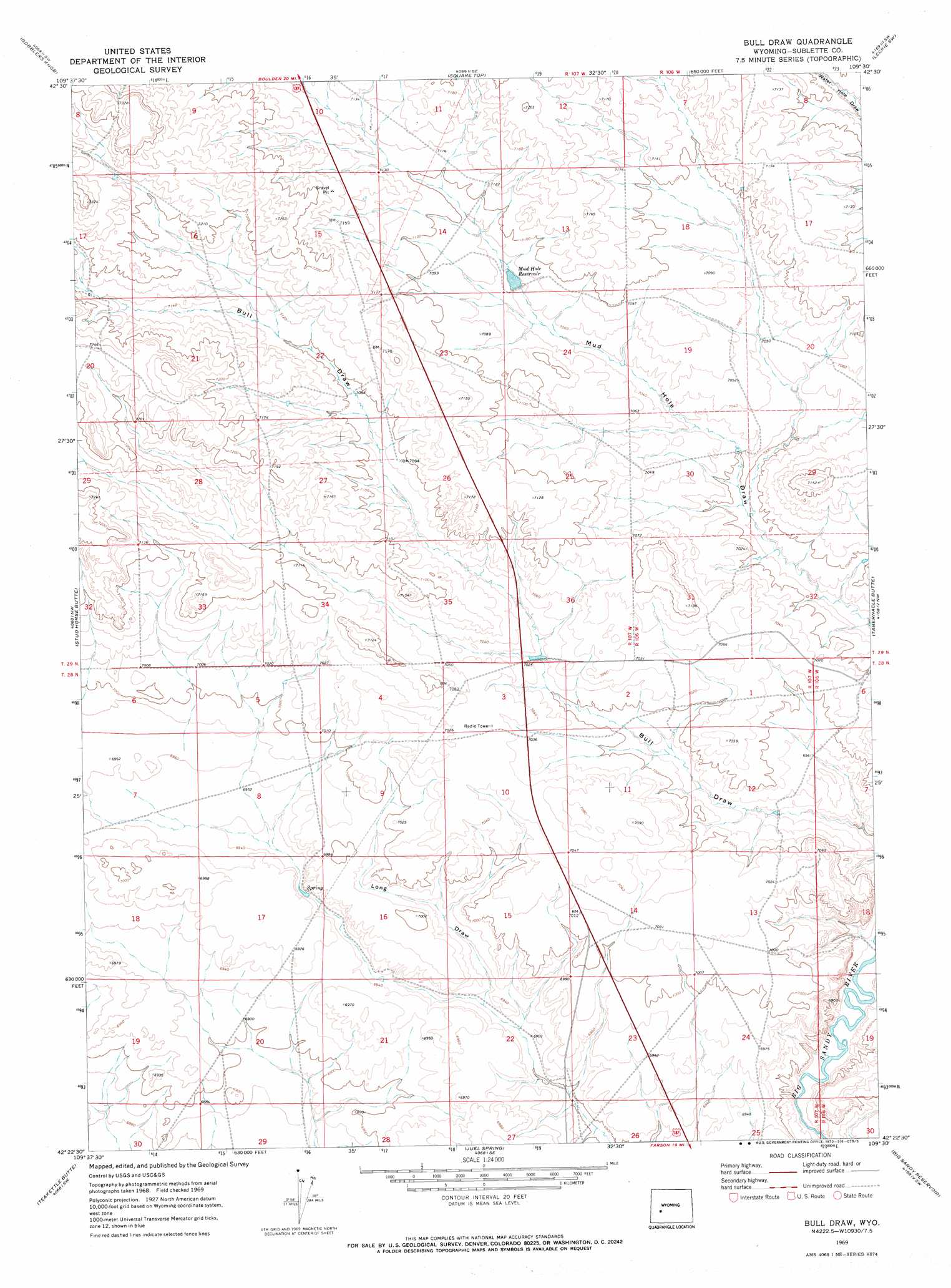
Bull Draw Topo Map Wyoming
To zoom in, hover over the map of Bull Draw
USGS Topo Quad 42109d5 - 1:24,000 scale
| Topo Map Name: | Bull Draw |
| USGS Topo Quad ID: | 42109d5 |
| Print Size: | ca. 21 1/4" wide x 27" high |
| Southeast Coordinates: | 42.375° N latitude / 109.5° W longitude |
| Map Center Coordinates: | 42.4375° N latitude / 109.5625° W longitude |
| U.S. State: | WY |
| Filename: | o42109d5.jpg |
| Download Map JPG Image: | Bull Draw topo map 1:24,000 scale |
| Map Type: | Topographic |
| Topo Series: | 7.5´ |
| Map Scale: | 1:24,000 |
| Source of Map Images: | United States Geological Survey (USGS) |
| Alternate Map Versions: |
Bull Draw WY 1969, updated 1973 Download PDF Buy paper map Bull Draw WY 1969, updated 1973 Download PDF Buy paper map Bull Draw WY 2012 Download PDF Buy paper map Bull Draw WY 2015 Download PDF Buy paper map |
1:24,000 Topo Quads surrounding Bull Draw
Two Buttes Reservoir |
Boulder |
Fremont Butte |
Pocket Creek Lake |
Big Sandy Opening |
Olsen Ranch |
Gobblers Knob |
Square Top |
Leckie Sw |
Leckie |
Sugar Loaf Ne |
Stud Horse Butte |
Bull Draw |
Tabernacle Butte |
Leckie Reservoir |
Sugar Loaf |
Teakettle Butte |
Juel Spring |
Big Sandy Reservoir |
Big Sandy Reservoir Se |
Monument Butte Ne |
Twelvemile Knoll |
Fourmile Knoll |
Eden Reservoir West |
Eden Reservoir East |
> Back to 42109a1 at 1:100,000 scale
> Back to 42108a1 at 1:250,000 scale
> Back to U.S. Topo Maps home
Bull Draw digital topo map on disk
Buy this Bull Draw topo map showing relief, roads, GPS coordinates and other geographical features, as a high-resolution digital map file on DVD: