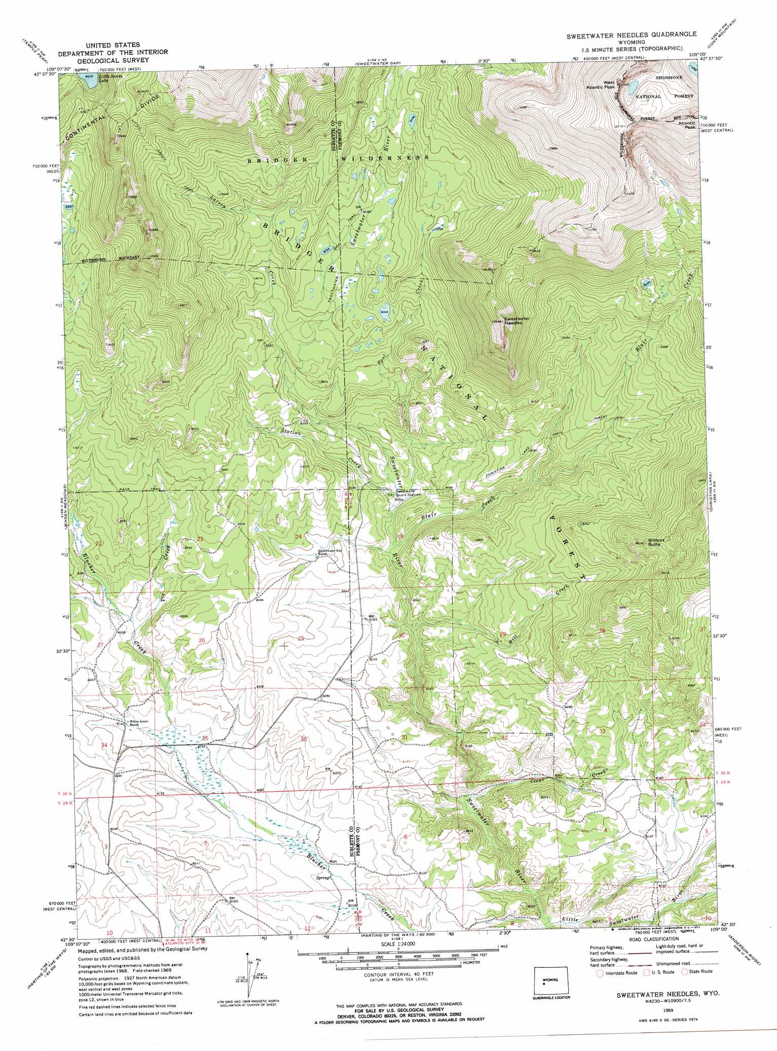
Sweetwater Needles Topo Map Wyoming
To zoom in, hover over the map of Sweetwater Needles
USGS Topo Quad 42109e1 - 1:24,000 scale
| Topo Map Name: | Sweetwater Needles |
| USGS Topo Quad ID: | 42109e1 |
| Print Size: | ca. 21 1/4" wide x 27" high |
| Southeast Coordinates: | 42.5° N latitude / 109° W longitude |
| Map Center Coordinates: | 42.5625° N latitude / 109.0625° W longitude |
| U.S. State: | WY |
| Filename: | o42109e1.jpg |
| Download Map JPG Image: | Sweetwater Needles topo map 1:24,000 scale |
| Map Type: | Topographic |
| Topo Series: | 7.5´ |
| Map Scale: | 1:24,000 |
| Source of Map Images: | United States Geological Survey (USGS) |
| Alternate Map Versions: |
Sweetwater Needles WY 1969, updated 1973 Download PDF Buy paper map Sweetwater Needles WY 1991, updated 1997 Download PDF Buy paper map Sweetwater Needles WY 2012 Download PDF Buy paper map Sweetwater Needles WY 2015 Download PDF Buy paper map |
| FStopo: | US Forest Service topo Sweetwater Needles is available: Download FStopo PDF Download FStopo TIF |
1:24,000 Topo Quads surrounding Sweetwater Needles
Mount Bonneville |
Lizard Head Peak |
Dickinson Park |
Mount Arter |
Mount Arter Se |
Big Sandy Opening |
Temple Peak |
Sweetwater Gap |
Cony Mountain |
Fossil Hill |
Leckie |
Jensen Meadows |
Sweetwater Needles |
Christina Lake |
Louis Lake |
Leckie Reservoir |
Prospect Mountains |
Halls Meadow Spring |
Anderson Ridge |
South Pass City |
Big Sandy Reservoir Se |
Parting Of The Ways |
Hay Meadow Reservoir |
Pacific Springs |
Dickie Springs |
> Back to 42109e1 at 1:100,000 scale
> Back to 42108a1 at 1:250,000 scale
> Back to U.S. Topo Maps home
Sweetwater Needles topo map: Gazetteer
Sweetwater Needles: Streams
Blair Creek elevation 2510m 8234′Clear Creek elevation 2401m 7877′
Larsen Creek elevation 2658m 8720′
Little Sweetwater River elevation 2387m 7831′
Mill Creek elevation 2481m 8139′
Pool Creek elevation 2521m 8270′
Station Creek elevation 2515m 8251′
Tie Creek elevation 2503m 8211′
Sweetwater Needles: Summits
Atlantic Peak elevation 3808m 12493′Sweetwater Needles elevation 3138m 10295′
West Atlantic Peak elevation 3687m 12096′
Wildcat Butte elevation 2927m 9603′
Sweetwater Needles: Trails
Christina Lake Trail elevation 2661m 8730′Sweetwater Trail elevation 2765m 9071′
Sweetwater Needles digital topo map on disk
Buy this Sweetwater Needles topo map showing relief, roads, GPS coordinates and other geographical features, as a high-resolution digital map file on DVD: