Leckie Sw Topo Map Wyoming
To zoom in, hover over the map of Leckie Sw
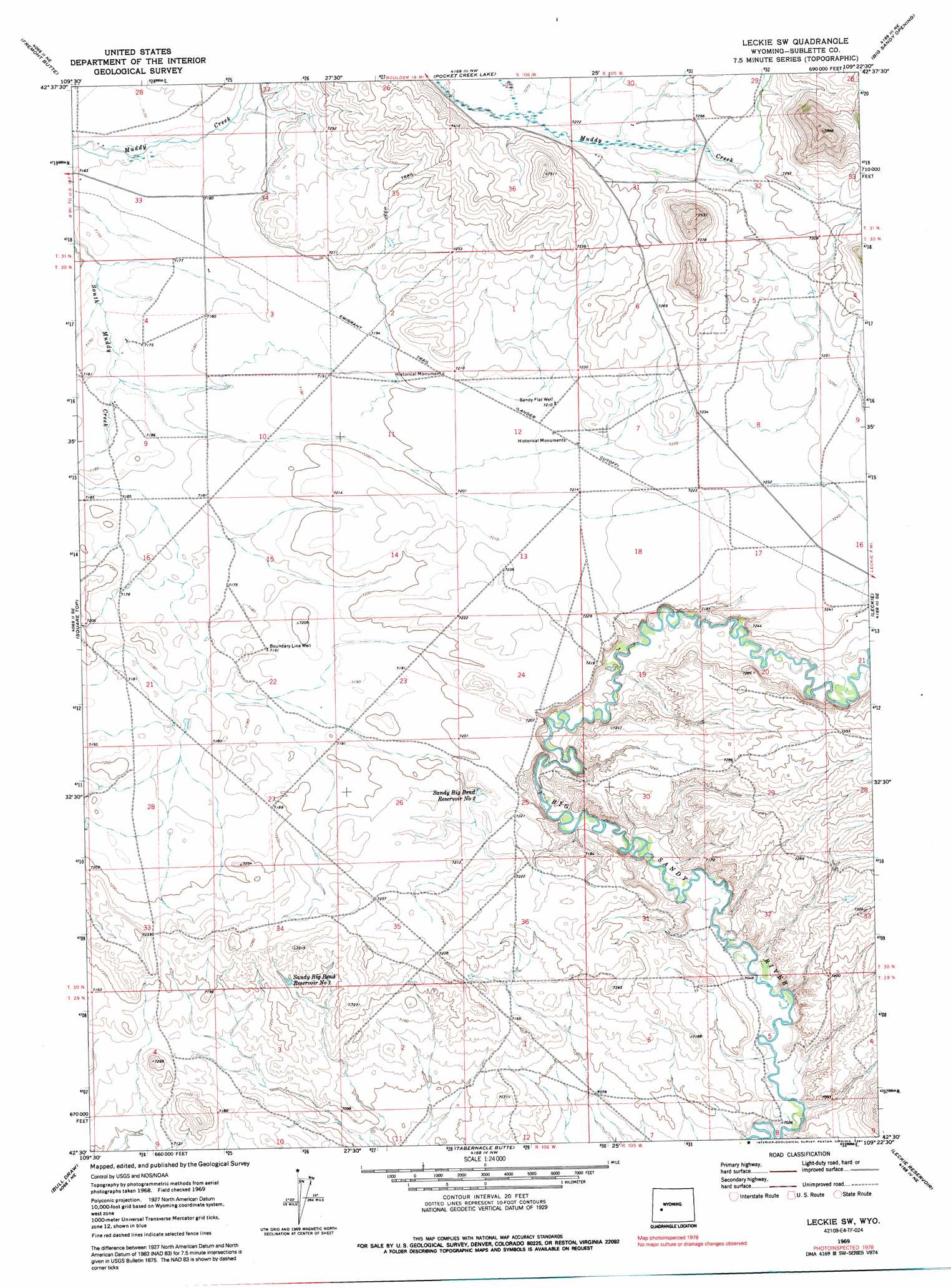
USGS Topo Quad 42109e4 - 1:24,000 scale
| Topo Map Name: | Leckie Sw |
| USGS Topo Quad ID: | 42109e4 |
| Print Size: | ca. 21 1/4" wide x 27" high |
| Southeast Coordinates: | 42.5° N latitude / 109.375° W longitude |
| Map Center Coordinates: | 42.5625° N latitude / 109.4375° W longitude |
| U.S. State: | WY |
| Filename: | o42109e4.jpg |
| Download Map JPG Image: | Leckie Sw topo map 1:24,000 scale |
| Map Type: | Topographic |
| Topo Series: | 7.5´ |
| Map Scale: | 1:24,000 |
| Source of Map Images: | United States Geological Survey (USGS) |
| Alternate Map Versions: |
Leckie SW WY 1969, updated 1973 Download PDF Buy paper map Leckie SW WY 1969, updated 1991 Download PDF Buy paper map Leckie SW WY 2012 Download PDF Buy paper map Leckie SW WY 2015 Download PDF Buy paper map |
1:24,000 Topo Quads surrounding Leckie Sw
Boulder Lake |
Scab Creek |
Raid Lake |
Mount Bonneville |
Lizard Head Peak |
Boulder |
Fremont Butte |
Pocket Creek Lake |
Big Sandy Opening |
Temple Peak |
Gobblers Knob |
Square Top |
Leckie Sw |
Leckie |
Jensen Meadows |
Stud Horse Butte |
Bull Draw |
Tabernacle Butte |
Leckie Reservoir |
Prospect Mountains |
Teakettle Butte |
Juel Spring |
Big Sandy Reservoir |
Big Sandy Reservoir Se |
Parting Of The Ways |
> Back to 42109e1 at 1:100,000 scale
> Back to 42108a1 at 1:250,000 scale
> Back to U.S. Topo Maps home
Leckie Sw topo map: Gazetteer
Leckie Sw: Reservoirs
Sandy Big Bend Reservoir Number 1 elevation 2194m 7198′Sandy Big Bend Reservoir Number 2 elevation 2202m 7224′
Leckie Sw: Streams
Sheep Creek elevation 2212m 7257′Leckie Sw digital topo map on disk
Buy this Leckie Sw topo map showing relief, roads, GPS coordinates and other geographical features, as a high-resolution digital map file on DVD: