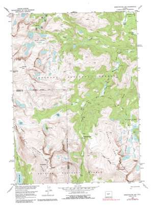
Sweetwater Gap Topo Map Wyoming
To zoom in, hover over the map of Sweetwater Gap
USGS Topo Quad 42109f1 - 1:24,000 scale
| Topo Map Name: | Sweetwater Gap |
| USGS Topo Quad ID: | 42109f1 |
| Print Size: | ca. 21 1/4" wide x 27" high |
| Southeast Coordinates: | 42.625° N latitude / 109° W longitude |
| Map Center Coordinates: | 42.6875° N latitude / 109.0625° W longitude |
| U.S. State: | WY |
| Filename: | o42109f1.jpg |
| Download Map JPG Image: | Sweetwater Gap topo map 1:24,000 scale |
| Map Type: | Topographic |
| Topo Series: | 7.5´ |
| Map Scale: | 1:24,000 |
| Source of Map Images: | United States Geological Survey (USGS) |
| Alternate Map Versions: |
Sweetwater Gap WY 1953, updated 1954 Download PDF Buy paper map Sweetwater Gap WY 1953, updated 1963 Download PDF Buy paper map Sweetwater Gap WY 1953, updated 1969 Download PDF Buy paper map Sweetwater Gap WY 1953, updated 1974 Download PDF Buy paper map Sweetwater Gap WY 1953, updated 1985 Download PDF Buy paper map Sweetwater Gap WY 1991, updated 1997 Download PDF Buy paper map Sweetwater Gap WY 2012 Download PDF Buy paper map Sweetwater Gap WY 2015 Download PDF Buy paper map |
| FStopo: | US Forest Service topo Sweetwater Gap is available: Download FStopo PDF Download FStopo TIF |
1:24,000 Topo Quads surrounding Sweetwater Gap
> Back to 42109e1 at 1:100,000 scale
> Back to 42108a1 at 1:250,000 scale
> Back to U.S. Topo Maps home
Sweetwater Gap topo map: Gazetteer
Sweetwater Gap: Basins
Shoshone Basin elevation 2953m 9688′Stough Creek Basin elevation 3200m 10498′
Sweetwater Gap: Flats
Bills Park elevation 2898m 9507′Gill Park elevation 2814m 9232′
Johnson Meadow elevation 2963m 9721′
Pinto Park elevation 3144m 10314′
Three Forks Park elevation 2756m 9041′
Upper Hudson Meadow elevation 2875m 9432′
Sweetwater Gap: Gaps
Sweetwater Gap elevation 3154m 10347′Sweetwater Gap: Lakes
Baer Lakes elevation 3046m 9993′Boot Lake elevation 3182m 10439′
Coon Lake elevation 3212m 10538′
Deep Creek Lakes elevation 3333m 10935′
East Echo Lake elevation 3084m 10118′
Echo Lakes elevation 3085m 10121′
Ice Lakes elevation 3330m 10925′
Jug Lake elevation 3181m 10436′
Little Sandy Lake elevation 2891m 9484′
Lower Baer Lake elevation 3049m 10003′
Mountain Sheep Lake elevation 3103m 10180′
Pinto Park Lake elevation 3010m 9875′
Poison Lake elevation 3064m 10052′
Squirrel Lake elevation 2998m 9835′
Stough Creek Lakes elevation 3327m 10915′
Tayo Lake elevation 3288m 10787′
Upper Baer Lake elevation 3048m 10000′
West Echo Lake elevation 3082m 10111′
Sweetwater Gap: Parks
Tayo Park elevation 2997m 9832′Sweetwater Gap: Pillars
Chimney Rock elevation 3859m 12660′Sweetwater Gap: Streams
Basco Creek elevation 2900m 9514′Deep Creek elevation 2756m 9041′
Tayo Creek elevation 2945m 9662′
Sweetwater Gap: Summits
Mount Nystrom elevation 3741m 12273′Roaring Fork Mountain elevation 3563m 11689′
Sweetwater Gap: Trails
Pinto Park Trail elevation 3059m 10036′Stough Creek Basin Trail elevation 3073m 10082′
Sweetwater Gap digital topo map on disk
Buy this Sweetwater Gap topo map showing relief, roads, GPS coordinates and other geographical features, as a high-resolution digital map file on DVD:


