Boulder Lake Topo Map Wyoming
To zoom in, hover over the map of Boulder Lake
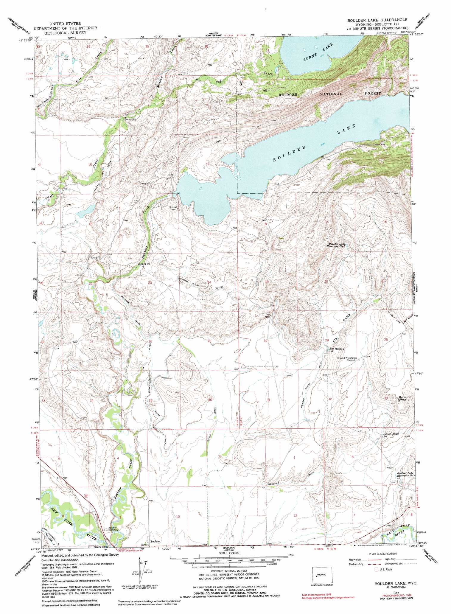
USGS Topo Quad 42109g6 - 1:24,000 scale
| Topo Map Name: | Boulder Lake |
| USGS Topo Quad ID: | 42109g6 |
| Print Size: | ca. 21 1/4" wide x 27" high |
| Southeast Coordinates: | 42.75° N latitude / 109.625° W longitude |
| Map Center Coordinates: | 42.8125° N latitude / 109.6875° W longitude |
| U.S. State: | WY |
| Filename: | o42109g6.jpg |
| Download Map JPG Image: | Boulder Lake topo map 1:24,000 scale |
| Map Type: | Topographic |
| Topo Series: | 7.5´ |
| Map Scale: | 1:24,000 |
| Source of Map Images: | United States Geological Survey (USGS) |
| Alternate Map Versions: |
Boulder Lake WY 1964, updated 1968 Download PDF Buy paper map Boulder Lake WY 1964, updated 1991 Download PDF Buy paper map Boulder Lake WY 1964, updated 1991 Download PDF Buy paper map Boulder Lake WY 2012 Download PDF Buy paper map Boulder Lake WY 2015 Download PDF Buy paper map |
| FStopo: | US Forest Service topo Boulder Lake is available: Download FStopo PDF Download FStopo TIF |
1:24,000 Topo Quads surrounding Boulder Lake
New Fork Lakes |
Fremont Lake North |
Bridger Lakes |
Fremont Peak South |
Alpine Lake |
Cora |
Fremont Lake South |
Fayette Lake |
Horseshoe Lake |
Halls Mountain |
Mount Airy |
Pinedale |
Boulder Lake |
Scab Creek |
Raid Lake |
Mesa Spring |
Two Buttes Reservoir |
Boulder |
Fremont Butte |
Pocket Creek Lake |
Ross Butte |
Olsen Ranch |
Gobblers Knob |
Square Top |
Leckie Sw |
> Back to 42109e1 at 1:100,000 scale
> Back to 42108a1 at 1:250,000 scale
> Back to U.S. Topo Maps home
Boulder Lake topo map: Gazetteer
Boulder Lake: Basins
Elk Meadow Pit elevation 2189m 7181′Indian Trail Pit elevation 2184m 7165′
Boulder Lake: Canals
Boulder Canal elevation 2162m 7093′Burkhalter Ditch elevation 2166m 7106′
Fayette Ditch elevation 2196m 7204′
Howard Routh Ditch elevation 2216m 7270′
Oliver Ditch elevation 2153m 7063′
Pole Creek Ditch Number 2 elevation 2214m 7263′
White Ditch elevation 2166m 7106′
Boulder Lake: Dams
Boulder Lake Dam elevation 2233m 7326′Boulder Lake: Lakes
Burnt Lake elevation 2414m 7919′Boulder Lake: Reservoirs
Boulder Lake elevation 2223m 7293′Boulder Lake Reservoir Number 4 elevation 2165m 7103′
Boulder Lake Reservoir Number 7 elevation 2273m 7457′
Boulder Lake: Springs
Burts Spring elevation 2244m 7362′Boulder Lake: Streams
Meadow Creek elevation 2246m 7368′Boulder Lake: Valleys
Elk Gulch elevation 2189m 7181′Boulder Lake digital topo map on disk
Buy this Boulder Lake topo map showing relief, roads, GPS coordinates and other geographical features, as a high-resolution digital map file on DVD: