Marse Topo Map Wyoming
To zoom in, hover over the map of Marse
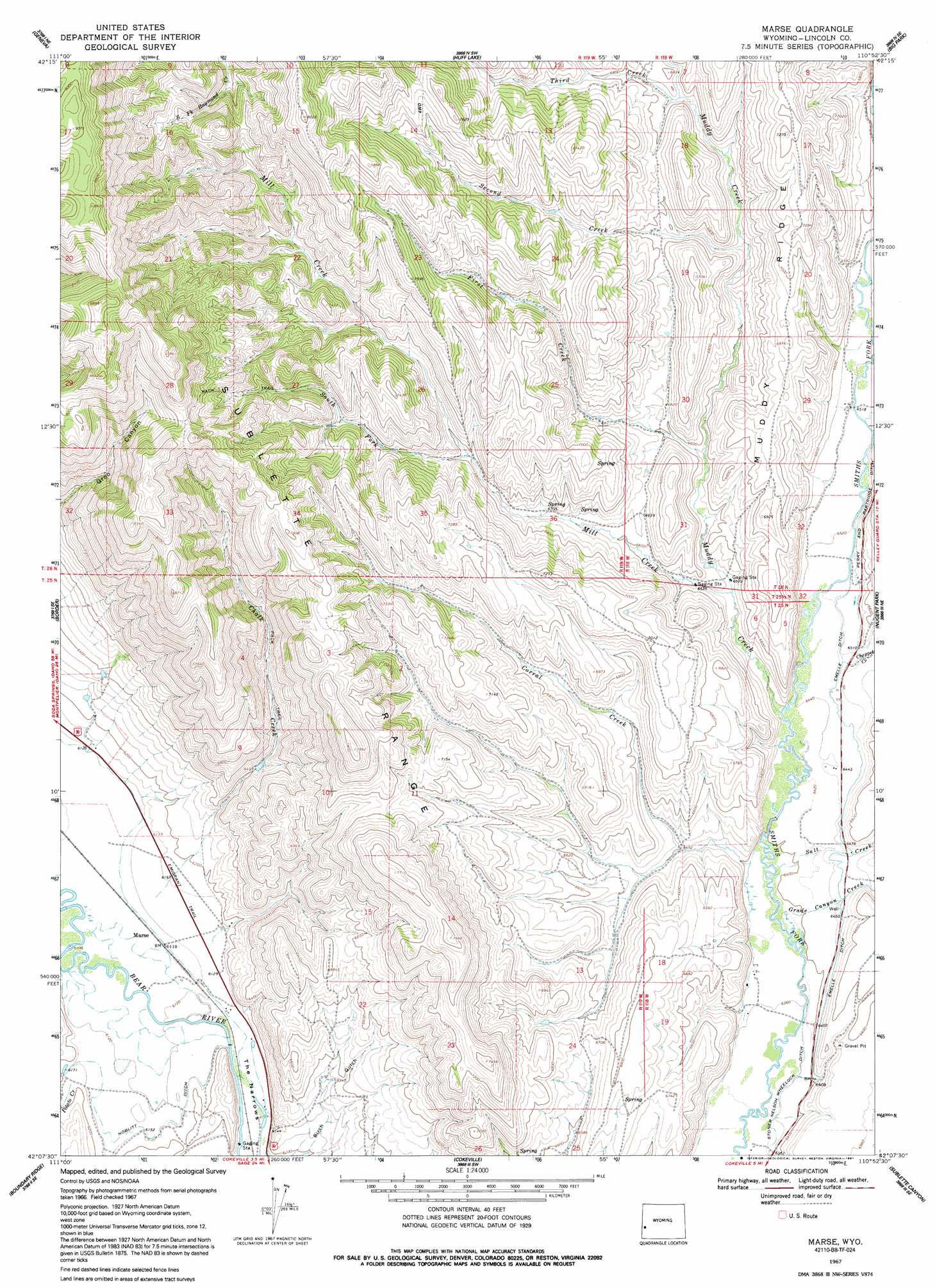
USGS Topo Quad 42110b8 - 1:24,000 scale
| Topo Map Name: | Marse |
| USGS Topo Quad ID: | 42110b8 |
| Print Size: | ca. 21 1/4" wide x 27" high |
| Southeast Coordinates: | 42.125° N latitude / 110.875° W longitude |
| Map Center Coordinates: | 42.1875° N latitude / 110.9375° W longitude |
| U.S. State: | WY |
| Filename: | o42110b8.jpg |
| Download Map JPG Image: | Marse topo map 1:24,000 scale |
| Map Type: | Topographic |
| Topo Series: | 7.5´ |
| Map Scale: | 1:24,000 |
| Source of Map Images: | United States Geological Survey (USGS) |
| Alternate Map Versions: |
Marse WY 1967, updated 1971 Download PDF Buy paper map Marse WY 1967, updated 1991 Download PDF Buy paper map Marse WY 2012 Download PDF Buy paper map Marse WY 2015 Download PDF Buy paper map |
1:24,000 Topo Quads surrounding Marse
Meade Peak |
Giraffe Creek |
Salt Flat |
Porcupine Creek |
Graham Peak |
Montpelier Canyon |
Geneva |
Huff Lake |
Big Park |
Devils Hole Creek |
Pegram |
Border |
Marse |
Nugent Park |
Pole Creek |
Pegram Creek |
Boundary Ridge |
Cokeville |
Sublette Canyon |
Wilkinson Creek |
Sheeppen Creek |
South Lake |
Beckwith |
The Rock Slide |
Kemmerer Reservoir |
> Back to 42110a1 at 1:100,000 scale
> Back to 42110a1 at 1:250,000 scale
> Back to U.S. Topo Maps home
Marse topo map: Gazetteer
Marse: Canals
Emelle Ditch elevation 1974m 6476′Noblitt Ditch elevation 1878m 6161′
Perry and Partridge Ditch elevation 1999m 6558′
Marse: Gaps
The Narrows elevation 1874m 6148′Marse: Ridges
Muddy Ridge elevation 2201m 7221′Marse: Streams
Chalk Creek elevation 1872m 6141′Chappel Creek elevation 1970m 6463′
Corral Creek elevation 1951m 6400′
Erwine Creek elevation 1867m 6125′
First Creek elevation 2013m 6604′
Grade Canyon Creek elevation 1944m 6377′
Hawkins Creek elevation 1982m 6502′
Mill Creek elevation 1989m 6525′
Muddy Creek elevation 1961m 6433′
Potato Creek elevation 1884m 6181′
Salt Creek elevation 1950m 6397′
Second Creek elevation 2032m 6666′
South Fork Mill Creek elevation 2070m 6791′
Third Creek elevation 2058m 6751′
Marse digital topo map on disk
Buy this Marse topo map showing relief, roads, GPS coordinates and other geographical features, as a high-resolution digital map file on DVD: