Springman Creek Topo Map Wyoming
To zoom in, hover over the map of Springman Creek
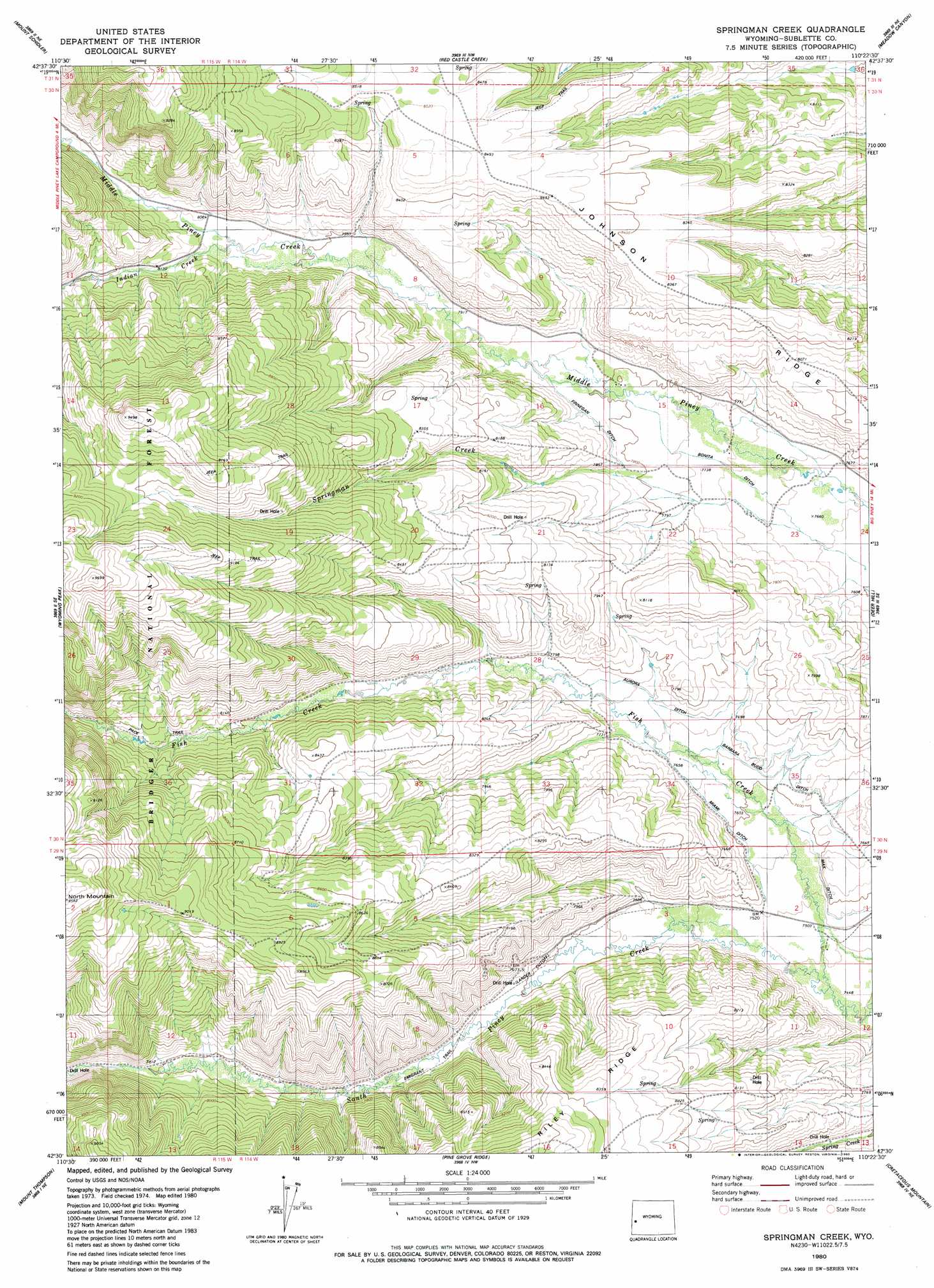
USGS Topo Quad 42110e4 - 1:24,000 scale
| Topo Map Name: | Springman Creek |
| USGS Topo Quad ID: | 42110e4 |
| Print Size: | ca. 21 1/4" wide x 27" high |
| Southeast Coordinates: | 42.5° N latitude / 110.375° W longitude |
| Map Center Coordinates: | 42.5625° N latitude / 110.4375° W longitude |
| U.S. State: | WY |
| Filename: | o42110e4.jpg |
| Download Map JPG Image: | Springman Creek topo map 1:24,000 scale |
| Map Type: | Topographic |
| Topo Series: | 7.5´ |
| Map Scale: | 1:24,000 |
| Source of Map Images: | United States Geological Survey (USGS) |
| Alternate Map Versions: |
Springman Creek WY 1980, updated 1980 Download PDF Buy paper map Springman Creek WY 2012 Download PDF Buy paper map Springman Creek WY 2015 Download PDF Buy paper map |
| FStopo: | US Forest Service topo Springman Creek is available: Download FStopo PDF Download FStopo TIF |
1:24,000 Topo Quads surrounding Springman Creek
Park Creek |
Triple Peak |
Maki Creek |
Halfway |
Onion Springs |
Box Canyon Creek |
Mount Schidler |
Red Castle Creek |
Meadow Canyon |
Budd Reservoir |
Poison Meadows |
Wyoming Peak |
Springman Creek |
Deer Hill |
Big Piney West |
Graham Peak |
Mount Thompson |
Pine Grove Ridge |
Cretaceous Mountain |
Chimney Butte |
Devils Hole Creek |
Coal Creek |
Lake Mountain |
The Hogsback |
La Barge |
> Back to 42110e1 at 1:100,000 scale
> Back to 42110a1 at 1:250,000 scale
> Back to U.S. Topo Maps home
Springman Creek topo map: Gazetteer
Springman Creek: Canals
Aurora Ditch elevation 2354m 7723′Barbara Budd Ditch elevation 2330m 7644′
Bonita Ditch elevation 2347m 7700′
Fmnegan Ditch elevation 2388m 7834′
Miami Ditch elevation 2327m 7634′
Springman Creek: Ridges
Johnson Ridge elevation 2512m 8241′Springman Creek: Streams
Fish Creek elevation 2277m 7470′Indian Creek elevation 2451m 8041′
Springman Creek elevation 2334m 7657′
Springman Creek digital topo map on disk
Buy this Springman Creek topo map showing relief, roads, GPS coordinates and other geographical features, as a high-resolution digital map file on DVD: