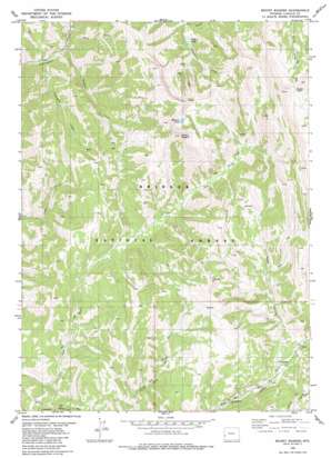
Mount Wagner Topo Map Wyoming
To zoom in, hover over the map of Mount Wagner
USGS Topo Quad 42110e7 - 1:24,000 scale
| Topo Map Name: | Mount Wagner |
| USGS Topo Quad ID: | 42110e7 |
| Print Size: | ca. 21 1/4" wide x 27" high |
| Southeast Coordinates: | 42.5° N latitude / 110.75° W longitude |
| Map Center Coordinates: | 42.5625° N latitude / 110.8125° W longitude |
| U.S. State: | WY |
| Filename: | o42110e7.jpg |
| Download Map JPG Image: | Mount Wagner topo map 1:24,000 scale |
| Map Type: | Topographic |
| Topo Series: | 7.5´ |
| Map Scale: | 1:24,000 |
| Source of Map Images: | United States Geological Survey (USGS) |
| Alternate Map Versions: |
Mount Wagner WY 1980, updated 1980 Download PDF Buy paper map Mount Wagner WY 2012 Download PDF Buy paper map Mount Wagner WY 2015 Download PDF Buy paper map |
| FStopo: | US Forest Service topo Mount Wagner is available: Download FStopo PDF Download FStopo TIF |
1:24,000 Topo Quads surrounding Mount Wagner
> Back to 42110e1 at 1:100,000 scale
> Back to 42110a1 at 1:250,000 scale
> Back to U.S. Topo Maps home
Mount Wagner topo map: Gazetteer
Mount Wagner: Gaps
Sheep Pass elevation 3056m 10026′Mount Wagner: Lakes
Slide Lake elevation 2430m 7972′Wagner Lake elevation 2983m 9786′
Mount Wagner: Streams
Porcupine Creek elevation 2102m 6896′Wagner Creek elevation 2124m 6968′
Mount Wagner: Summits
Mount Wagner elevation 3185m 10449′Mount Wagner: Valleys
Mud Gulch elevation 2139m 7017′Poker Hollow elevation 2402m 7880′
Slide Canyon elevation 2347m 7700′
Mount Wagner digital topo map on disk
Buy this Mount Wagner topo map showing relief, roads, GPS coordinates and other geographical features, as a high-resolution digital map file on DVD:


