Onion Springs Topo Map Wyoming
To zoom in, hover over the map of Onion Springs
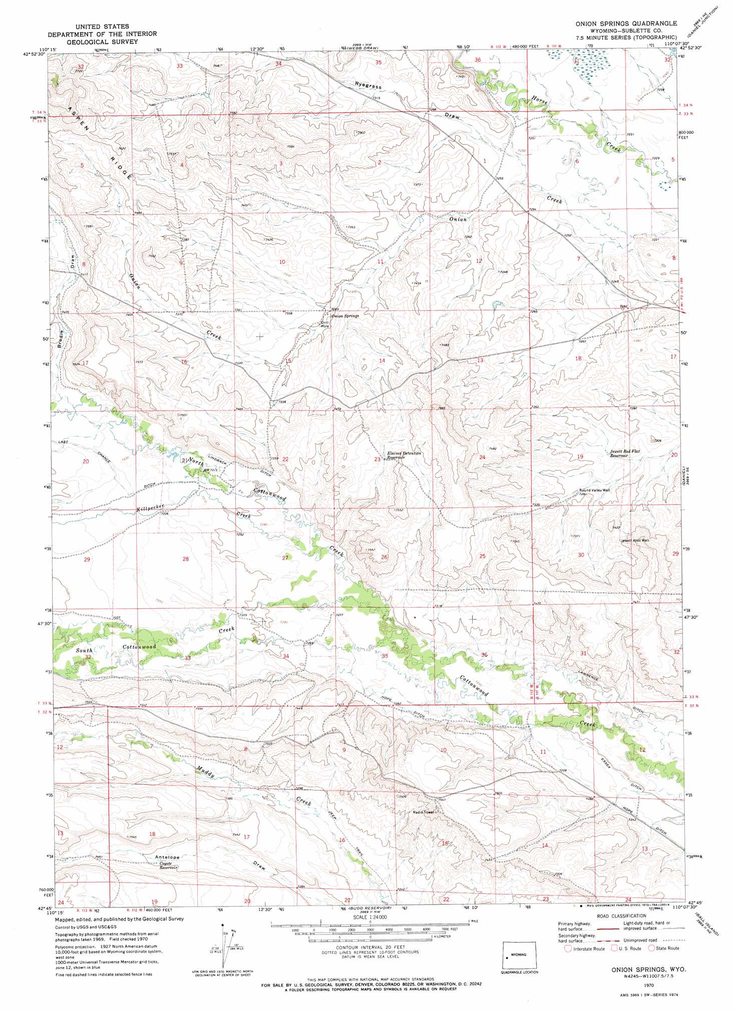
USGS Topo Quad 42110g2 - 1:24,000 scale
| Topo Map Name: | Onion Springs |
| USGS Topo Quad ID: | 42110g2 |
| Print Size: | ca. 21 1/4" wide x 27" high |
| Southeast Coordinates: | 42.75° N latitude / 110.125° W longitude |
| Map Center Coordinates: | 42.8125° N latitude / 110.1875° W longitude |
| U.S. State: | WY |
| Filename: | o42110g2.jpg |
| Download Map JPG Image: | Onion Springs topo map 1:24,000 scale |
| Map Type: | Topographic |
| Topo Series: | 7.5´ |
| Map Scale: | 1:24,000 |
| Source of Map Images: | United States Geological Survey (USGS) |
| Alternate Map Versions: |
Onion Springs WY 1970, updated 1973 Download PDF Buy paper map Onion Springs WY 2012 Download PDF Buy paper map Onion Springs WY 2015 Download PDF Buy paper map |
1:24,000 Topo Quads surrounding Onion Springs
Noble Basin |
Kismet Peak |
Signal Hill |
Warren Bridge |
New Fork Lakes |
Prospect Peak |
Merna Butte |
Webb Draw |
Daniel Junction |
Cora |
Maki Creek |
Halfway |
Onion Springs |
Daniel |
Mount Airy |
Red Castle Creek |
Meadow Canyon |
Budd Reservoir |
Ball Island |
Mesa Spring |
Springman Creek |
Deer Hill |
Big Piney West |
Big Piney East |
Ross Butte |
> Back to 42110e1 at 1:100,000 scale
> Back to 42110a1 at 1:250,000 scale
> Back to U.S. Topo Maps home
Onion Springs topo map: Gazetteer
Onion Springs: Canals
Hope Ditch elevation 2203m 7227′Lindback Ditch elevation 2231m 7319′
Onion Springs: Reservoirs
Coyote Reservoir elevation 2251m 7385′Elaines Detention Reservoir elevation 2269m 7444′
Jewett Red Flat Reservoir elevation 2216m 7270′
Onion Springs: Springs
Onion Springs elevation 2226m 7303′Onion Springs: Streams
Killpecker Creek elevation 2219m 7280′North Cottonwood Creek elevation 2208m 7244′
South Cottonwood Creek elevation 2208m 7244′
Onion Springs: Valleys
Brodie Draw elevation 2241m 7352′North Antelope Draw elevation 2273m 7457′
South Antelope Draw elevation 2273m 7457′
Onion Springs: Wells
Jewett Allot Well elevation 2251m 7385′Round Valley Well elevation 2220m 7283′
Onion Springs digital topo map on disk
Buy this Onion Springs topo map showing relief, roads, GPS coordinates and other geographical features, as a high-resolution digital map file on DVD: