Prospect Peak Topo Map Wyoming
To zoom in, hover over the map of Prospect Peak
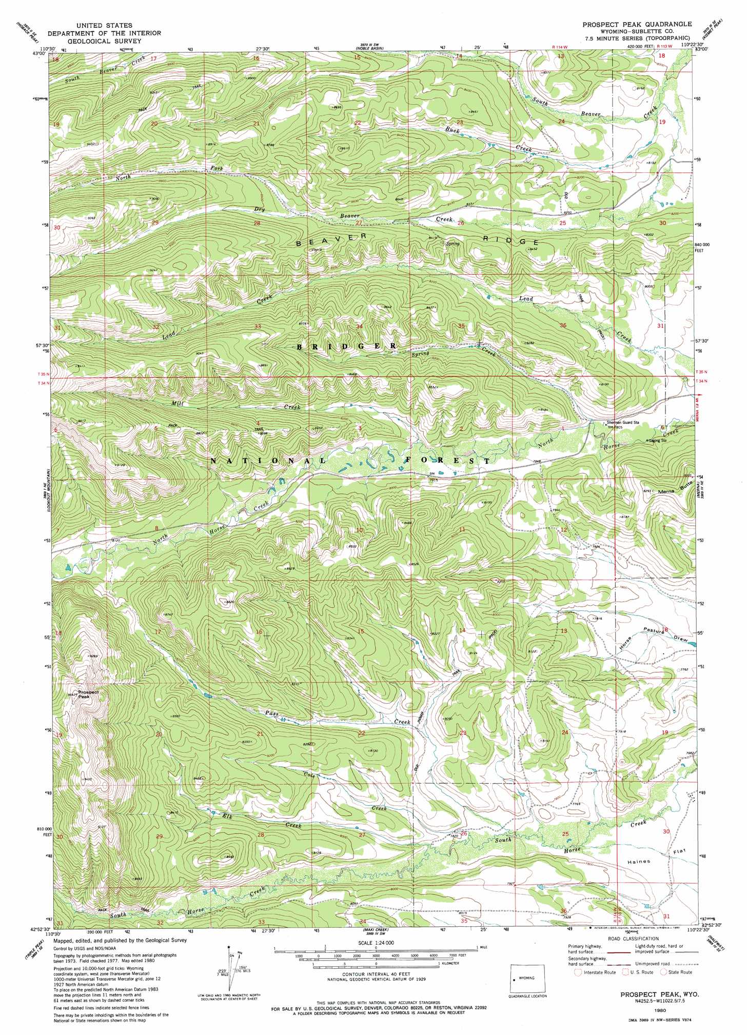
USGS Topo Quad 42110h4 - 1:24,000 scale
| Topo Map Name: | Prospect Peak |
| USGS Topo Quad ID: | 42110h4 |
| Print Size: | ca. 21 1/4" wide x 27" high |
| Southeast Coordinates: | 42.875° N latitude / 110.375° W longitude |
| Map Center Coordinates: | 42.9375° N latitude / 110.4375° W longitude |
| U.S. State: | WY |
| Filename: | o42110h4.jpg |
| Download Map JPG Image: | Prospect Peak topo map 1:24,000 scale |
| Map Type: | Topographic |
| Topo Series: | 7.5´ |
| Map Scale: | 1:24,000 |
| Source of Map Images: | United States Geological Survey (USGS) |
| Alternate Map Versions: |
Prospect Peak WY 1980, updated 1980 Download PDF Buy paper map Prospect Peak WY 1980, updated 1980 Download PDF Buy paper map Prospect Peak WY 2012 Download PDF Buy paper map Prospect Peak WY 2015 Download PDF Buy paper map |
| FStopo: | US Forest Service topo Prospect Peak is available: Download FStopo PDF Download FStopo TIF |
1:24,000 Topo Quads surrounding Prospect Peak
Bailey Lake |
Clause Peak |
Bondurant |
Raspberry Ridge |
Pass Peak |
Pickle Pass |
Hoback Peak |
Noble Basin |
Kismet Peak |
Signal Hill |
Blind Bull Creek |
Lookout Mountain |
Prospect Peak |
Merna Butte |
Webb Draw |
Park Creek |
Triple Peak |
Maki Creek |
Halfway |
Onion Springs |
Box Canyon Creek |
Mount Schidler |
Red Castle Creek |
Meadow Canyon |
Budd Reservoir |
> Back to 42110e1 at 1:100,000 scale
> Back to 42110a1 at 1:250,000 scale
> Back to U.S. Topo Maps home
Prospect Peak topo map: Gazetteer
Prospect Peak: Streams
Buck Creek elevation 2453m 8047′Cole Creek elevation 2367m 7765′
Dry Beaver Creek elevation 2448m 8031′
Elk Creek elevation 2377m 7798′
Mill Creek elevation 2424m 7952′
North Fork Dry Beaver Creek elevation 2623m 8605′
Pass Creek elevation 2359m 7739′
Spring Creek elevation 2380m 7808′
Prospect Peak: Summits
Jewett Pinnacle elevation 2428m 7965′Prospect Peak elevation 2933m 9622′
Prospect Peak digital topo map on disk
Buy this Prospect Peak topo map showing relief, roads, GPS coordinates and other geographical features, as a high-resolution digital map file on DVD: