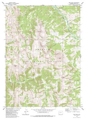
Man Peak Topo Map Wyoming
To zoom in, hover over the map of Man Peak
USGS Topo Quad 42110h7 - 1:24,000 scale
| Topo Map Name: | Man Peak |
| USGS Topo Quad ID: | 42110h7 |
| Print Size: | ca. 21 1/4" wide x 27" high |
| Southeast Coordinates: | 42.875° N latitude / 110.75° W longitude |
| Map Center Coordinates: | 42.9375° N latitude / 110.8125° W longitude |
| U.S. State: | WY |
| Filename: | o42110h7.jpg |
| Download Map JPG Image: | Man Peak topo map 1:24,000 scale |
| Map Type: | Topographic |
| Topo Series: | 7.5´ |
| Map Scale: | 1:24,000 |
| Source of Map Images: | United States Geological Survey (USGS) |
| Alternate Map Versions: |
Man Peak WY 1980, updated 1980 Download PDF Buy paper map Man Peak WY 1980, updated 1980 Download PDF Buy paper map Man Peak WY 2012 Download PDF Buy paper map Man Peak WY 2015 Download PDF Buy paper map |
| FStopo: | US Forest Service topo Man Peak is available: Download FStopo PDF Download FStopo TIF |
1:24,000 Topo Quads surrounding Man Peak
> Back to 42110e1 at 1:100,000 scale
> Back to 42110a1 at 1:250,000 scale
> Back to U.S. Topo Maps home
Man Peak topo map: Gazetteer
Man Peak: Flats
Indian Grave Flat elevation 1936m 6351′Moose Flat elevation 1965m 6446′
Man Peak: Streams
Little Elk Creek elevation 1973m 6473′Man Creek elevation 1958m 6423′
Moose Creek elevation 1971m 6466′
North Fork Strawberry Creek elevation 2178m 7145′
Pearson Creek elevation 2001m 6564′
Man Peak: Summits
Haystack Peak elevation 3006m 9862′Man Peak elevation 2909m 9543′
Sherman Peak elevation 2833m 9294′
Virginia Peak elevation 2758m 9048′
Visser Peak elevation 3054m 10019′
Man Peak digital topo map on disk
Buy this Man Peak topo map showing relief, roads, GPS coordinates and other geographical features, as a high-resolution digital map file on DVD:


