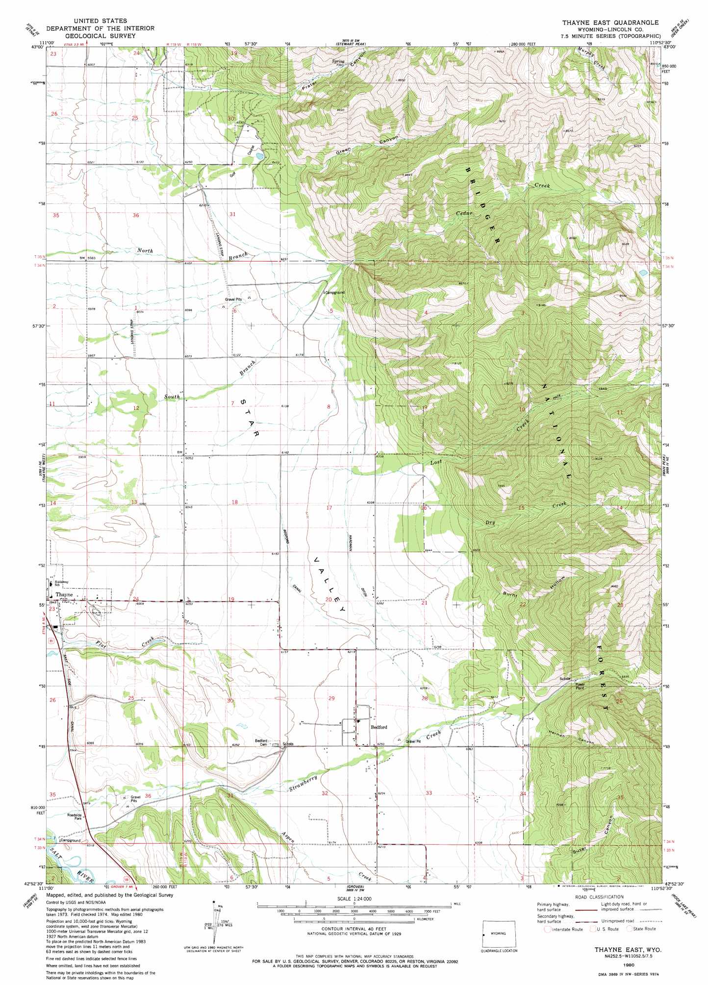
Thayne East Topo Map Wyoming
To zoom in, hover over the map of Thayne East
USGS Topo Quad 42110h8 - 1:24,000 scale
| Topo Map Name: | Thayne East |
| USGS Topo Quad ID: | 42110h8 |
| Print Size: | ca. 21 1/4" wide x 27" high |
| Southeast Coordinates: | 42.875° N latitude / 110.875° W longitude |
| Map Center Coordinates: | 42.9375° N latitude / 110.9375° W longitude |
| U.S. State: | WY |
| Filename: | o42110h8.jpg |
| Download Map JPG Image: | Thayne East topo map 1:24,000 scale |
| Map Type: | Topographic |
| Topo Series: | 7.5´ |
| Map Scale: | 1:24,000 |
| Source of Map Images: | United States Geological Survey (USGS) |
| Alternate Map Versions: |
Thayne East WY 1980, updated 1981 Download PDF Buy paper map Thayne East WY 2012 Download PDF Buy paper map Thayne East WY 2015 Download PDF Buy paper map |
| FStopo: | US Forest Service topo Thayne East is available: Download FStopo PDF Download FStopo TIF |
1:24,000 Topo Quads surrounding Thayne East
Poker Peak |
Alpine |
Ferry Peak |
Pine Creek |
Bailey Lake |
Tincup Mountain |
Etna |
Stewart Peak |
Deer Creek |
Pickle Pass |
Stump Peak |
Thayne West |
Thayne East |
Man Peak |
Blind Bull Creek |
Diamond Flat |
Auburn |
Grover |
Rock Lake Peak |
Park Creek |
Stewart Flat |
Sage Valley |
Afton |
Red Top Mountain |
Box Canyon Creek |
> Back to 42110e1 at 1:100,000 scale
> Back to 42110a1 at 1:250,000 scale
> Back to U.S. Topo Maps home
Thayne East topo map: Gazetteer
Thayne East: Airports
Lone Pine Flying Ranch Airport elevation 1836m 6023′Star Valley Ranch Airport elevation 1880m 6167′
Thayne East: Canals
Bedford Canal elevation 1889m 6197′Hardman Ditch elevation 1941m 6368′
Thayne East: Populated Places
Bedford elevation 1909m 6263′Star Valley Ranch elevation 1906m 6253′
Thayne East: Streams
Aspen Creek elevation 1875m 6151′Cedar Creek elevation 1940m 6364′
Dry Creek elevation 1954m 6410′
Lost Creek elevation 1885m 6184′
Thayne East: Valleys
Burnt Hollow elevation 2014m 6607′Green Canyon elevation 2120m 6955′
Herman Canyon elevation 2064m 6771′
Prater Canyon elevation 2062m 6765′
Suter Canyon elevation 2080m 6824′
Thayne East digital topo map on disk
Buy this Thayne East topo map showing relief, roads, GPS coordinates and other geographical features, as a high-resolution digital map file on DVD: