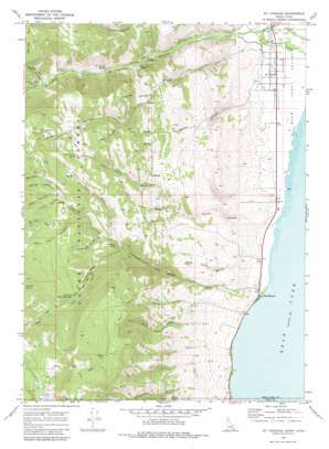
Saint Charles Topo Map Idaho
To zoom in, hover over the map of Saint Charles
USGS Topo Quad 42111a4 - 1:24,000 scale
| Topo Map Name: | Saint Charles |
| USGS Topo Quad ID: | 42111a4 |
| Print Size: | ca. 21 1/4" wide x 27" high |
| Southeast Coordinates: | 42° N latitude / 111.375° W longitude |
| Map Center Coordinates: | 42.0625° N latitude / 111.4375° W longitude |
| U.S. States: | ID, UT |
| Filename: | o42111a4.jpg |
| Download Map JPG Image: | Saint Charles topo map 1:24,000 scale |
| Map Type: | Topographic |
| Topo Series: | 7.5´ |
| Map Scale: | 1:24,000 |
| Source of Map Images: | United States Geological Survey (USGS) |
| Alternate Map Versions: |
St Charles ID 1969, updated 1973 Download PDF Buy paper map St Charles ID 1969, updated 1984 Download PDF Buy paper map Saint Charles ID 2005, updated 2007 Download PDF Buy paper map Saint Charles ID 2011 Download PDF Buy paper map Saint Charles ID 2013 Download PDF Buy paper map |
| FStopo: | US Forest Service topo Saint Charles is available: Download FStopo PDF Download FStopo TIF |
1:24,000 Topo Quads surrounding Saint Charles
> Back to 42111a1 at 1:100,000 scale
> Back to 42110a1 at 1:250,000 scale
> Back to U.S. Topo Maps home
Saint Charles topo map: Gazetteer
Saint Charles: Lakes
Ranger Dip elevation 2581m 8467′Swan Lake elevation 2532m 8307′
Saint Charles: Mines
Blackstone Mine elevation 1895m 6217′Saint Charles: Populated Places
Fish Haven elevation 1816m 5958′Glencoe elevation 1821m 5974′
Saint Charles elevation 1818m 5964′
Saint Charles: Ridges
Hogsback Ridge elevation 2219m 7280′Saint Charles: Springs
Blue Pond Spring elevation 1982m 6502′Coby Spring elevation 2107m 6912′
Dune Spring elevation 2097m 6879′
Green Canyon Spring elevation 2309m 7575′
Left Fork Fish Haven Spring elevation 2373m 7785′
Little Spring elevation 1953m 6407′
Maple Canyon Spring elevation 2281m 7483′
Sadducee Spring elevation 2117m 6945′
Saint Charles Spring elevation 1901m 6236′
Sherma Spring elevation 2050m 6725′
Saint Charles: Streams
Fish Haven Creek elevation 1807m 5928′Saint Charles Creek elevation 1818m 5964′
Saint Charles: Valleys
Cabin Hollow elevation 2304m 7559′Crossley Hollow elevation 2051m 6729′
Davis Canyon elevation 2003m 6571′
Dry Canyon elevation 1841m 6040′
Dutch Canyon elevation 1900m 6233′
Findlay Hollow elevation 2308m 7572′
Fish Haven Canyon elevation 1827m 5994′
French Hollow elevation 1880m 6167′
Green Canyon elevation 1847m 6059′
Jacobs Canyon elevation 1847m 6059′
Left Fork Fish Haven Canyon elevation 2065m 6774′
Maple Canyon elevation 2006m 6581′
Middle Fork South Canyon elevation 1997m 6551′
Peter Hollow elevation 2138m 7014′
Red Pine Hollow elevation 2371m 7778′
Rich Hollow elevation 2342m 7683′
Right Fork Fish Haven Canyon elevation 2086m 6843′
Sadducee Hollow elevation 2125m 6971′
Saint Charles Canyon elevation 1831m 6007′
Sams Hollow elevation 1841m 6040′
South Canyon elevation 1823m 5980′
South Fork South Canyon elevation 1997m 6551′
Spring Hollow elevation 2304m 7559′
White Pine Canyon elevation 2259m 7411′
Williamson Hollow elevation 1984m 6509′
Saint Charles digital topo map on disk
Buy this Saint Charles topo map showing relief, roads, GPS coordinates and other geographical features, as a high-resolution digital map file on DVD:


