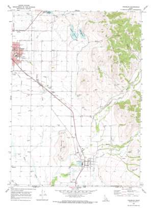
Franklin Topo Map Idaho
To zoom in, hover over the map of Franklin
USGS Topo Quad 42111a7 - 1:24,000 scale
| Topo Map Name: | Franklin |
| USGS Topo Quad ID: | 42111a7 |
| Print Size: | ca. 21 1/4" wide x 27" high |
| Southeast Coordinates: | 42° N latitude / 111.75° W longitude |
| Map Center Coordinates: | 42.0625° N latitude / 111.8125° W longitude |
| U.S. State: | ID |
| Filename: | o42111a7.jpg |
| Download Map JPG Image: | Franklin topo map 1:24,000 scale |
| Map Type: | Topographic |
| Topo Series: | 7.5´ |
| Map Scale: | 1:24,000 |
| Source of Map Images: | United States Geological Survey (USGS) |
| Alternate Map Versions: |
Franklin ID 1969, updated 1973 Download PDF Buy paper map Franklin ID 2010 Download PDF Buy paper map Franklin ID 2013 Download PDF Buy paper map |
1:24,000 Topo Quads surrounding Franklin
> Back to 42111a1 at 1:100,000 scale
> Back to 42110a1 at 1:250,000 scale
> Back to U.S. Topo Maps home
Franklin topo map: Gazetteer
Franklin: Canals
Cub Canal elevation 1404m 4606′Middle Ditch elevation 1446m 4744′
Franklin: Dams
Foster Dam elevation 1480m 4855′Hinkley Dam elevation 1373m 4504′
Johnson Dam elevation 1489m 4885′
Lamont Dam elevation 1485m 4872′
Le Fevre Dam elevation 1389m 4557′
Van Orden Dam elevation 1363m 4471′
Franklin: Populated Places
Egypt elevation 1451m 4760′Franklin elevation 1372m 4501′
Nashville elevation 1400m 4593′
Whitney elevation 1403m 4603′
Franklin: Reservoirs
Foster Reservoir elevation 1480m 4855′Johnson Reservoir elevation 1489m 4885′
Lamont Reservoir elevation 1485m 4872′
Franklin: Streams
Deep Creek elevation 1488m 4881′Maple Creek elevation 1369m 4491′
Franklin: Summits
Big Hill elevation 1846m 6056′Little Mountain elevation 1591m 5219′
Franklin digital topo map on disk
Buy this Franklin topo map showing relief, roads, GPS coordinates and other geographical features, as a high-resolution digital map file on DVD:


