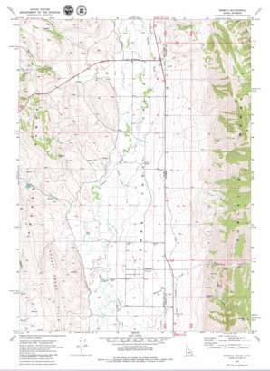
Geneva Topo Map Idaho
To zoom in, hover over the map of Geneva
USGS Topo Quad 42111c1 - 1:24,000 scale
| Topo Map Name: | Geneva |
| USGS Topo Quad ID: | 42111c1 |
| Print Size: | ca. 21 1/4" wide x 27" high |
| Southeast Coordinates: | 42.25° N latitude / 111° W longitude |
| Map Center Coordinates: | 42.3125° N latitude / 111.0625° W longitude |
| U.S. States: | ID, WY |
| Filename: | o42111c1.jpg |
| Download Map JPG Image: | Geneva topo map 1:24,000 scale |
| Map Type: | Topographic |
| Topo Series: | 7.5´ |
| Map Scale: | 1:24,000 |
| Source of Map Images: | United States Geological Survey (USGS) |
| Alternate Map Versions: |
Geneva ID 1970, updated 1973 Download PDF Buy paper map Geneva ID 2010 Download PDF Buy paper map Geneva ID 2013 Download PDF Buy paper map |
1:24,000 Topo Quads surrounding Geneva
> Back to 42111a1 at 1:100,000 scale
> Back to 42110a1 at 1:250,000 scale
> Back to U.S. Topo Maps home
Geneva topo map: Gazetteer
Geneva: Canals
Geneva Ditch elevation 1888m 6194′Halls Ditch elevation 1870m 6135′
Raymond Canal elevation 1852m 6076′
Steven Larson Ditch elevation 1864m 6115′
Taylor Canal elevation 1893m 6210′
Taylor Canal elevation 1891m 6204′
Geneva: Dams
Gardiner-Lower Dam elevation 1927m 6322′Gardiner-Upper Dam elevation 1950m 6397′
Geneva: Mines
Jackson Canyon-Coal Canyon Mine elevation 2159m 7083′Price and Thomas Claims elevation 1893m 6210′
Geneva: Populated Places
Geneva elevation 1883m 6177′Raymond elevation 1872m 6141′
Geneva: Streams
Raymond Creek elevation 1854m 6082′Geneva: Summits
Sublette Mountain elevation 2832m 9291′Geneva: Valleys
Bischoff Canyon elevation 1908m 6259′Raymond Canyon elevation 1929m 6328′
Rose Canyon elevation 2013m 6604′
Wood Canyon elevation 1879m 6164′
Geneva digital topo map on disk
Buy this Geneva topo map showing relief, roads, GPS coordinates and other geographical features, as a high-resolution digital map file on DVD:


