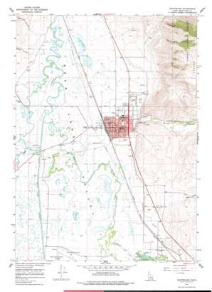
Montpelier Topo Map Idaho
To zoom in, hover over the map of Montpelier
USGS Topo Quad 42111c3 - 1:24,000 scale
| Topo Map Name: | Montpelier |
| USGS Topo Quad ID: | 42111c3 |
| Print Size: | ca. 21 1/4" wide x 27" high |
| Southeast Coordinates: | 42.25° N latitude / 111.25° W longitude |
| Map Center Coordinates: | 42.3125° N latitude / 111.3125° W longitude |
| U.S. State: | ID |
| Filename: | o42111c3.jpg |
| Download Map JPG Image: | Montpelier topo map 1:24,000 scale |
| Map Type: | Topographic |
| Topo Series: | 7.5´ |
| Map Scale: | 1:24,000 |
| Source of Map Images: | United States Geological Survey (USGS) |
| Alternate Map Versions: |
Montpelier ID 1967, updated 1968 Download PDF Buy paper map Montpelier ID 1967, updated 1978 Download PDF Buy paper map Montpelier ID 2011 Download PDF Buy paper map Montpelier ID 2013 Download PDF Buy paper map |
| FStopo: | US Forest Service topo Montpelier is available: Download FStopo PDF Download FStopo TIF |
1:24,000 Topo Quads surrounding Montpelier
> Back to 42111a1 at 1:100,000 scale
> Back to 42110a1 at 1:250,000 scale
> Back to U.S. Topo Maps home
Montpelier topo map: Gazetteer
Montpelier: Canals
Kent La Roco Canal elevation 1809m 5935′Montpelier: Dams
Rainbow Dam elevation 1811m 5941′Stewart Dam elevation 1812m 5944′
Montpelier: Gaps
Joes Gap elevation 2034m 6673′Montpelier: Parks
Stock Park elevation 1823m 5980′Montpelier: Populated Places
Montpelier elevation 1823m 5980′Wardboro elevation 1814m 5951′
Montpelier: Streams
Montpelier Creek elevation 1806m 5925′Ovid Creek elevation 1806m 5925′
Montpelier: Valleys
Bagley Hollow elevation 1877m 6158′Bear Hollow elevation 1858m 6095′
Montpelier Canyon elevation 1832m 6010′
Red Pine Hollow elevation 1849m 6066′
Sheep Hollow elevation 1822m 5977′
Montpelier digital topo map on disk
Buy this Montpelier topo map showing relief, roads, GPS coordinates and other geographical features, as a high-resolution digital map file on DVD:


