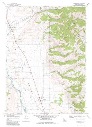
Georgetown Topo Map Idaho
To zoom in, hover over the map of Georgetown
USGS Topo Quad 42111d3 - 1:24,000 scale
| Topo Map Name: | Georgetown |
| USGS Topo Quad ID: | 42111d3 |
| Print Size: | ca. 21 1/4" wide x 27" high |
| Southeast Coordinates: | 42.375° N latitude / 111.25° W longitude |
| Map Center Coordinates: | 42.4375° N latitude / 111.3125° W longitude |
| U.S. State: | ID |
| Filename: | o42111d3.jpg |
| Download Map JPG Image: | Georgetown topo map 1:24,000 scale |
| Map Type: | Topographic |
| Topo Series: | 7.5´ |
| Map Scale: | 1:24,000 |
| Source of Map Images: | United States Geological Survey (USGS) |
| Alternate Map Versions: |
Georgetown ID 1970, updated 1973 Download PDF Buy paper map Georgetown ID 1970, updated 1981 Download PDF Buy paper map Georgetown ID 2011 Download PDF Buy paper map Georgetown ID 2013 Download PDF Buy paper map |
| FStopo: | US Forest Service topo Georgetown is available: Download FStopo PDF Download FStopo TIF |
1:24,000 Topo Quads surrounding Georgetown
> Back to 42111a1 at 1:100,000 scale
> Back to 42110a1 at 1:250,000 scale
> Back to U.S. Topo Maps home
Georgetown topo map: Gazetteer
Georgetown: Dams
Red Pine Canyon Dam elevation 1865m 6118′Welling Number Two Dam elevation 1824m 5984′
Georgetown: Gaps
White Pass elevation 2212m 7257′Georgetown: Populated Places
Bennington elevation 1845m 6053′Georgetown elevation 1842m 6043′
Georgetown: Summits
Bald Mountain elevation 2761m 9058′Threemile Peak elevation 2652m 8700′
Georgetown: Valleys
Bennington Canyon elevation 2047m 6715′Cart Hollow elevation 1895m 6217′
Dry Canyon elevation 2116m 6942′
Dunns Canyon elevation 1950m 6397′
Georgetown Canyon elevation 1878m 6161′
Hardscrabble Canyon elevation 2081m 6827′
Honeycomb elevation 1907m 6256′
Jack Hollow elevation 2342m 7683′
Left Fork Maple Canyon elevation 2167m 7109′
Left Hand Fork Georgetown Canyon elevation 1878m 6161′
Little Threemile Canyon elevation 2042m 6699′
Maple Canyon elevation 1976m 6482′
Pine Canyon elevation 1900m 6233′
Red Canyon elevation 2051m 6729′
Right Fork Maple Canyon elevation 2167m 7109′
Right Hand Fork Georgetown Canyon elevation 1925m 6315′
Rowley Canyon elevation 2024m 6640′
Georgetown digital topo map on disk
Buy this Georgetown topo map showing relief, roads, GPS coordinates and other geographical features, as a high-resolution digital map file on DVD:


