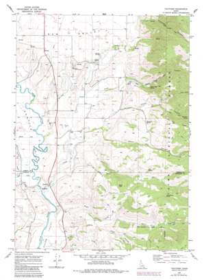
Thatcher Topo Map Idaho
To zoom in, hover over the map of Thatcher
USGS Topo Quad 42111d6 - 1:24,000 scale
| Topo Map Name: | Thatcher |
| USGS Topo Quad ID: | 42111d6 |
| Print Size: | ca. 21 1/4" wide x 27" high |
| Southeast Coordinates: | 42.375° N latitude / 111.625° W longitude |
| Map Center Coordinates: | 42.4375° N latitude / 111.6875° W longitude |
| U.S. State: | ID |
| Filename: | o42111d6.jpg |
| Download Map JPG Image: | Thatcher topo map 1:24,000 scale |
| Map Type: | Topographic |
| Topo Series: | 7.5´ |
| Map Scale: | 1:24,000 |
| Source of Map Images: | United States Geological Survey (USGS) |
| Alternate Map Versions: |
Thatcher ID 1969, updated 1973 Download PDF Buy paper map Thatcher ID 1969, updated 1984 Download PDF Buy paper map Thatcher ID 2005, updated 2007 Download PDF Buy paper map Thatcher ID 2011 Download PDF Buy paper map Thatcher ID 2013 Download PDF Buy paper map |
| FStopo: | US Forest Service topo Thatcher is available: Download FStopo PDF Download FStopo TIF |
1:24,000 Topo Quads surrounding Thatcher
> Back to 42111a1 at 1:100,000 scale
> Back to 42110a1 at 1:250,000 scale
> Back to U.S. Topo Maps home
Thatcher topo map: Gazetteer
Thatcher: Populated Places
Lago elevation 1557m 5108′Thatcher elevation 1494m 4901′
Thatcher: Springs
Bitton Spring elevation 1619m 5311′Boundary Spring elevation 1756m 5761′
Harris Spring elevation 1613m 5291′
Mickelson Spring elevation 1938m 6358′
Mud Spring elevation 1838m 6030′
Thimbleberry Spring elevation 1977m 6486′
Trout Creek Spring elevation 1713m 5620′
Thatcher: Streams
Burton Creek elevation 1495m 4904′Cheatbeck Creek elevation 1709m 5606′
King Creek elevation 1493m 4898′
Kuntz Creek elevation 1495m 4904′
Spring Creek elevation 1494m 4901′
Trout Creek elevation 1492m 4895′
Whiskey Creek elevation 1495m 4904′
Thatcher: Summits
Rocky Knoll elevation 1939m 6361′Thatcher: Valleys
Cheatbeck Canyon elevation 1707m 5600′Gentile Valley elevation 1492m 4895′
Hell Hole elevation 1819m 5967′
Main Canyon elevation 1695m 5561′
North Ant Canyon elevation 1632m 5354′
Post Hollow elevation 1682m 5518′
South Ant Canyon elevation 1562m 5124′
Trout Creek Canyon elevation 1610m 5282′
Thatcher digital topo map on disk
Buy this Thatcher topo map showing relief, roads, GPS coordinates and other geographical features, as a high-resolution digital map file on DVD:


