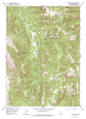
Stewart Flat Topo Map Idaho
To zoom in, hover over the map of Stewart Flat
USGS Topo Quad 42111f2 - 1:24,000 scale
| Topo Map Name: | Stewart Flat |
| USGS Topo Quad ID: | 42111f2 |
| Print Size: | ca. 21 1/4" wide x 27" high |
| Southeast Coordinates: | 42.625° N latitude / 111.125° W longitude |
| Map Center Coordinates: | 42.6875° N latitude / 111.1875° W longitude |
| U.S. State: | ID |
| Filename: | o42111f2.jpg |
| Download Map JPG Image: | Stewart Flat topo map 1:24,000 scale |
| Map Type: | Topographic |
| Topo Series: | 7.5´ |
| Map Scale: | 1:24,000 |
| Source of Map Images: | United States Geological Survey (USGS) |
| Alternate Map Versions: |
Stewart Flat ID 1949, updated 1960 Download PDF Buy paper map Stewart Flat ID 1949, updated 1977 Download PDF Buy paper map Stewart Flat ID 1951 Download PDF Buy paper map Stewart Flat ID 1999, updated 2002 Download PDF Buy paper map Stewart Flat ID 2011 Download PDF Buy paper map Stewart Flat ID 2013 Download PDF Buy paper map |
| FStopo: | US Forest Service topo Stewart Flat is available: Download FStopo PDF Download FStopo TIF |
1:24,000 Topo Quads surrounding Stewart Flat
> Back to 42111e1 at 1:100,000 scale
> Back to 42110a1 at 1:250,000 scale
> Back to U.S. Topo Maps home
Stewart Flat topo map: Gazetteer
Stewart Flat: Flats
Stewart Flat elevation 2091m 6860′Stewart Flat: Gaps
Freeman Pass elevation 2352m 7716′Stewart Flat: Ridges
Dry Ridge elevation 2646m 8681′Freeman Ridge elevation 2638m 8654′
Stewart Flat: Springs
Bell Spring elevation 2113m 6932′Hill Spring elevation 2407m 7896′
Lone Pine Spring elevation 2132m 6994′
Stewart Flat: Streams
South Fork Timber Creek elevation 2166m 7106′Timber Creek elevation 2103m 6899′
Stewart Flat: Summits
Draney Peak elevation 2735m 8973′Stewart Flat: Valleys
Bear Canyon elevation 2132m 6994′Hornet Canyon elevation 2056m 6745′
South Stewart Canyon elevation 2140m 7020′
Stewart Canyon elevation 2136m 7007′
Stewart Flat digital topo map on disk
Buy this Stewart Flat topo map showing relief, roads, GPS coordinates and other geographical features, as a high-resolution digital map file on DVD:


