Johnson Creek Topo Map Idaho
To zoom in, hover over the map of Johnson Creek
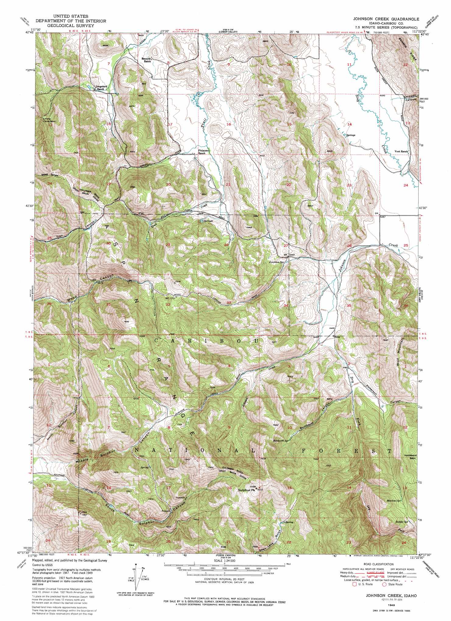
USGS Topo Quad 42111f4 - 1:24,000 scale
| Topo Map Name: | Johnson Creek |
| USGS Topo Quad ID: | 42111f4 |
| Print Size: | ca. 21 1/4" wide x 27" high |
| Southeast Coordinates: | 42.625° N latitude / 111.375° W longitude |
| Map Center Coordinates: | 42.6875° N latitude / 111.4375° W longitude |
| U.S. State: | ID |
| Filename: | o42111f4.jpg |
| Download Map JPG Image: | Johnson Creek topo map 1:24,000 scale |
| Map Type: | Topographic |
| Topo Series: | 7.5´ |
| Map Scale: | 1:24,000 |
| Source of Map Images: | United States Geological Survey (USGS) |
| Alternate Map Versions: |
Johnson Creek ID 1949, updated 1952 Download PDF Buy paper map Johnson Creek ID 1949, updated 1977 Download PDF Buy paper map Johnson Creek ID 1949, updated 1986 Download PDF Buy paper map Johnson Creek ID 1951 Download PDF Buy paper map Johnson Creek ID 2011 Download PDF Buy paper map Johnson Creek ID 2013 Download PDF Buy paper map |
| FStopo: | US Forest Service topo Johnson Creek is available: Download FStopo PDF Download FStopo TIF |
1:24,000 Topo Quads surrounding Johnson Creek
Reservoir Mountain |
Henry |
Wayan West |
Wayan East |
Stump Peak |
The Dip |
China Hat |
Lower Valley |
Upper Valley |
Diamond Flat |
Alexander |
Soda Springs |
Johnson Creek |
Dry Valley |
Stewart Flat |
Grace |
Soda Peak |
Fossil Canyon |
Harrington Peak |
Snowdrift Mountain |
Thatcher |
North Canyon |
Nounan |
Georgetown |
Meade Peak |
> Back to 42111e1 at 1:100,000 scale
> Back to 42110a1 at 1:250,000 scale
> Back to U.S. Topo Maps home
Johnson Creek topo map: Gazetteer
Johnson Creek: Dams
Simplot Number Six Tailings Dam elevation 1953m 6407′Johnson Creek: Mines
G Portal elevation 2094m 6870′Johnson Creek: Ranges
Aspen Range elevation 2387m 7831′Johnson Creek: Ridges
Columbia River Great Basin Divide elevation 2213m 7260′Johnson Creek: Springs
Burchertt Spring elevation 2132m 6994′Junction Spring elevation 2019m 6624′
Meadow Spring elevation 2242m 7355′
Saddle Spring elevation 2259m 7411′
Johnson Creek: Streams
Dry Fork elevation 1981m 6499′Johnson Creek: Summits
Sulphur Peak elevation 2493m 8179′Wolf Mountain elevation 2276m 7467′
Johnson Creek: Valleys
Burchertt Canyon elevation 2014m 6607′Caldwell Canyon elevation 2047m 6715′
Petterson Canyon elevation 2027m 6650′
Johnson Creek digital topo map on disk
Buy this Johnson Creek topo map showing relief, roads, GPS coordinates and other geographical features, as a high-resolution digital map file on DVD: