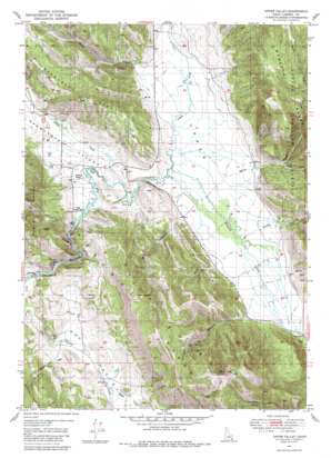
Upper Valley Topo Map Idaho
To zoom in, hover over the map of Upper Valley
USGS Topo Quad 42111g3 - 1:24,000 scale
| Topo Map Name: | Upper Valley |
| USGS Topo Quad ID: | 42111g3 |
| Print Size: | ca. 21 1/4" wide x 27" high |
| Southeast Coordinates: | 42.75° N latitude / 111.25° W longitude |
| Map Center Coordinates: | 42.8125° N latitude / 111.3125° W longitude |
| U.S. State: | ID |
| Filename: | o42111g3.jpg |
| Download Map JPG Image: | Upper Valley topo map 1:24,000 scale |
| Map Type: | Topographic |
| Topo Series: | 7.5´ |
| Map Scale: | 1:24,000 |
| Source of Map Images: | United States Geological Survey (USGS) |
| Alternate Map Versions: |
Upper Valley ID 1951 Download PDF Buy paper map Upper Valley ID 1951 Download PDF Buy paper map Upper Valley ID 1951, updated 1984 Download PDF Buy paper map Upper Valley ID 1951, updated 1984 Download PDF Buy paper map Upper Valley ID 2011 Download PDF Buy paper map Upper Valley ID 2013 Download PDF Buy paper map |
| FStopo: | US Forest Service topo Upper Valley is available: Download FStopo PDF Download FStopo TIF |
1:24,000 Topo Quads surrounding Upper Valley
> Back to 42111e1 at 1:100,000 scale
> Back to 42110a1 at 1:250,000 scale
> Back to U.S. Topo Maps home
Upper Valley topo map: Gazetteer
Upper Valley: Gaps
The Narrows elevation 1964m 6443′Upper Valley: Ridges
Rasmussen Ridge elevation 2220m 7283′Upper Valley: Streams
Angus Creek elevation 1963m 6440′Bacon Creek elevation 1960m 6430′
Cabin Creek elevation 2014m 6607′
Chicken Creek elevation 1950m 6397′
Diamond Creek elevation 1958m 6423′
Lanes Creek elevation 1960m 6430′
Mabey Creek elevation 1970m 6463′
Sheep Creek elevation 1964m 6443′
South Fork Bacon Creek elevation 2078m 6817′
South Fork Campbell Canyon elevation 2177m 7142′
Timothy Creek elevation 1972m 6469′
Upper Valley: Trails
Dry Valley Trail elevation 2428m 7965′Upper Valley: Valleys
Dry Valley elevation 1951m 6400′Kendall Canyon elevation 2014m 6607′
Mill Canyon elevation 1968m 6456′
Rasmussen Valley elevation 1957m 6420′
Upper Valley digital topo map on disk
Buy this Upper Valley topo map showing relief, roads, GPS coordinates and other geographical features, as a high-resolution digital map file on DVD:


