Chesterfield Topo Map Idaho
To zoom in, hover over the map of Chesterfield
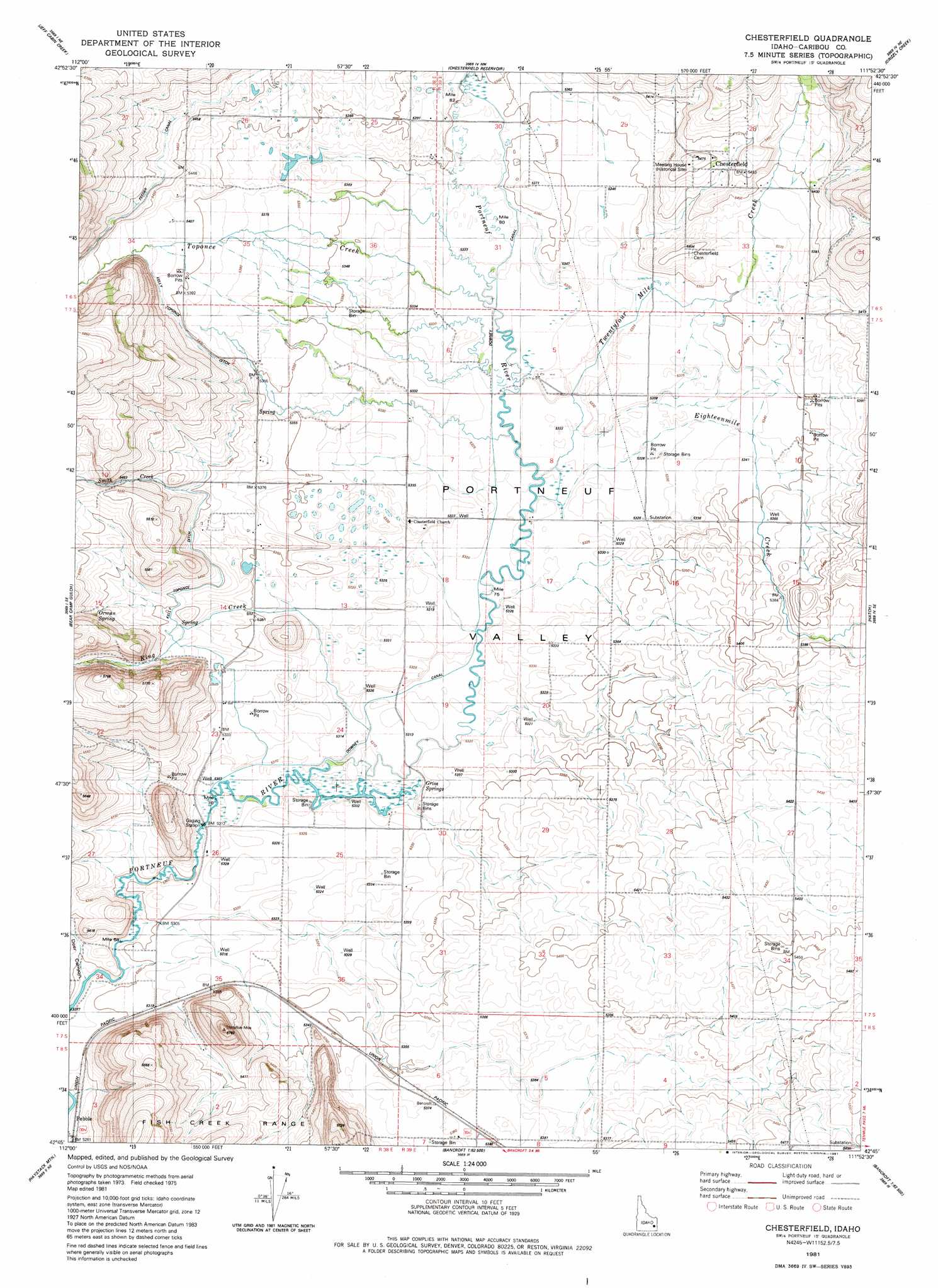
USGS Topo Quad 42111g8 - 1:24,000 scale
| Topo Map Name: | Chesterfield |
| USGS Topo Quad ID: | 42111g8 |
| Print Size: | ca. 21 1/4" wide x 27" high |
| Southeast Coordinates: | 42.75° N latitude / 111.875° W longitude |
| Map Center Coordinates: | 42.8125° N latitude / 111.9375° W longitude |
| U.S. State: | ID |
| Filename: | o42111g8.jpg |
| Download Map JPG Image: | Chesterfield topo map 1:24,000 scale |
| Map Type: | Topographic |
| Topo Series: | 7.5´ |
| Map Scale: | 1:24,000 |
| Source of Map Images: | United States Geological Survey (USGS) |
| Alternate Map Versions: |
Chesterfield ID 1981, updated 1981 Download PDF Buy paper map Chesterfield ID 2010 Download PDF Buy paper map Chesterfield ID 2013 Download PDF Buy paper map |
1:24,000 Topo Quads surrounding Chesterfield
Yandell Springs |
Lincoln Peak |
Dunn Basin |
Paradise Valley |
Meadow Creek Mountain |
South Putnam Mountain |
Jeff Cabin Creek |
Chesterfield Res |
Grizzly Creek |
Reservoir Mountain |
Bonneville Peak |
Bear Camp Gulch |
Chesterfield |
Hatch |
The Dip |
Mccammon |
Haystack Mountain |
Bancroft |
Talmage |
Alexander |
Arimo |
Lava Hot Springs |
Sedgwick Peak |
Grace Power Plant |
Grace |
> Back to 42111e1 at 1:100,000 scale
> Back to 42110a1 at 1:250,000 scale
> Back to U.S. Topo Maps home
Chesterfield topo map: Gazetteer
Chesterfield: Canals
Downey Canal elevation 1623m 5324′Kelly Toponce Ditch elevation 1648m 5406′
Portneuf Marsh Valley Irrigation Company Feeder Canal elevation 1684m 5524′
Toponce and Chesterfield Land Co Ditch elevation 1661m 5449′
Chesterfield: Populated Places
Chesterfield elevation 1660m 5446′Kinport elevation 1639m 5377′
Chesterfield: Springs
Grim Springs elevation 1620m 5314′Orman Spring elevation 1666m 5465′
Chesterfield: Streams
Eighteenmile Creek elevation 1629m 5344′King Creek elevation 1631m 5351′
Moses Creek elevation 1644m 5393′
Smith Creek elevation 1650m 5413′
Toponce Creek elevation 1625m 5331′
Twentyfour Mile Creek elevation 1626m 5334′
Chesterfield: Valleys
Higginson Canyon elevation 1654m 5426′Chesterfield digital topo map on disk
Buy this Chesterfield topo map showing relief, roads, GPS coordinates and other geographical features, as a high-resolution digital map file on DVD: