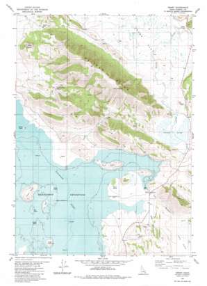
Henry Topo Map Idaho
To zoom in, hover over the map of Henry
USGS Topo Quad 42111h5 - 1:24,000 scale
| Topo Map Name: | Henry |
| USGS Topo Quad ID: | 42111h5 |
| Print Size: | ca. 21 1/4" wide x 27" high |
| Southeast Coordinates: | 42.875° N latitude / 111.5° W longitude |
| Map Center Coordinates: | 42.9375° N latitude / 111.5625° W longitude |
| U.S. State: | ID |
| Filename: | o42111h5.jpg |
| Download Map JPG Image: | Henry topo map 1:24,000 scale |
| Map Type: | Topographic |
| Topo Series: | 7.5´ |
| Map Scale: | 1:24,000 |
| Source of Map Images: | United States Geological Survey (USGS) |
| Alternate Map Versions: |
Henry ID 1981, updated 1981 Download PDF Buy paper map Henry ID 2010 Download PDF Buy paper map Henry ID 2013 Download PDF Buy paper map |
1:24,000 Topo Quads surrounding Henry
> Back to 42111e1 at 1:100,000 scale
> Back to 42110a1 at 1:250,000 scale
> Back to U.S. Topo Maps home
Henry topo map: Gazetteer
Henry: Flats
Chubb Flat elevation 1907m 6256′Henry: Gaps
Wilson Pass elevation 2017m 6617′Henry: Islands
Buck Island elevation 1891m 6204′Chain Island elevation 1867m 6125′
Cinder Island elevation 1886m 6187′
Gull Island elevation 1871m 6138′
Long Island elevation 1871m 6138′
Sheep Island elevation 1903m 6243′
Spring Island elevation 1867m 6125′
Willow Island elevation 1867m 6125′
Henry: Parks
Henry Stampede Park elevation 1871m 6138′Henry: Populated Places
Henry elevation 1871m 6138′Henry: Ridges
Pelican Ridge elevation 2320m 7611′Henry: Springs
Chubb Springs elevation 1913m 6276′Gaston Beatty Spring elevation 1978m 6489′
Rosie Spring elevation 1910m 6266′
Warm Spring elevation 1875m 6151′
Henry: Streams
Collett Creek elevation 1866m 6122′Little Blackfoot River elevation 1870m 6135′
Meadow Creek elevation 1866m 6122′
Henry: Summits
Camp Peak elevation 2268m 7440′Crater Mountain elevation 2138m 7014′
Robbers Roost elevation 1923m 6309′
Henry: Swamps
Goose Lake elevation 1896m 6220′Henry: Valleys
Long Valley elevation 1920m 6299′Henry digital topo map on disk
Buy this Henry topo map showing relief, roads, GPS coordinates and other geographical features, as a high-resolution digital map file on DVD:


