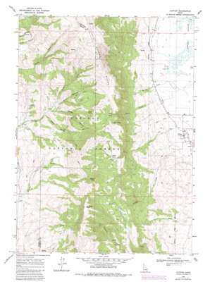
Clifton Topo Map Idaho
To zoom in, hover over the map of Clifton
USGS Topo Quad 42112b1 - 1:24,000 scale
| Topo Map Name: | Clifton |
| USGS Topo Quad ID: | 42112b1 |
| Print Size: | ca. 21 1/4" wide x 27" high |
| Southeast Coordinates: | 42.125° N latitude / 112° W longitude |
| Map Center Coordinates: | 42.1875° N latitude / 112.0625° W longitude |
| U.S. State: | ID |
| Filename: | o42112b1.jpg |
| Download Map JPG Image: | Clifton topo map 1:24,000 scale |
| Map Type: | Topographic |
| Topo Series: | 7.5´ |
| Map Scale: | 1:24,000 |
| Source of Map Images: | United States Geological Survey (USGS) |
| Alternate Map Versions: |
Clifton ID 1968, updated 1971 Download PDF Buy paper map Clifton ID 1968, updated 1982 Download PDF Buy paper map Clifton ID 1968, updated 1984 Download PDF Buy paper map Clifton ID 2011 Download PDF Buy paper map Clifton ID 2013 Download PDF Buy paper map |
| FStopo: | US Forest Service topo Clifton is available: Download FStopo PDF Download FStopo TIF |
1:24,000 Topo Quads surrounding Clifton
> Back to 42112a1 at 1:100,000 scale
> Back to 42112a1 at 1:250,000 scale
> Back to U.S. Topo Maps home
Clifton topo map: Gazetteer
Clifton: Basins
Clifton Basin elevation 1931m 6335′Davis Basin elevation 2086m 6843′
Clifton: Populated Places
Clifton elevation 1479m 4852′Clifton: Ridges
Oxford Ridge elevation 2531m 8303′Clifton: Springs
Poison Spring elevation 2084m 6837′Clifton: Streams
Clifton Creek elevation 1489m 4885′Davis Creek elevation 1505m 4937′
Michael Creek elevation 1448m 4750′
Third Creek elevation 1761m 5777′
Clifton: Summits
Buck Peak elevation 2273m 7457′Old Baldy Peak elevation 2549m 8362′
Weston Peak elevation 2469m 8100′
Clifton: Valleys
Mine Hollow elevation 1822m 5977′Ruben Hollow elevation 1732m 5682′
Steep Canyon elevation 1797m 5895′
Clifton digital topo map on disk
Buy this Clifton topo map showing relief, roads, GPS coordinates and other geographical features, as a high-resolution digital map file on DVD:


