Ireland Springs Topo Map Idaho
To zoom in, hover over the map of Ireland Springs
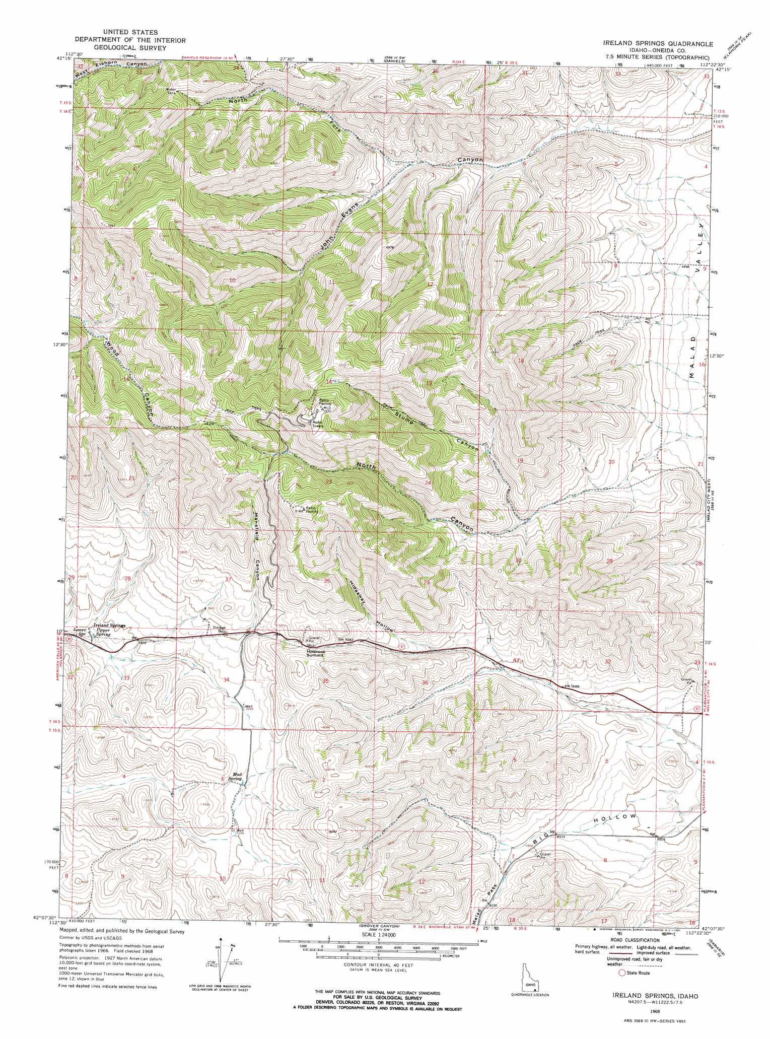
USGS Topo Quad 42112b4 - 1:24,000 scale
| Topo Map Name: | Ireland Springs |
| USGS Topo Quad ID: | 42112b4 |
| Print Size: | ca. 21 1/4" wide x 27" high |
| Southeast Coordinates: | 42.125° N latitude / 112.375° W longitude |
| Map Center Coordinates: | 42.1875° N latitude / 112.4375° W longitude |
| U.S. State: | ID |
| Filename: | o42112b4.jpg |
| Download Map JPG Image: | Ireland Springs topo map 1:24,000 scale |
| Map Type: | Topographic |
| Topo Series: | 7.5´ |
| Map Scale: | 1:24,000 |
| Source of Map Images: | United States Geological Survey (USGS) |
| Alternate Map Versions: |
Ireland Springs ID 1968, updated 1971 Download PDF Buy paper map Ireland Springs ID 2010 Download PDF Buy paper map Ireland Springs ID 2013 Download PDF Buy paper map |
1:24,000 Topo Quads surrounding Ireland Springs
Deep Creek Peak |
Arbon |
Dairy Creek |
Wakley Peak |
Downey West |
Cedarhill |
Buist |
Daniels |
Elkhorn Peak |
Malad Summit |
Holbrook |
Sheep Creek Spring |
Ireland Springs |
Malad City West |
Malad City East |
Stone |
Co-Op Spring |
Grover Canyon |
Samaria |
Henderson Creek |
Snowville |
Rattlesnake Pass |
Ridgedale Pass |
Limekiln Knoll |
Portage |
> Back to 42112a1 at 1:100,000 scale
> Back to 42112a1 at 1:250,000 scale
> Back to U.S. Topo Maps home
Ireland Springs topo map: Gazetteer
Ireland Springs: Populated Places
Holbrook Summit elevation 1779m 5836′Ireland Springs elevation 1608m 5275′
Ireland Springs: Springs
Lower Spring elevation 1610m 5282′Mud Spring elevation 1657m 5436′
Upper Spring elevation 1612m 5288′
Ireland Springs: Valleys
Big Hollow elevation 1452m 4763′Hideaway Hollow elevation 1641m 5383′
Mansfield Canyon elevation 1670m 5479′
North Canyon elevation 1489m 4885′
North Fork John Evans Canyon elevation 1664m 5459′
Stump Canyon elevation 1608m 5275′
Ireland Springs digital topo map on disk
Buy this Ireland Springs topo map showing relief, roads, GPS coordinates and other geographical features, as a high-resolution digital map file on DVD: