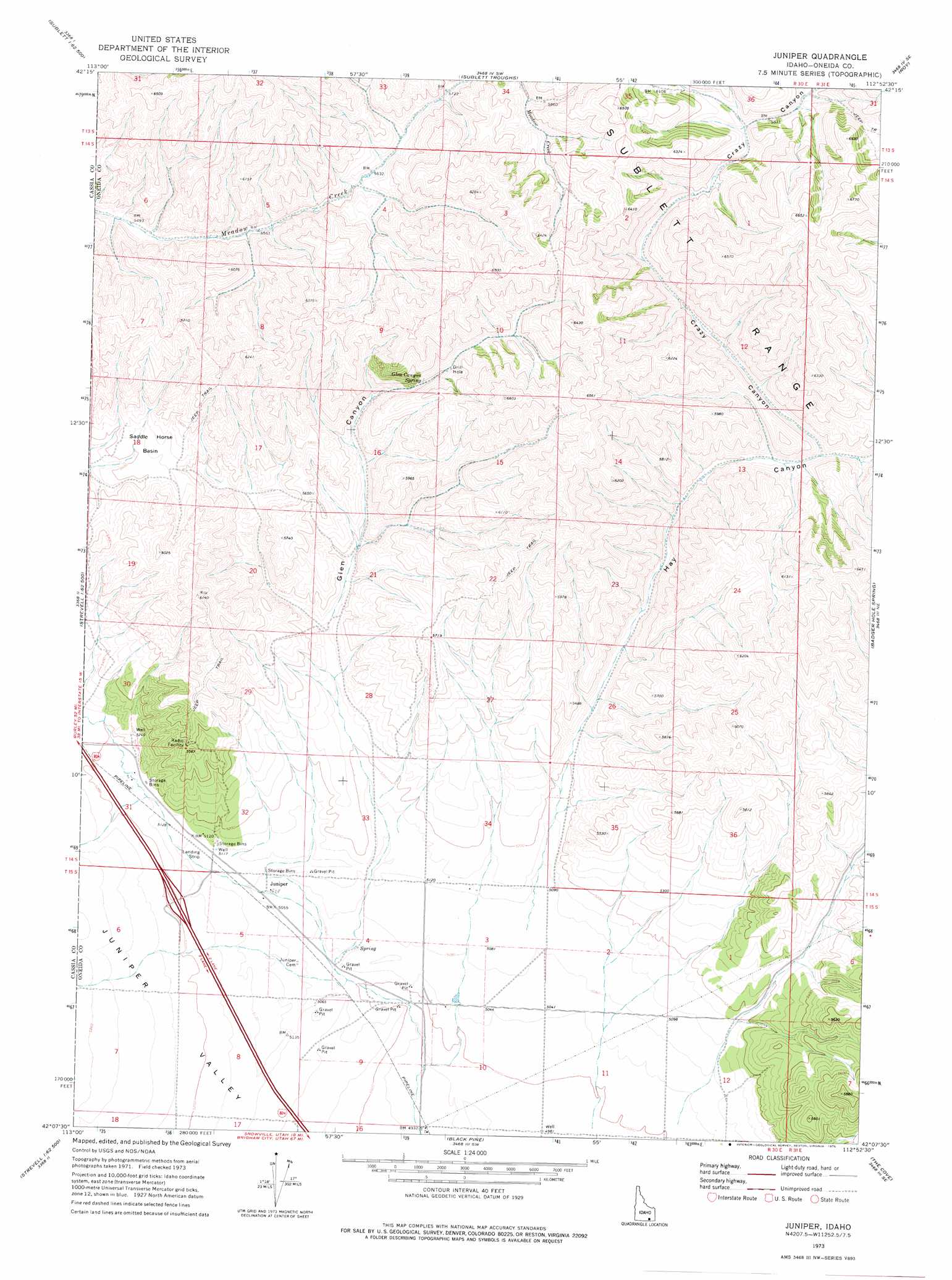
Juniper Topo Map Idaho
To zoom in, hover over the map of Juniper
USGS Topo Quad 42112b8 - 1:24,000 scale
| Topo Map Name: | Juniper |
| USGS Topo Quad ID: | 42112b8 |
| Print Size: | ca. 21 1/4" wide x 27" high |
| Southeast Coordinates: | 42.125° N latitude / 112.875° W longitude |
| Map Center Coordinates: | 42.1875° N latitude / 112.9375° W longitude |
| U.S. State: | ID |
| Filename: | o42112b8.jpg |
| Download Map JPG Image: | Juniper topo map 1:24,000 scale |
| Map Type: | Topographic |
| Topo Series: | 7.5´ |
| Map Scale: | 1:24,000 |
| Source of Map Images: | United States Geological Survey (USGS) |
| Alternate Map Versions: |
Juniper ID 1973, updated 1976 Download PDF Buy paper map Juniper ID 2011 Download PDF Buy paper map Juniper ID 2013 Download PDF Buy paper map |
1:24,000 Topo Quads surrounding Juniper
South Chapin Mountain |
North Heglar Canyon |
Hartley Peak |
Roy Ne |
Deep Creek Peak |
Sublett |
Sublett Reservoir |
Sublett Troughs |
Roy |
Cedarhill |
Sandrock Canyon |
Sweetzer Canyon |
Juniper |
Badger Hole Spring |
Holbrook |
Strevell |
Black Pine Peak |
Black Pine |
The Cove |
Stone |
Kelton Pass |
Curlew Junction |
Monument Peak Nw |
Monument Peak Ne |
Snowville |
> Back to 42112a1 at 1:100,000 scale
> Back to 42112a1 at 1:250,000 scale
> Back to U.S. Topo Maps home
Juniper topo map: Gazetteer
Juniper: Basins
Saddle Horse Basin elevation 1728m 5669′Juniper: Populated Places
Juniper elevation 1547m 5075′Juniper: Springs
Glen Canyon Spring elevation 1784m 5853′Juniper: Valleys
Crazy Canyon elevation 1652m 5419′Glen Canyon elevation 1551m 5088′
Hay Canyon elevation 1559m 5114′
Juniper digital topo map on disk
Buy this Juniper topo map showing relief, roads, GPS coordinates and other geographical features, as a high-resolution digital map file on DVD: