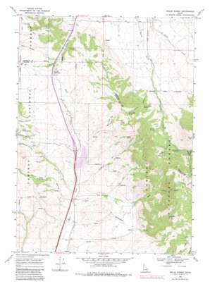
Malad Summit Topo Map Idaho
To zoom in, hover over the map of Malad Summit
USGS Topo Quad 42112c2 - 1:24,000 scale
| Topo Map Name: | Malad Summit |
| USGS Topo Quad ID: | 42112c2 |
| Print Size: | ca. 21 1/4" wide x 27" high |
| Southeast Coordinates: | 42.25° N latitude / 112.125° W longitude |
| Map Center Coordinates: | 42.3125° N latitude / 112.1875° W longitude |
| U.S. State: | ID |
| Filename: | o42112c2.jpg |
| Download Map JPG Image: | Malad Summit topo map 1:24,000 scale |
| Map Type: | Topographic |
| Topo Series: | 7.5´ |
| Map Scale: | 1:24,000 |
| Source of Map Images: | United States Geological Survey (USGS) |
| Alternate Map Versions: |
Malad Summit ID 1968, updated 1971 Download PDF Buy paper map Malad Summit ID 1968, updated 1984 Download PDF Buy paper map Malad Summit ID 2011 Download PDF Buy paper map Malad Summit ID 2013 Download PDF Buy paper map |
| FStopo: | US Forest Service topo Malad Summit is available: Download FStopo PDF Download FStopo TIF |
1:24,000 Topo Quads surrounding Malad Summit
> Back to 42112a1 at 1:100,000 scale
> Back to 42112a1 at 1:250,000 scale
> Back to U.S. Topo Maps home
Malad Summit topo map: Gazetteer
Malad Summit: Dams
Devil Creek Dam elevation 1555m 5101′Malad Summit: Flats
Curly Jack Flat elevation 1786m 5859′Malad Summit: Springs
Campbell Spring elevation 1920m 6299′Cherry Spring elevation 1817m 5961′
Curly Jack Spring elevation 1939m 6361′
Heath Spring elevation 1702m 5583′
Lower Station Spring elevation 1855m 6085′
Pine Spring elevation 1921m 6302′
Rattlesnake Spring elevation 2006m 6581′
Toms Canyon Spring elevation 1729m 5672′
Malad Summit: Streams
Campbell Creek elevation 1547m 5075′Left Fork Cherry Creek elevation 1818m 5964′
Middle Fork Cherry Creek elevation 1744m 5721′
Mill Creek elevation 1751m 5744′
Mine Creek elevation 1893m 6210′
New Canyon Creek elevation 1538m 5045′
Rattlesnake Creek elevation 1508m 4947′
Right Fork Cherry Creek elevation 1744m 5721′
Malad Summit: Summits
Malad Summit elevation 1708m 5603′Malad Summit: Valleys
Evans Canyon elevation 1757m 5764′Heath Hollow elevation 1549m 5082′
Little Station Canyon elevation 1696m 5564′
New Canyon elevation 1639m 5377′
North Canyon elevation 1658m 5439′
Station Canyon elevation 1780m 5839′
Toms Canyon elevation 1608m 5275′
Malad Summit digital topo map on disk
Buy this Malad Summit topo map showing relief, roads, GPS coordinates and other geographical features, as a high-resolution digital map file on DVD:


