Dairy Creek Topo Map Idaho
To zoom in, hover over the map of Dairy Creek
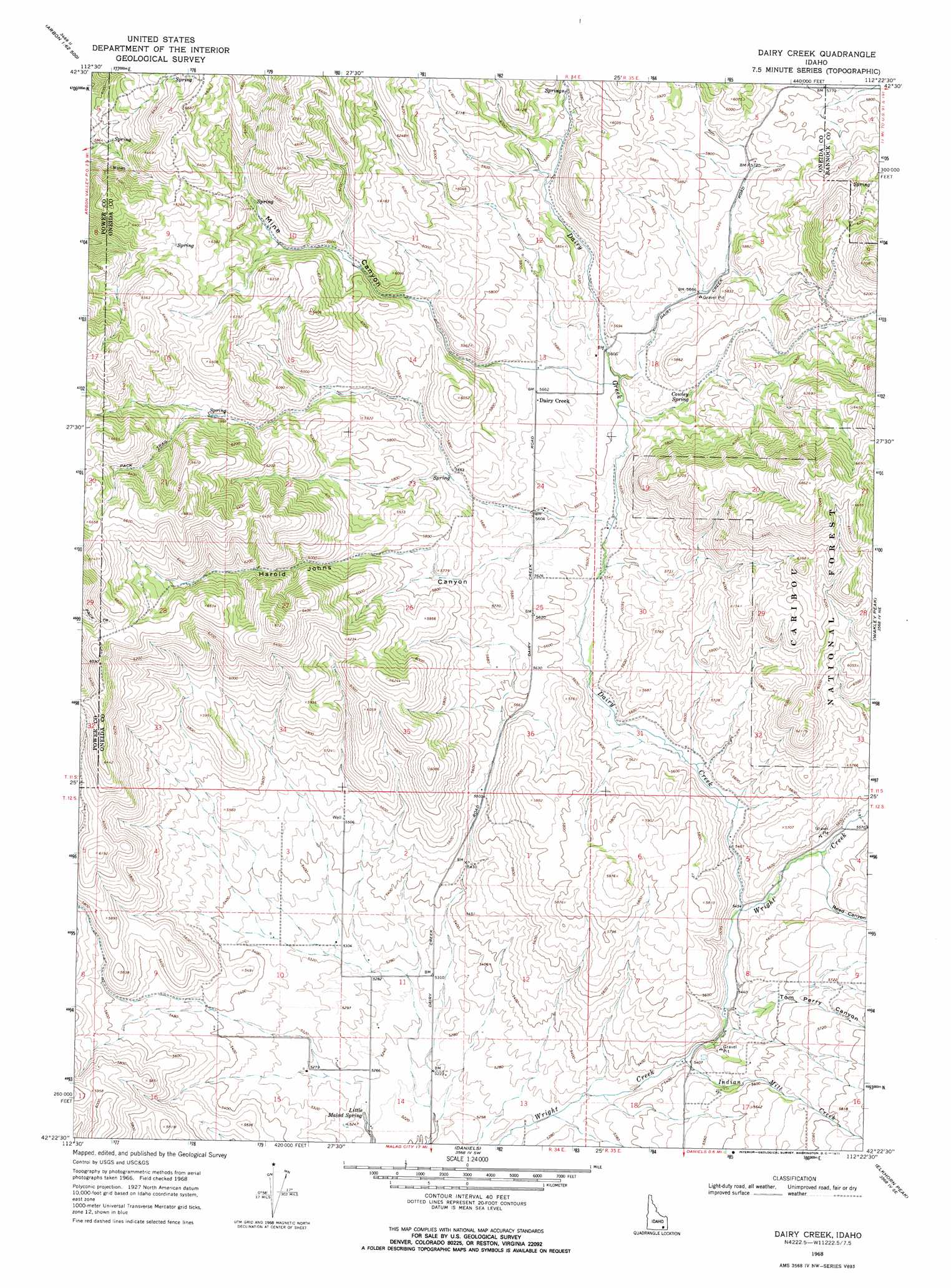
USGS Topo Quad 42112d4 - 1:24,000 scale
| Topo Map Name: | Dairy Creek |
| USGS Topo Quad ID: | 42112d4 |
| Print Size: | ca. 21 1/4" wide x 27" high |
| Southeast Coordinates: | 42.375° N latitude / 112.375° W longitude |
| Map Center Coordinates: | 42.4375° N latitude / 112.4375° W longitude |
| U.S. State: | ID |
| Filename: | o42112d4.jpg |
| Download Map JPG Image: | Dairy Creek topo map 1:24,000 scale |
| Map Type: | Topographic |
| Topo Series: | 7.5´ |
| Map Scale: | 1:24,000 |
| Source of Map Images: | United States Geological Survey (USGS) |
| Alternate Map Versions: |
Dairy Creek ID 1968, updated 1971 Download PDF Buy paper map Dairy Creek ID 2011 Download PDF Buy paper map Dairy Creek ID 2013 Download PDF Buy paper map |
| FStopo: | US Forest Service topo Dairy Creek is available: Download FStopo PDF Download FStopo TIF |
1:24,000 Topo Quads surrounding Dairy Creek
Sawmill Creek |
Flatiron Hill |
Clifton Creek |
Scout Mountain |
Mccammon |
Bannock Peak |
Pauline |
Bradley Mountain |
Hawkins |
Arimo |
Deep Creek Peak |
Arbon |
Dairy Creek |
Wakley Peak |
Downey West |
Cedarhill |
Buist |
Daniels |
Elkhorn Peak |
Malad Summit |
Holbrook |
Sheep Creek Spring |
Ireland Springs |
Malad City West |
Malad City East |
> Back to 42112a1 at 1:100,000 scale
> Back to 42112a1 at 1:250,000 scale
> Back to U.S. Topo Maps home
Dairy Creek topo map: Gazetteer
Dairy Creek: Populated Places
Dairy Creek elevation 1732m 5682′Dairy Creek: Springs
Cowley Spring elevation 1731m 5679′Little Malad Spring elevation 1585m 5200′
Dairy Creek: Streams
Dairy Creek elevation 1664m 5459′Indian Mill Creek elevation 1643m 5390′
Dairy Creek: Summits
Mount Elkhorn elevation 1856m 6089′Dairy Creek: Valleys
Harold Johns Canyon elevation 1707m 5600′Mine Canyon elevation 1719m 5639′
Reed Canyon elevation 1684m 5524′
Tom Perry Canyon elevation 1659m 5442′
Dairy Creek digital topo map on disk
Buy this Dairy Creek topo map showing relief, roads, GPS coordinates and other geographical features, as a high-resolution digital map file on DVD: