Deep Creek Peak Topo Map Idaho
To zoom in, hover over the map of Deep Creek Peak
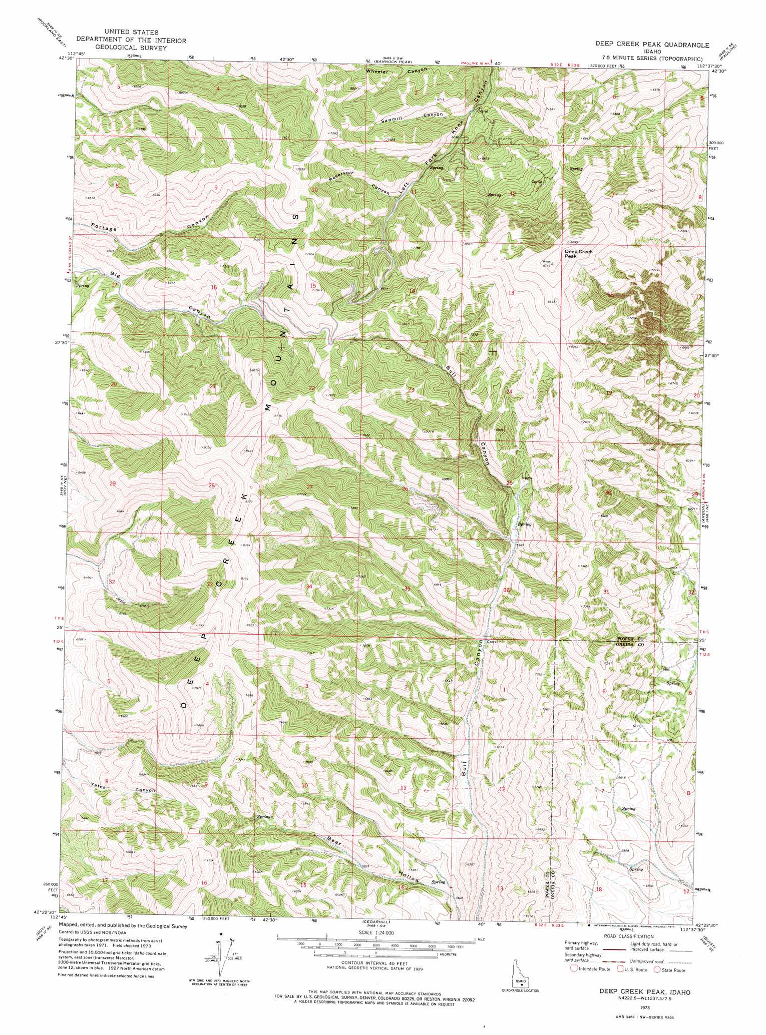
USGS Topo Quad 42112d6 - 1:24,000 scale
| Topo Map Name: | Deep Creek Peak |
| USGS Topo Quad ID: | 42112d6 |
| Print Size: | ca. 21 1/4" wide x 27" high |
| Southeast Coordinates: | 42.375° N latitude / 112.625° W longitude |
| Map Center Coordinates: | 42.4375° N latitude / 112.6875° W longitude |
| U.S. State: | ID |
| Filename: | o42112d6.jpg |
| Download Map JPG Image: | Deep Creek Peak topo map 1:24,000 scale |
| Map Type: | Topographic |
| Topo Series: | 7.5´ |
| Map Scale: | 1:24,000 |
| Source of Map Images: | United States Geological Survey (USGS) |
| Alternate Map Versions: |
Deep Creek Peak ID 1973, updated 1977 Download PDF Buy paper map Deep Creek Peak ID 2010 Download PDF Buy paper map Deep Creek Peak ID 2013 Download PDF Buy paper map |
1:24,000 Topo Quads surrounding Deep Creek Peak
Neeley |
Indian Springs |
Sawmill Creek |
Flatiron Hill |
Clifton Creek |
Rockland West |
Rockland East |
Bannock Peak |
Pauline |
Bradley Mountain |
Hartley Peak |
Roy Ne |
Deep Creek Peak |
Arbon |
Dairy Creek |
Sublett Troughs |
Roy |
Cedarhill |
Buist |
Daniels |
Juniper |
Badger Hole Spring |
Holbrook |
Sheep Creek Spring |
Ireland Springs |
> Back to 42112a1 at 1:100,000 scale
> Back to 42112a1 at 1:250,000 scale
> Back to U.S. Topo Maps home
Deep Creek Peak topo map: Gazetteer
Deep Creek Peak: Ranges
Deep Creek Mountains elevation 2564m 8412′Deep Creek Peak: Summits
Deep Creek Peak elevation 2664m 8740′Deep Creek Peak: Valleys
Reservoir Canyon elevation 1961m 6433′Sawmill Canyon elevation 1840m 6036′
Deep Creek Peak digital topo map on disk
Buy this Deep Creek Peak topo map showing relief, roads, GPS coordinates and other geographical features, as a high-resolution digital map file on DVD: