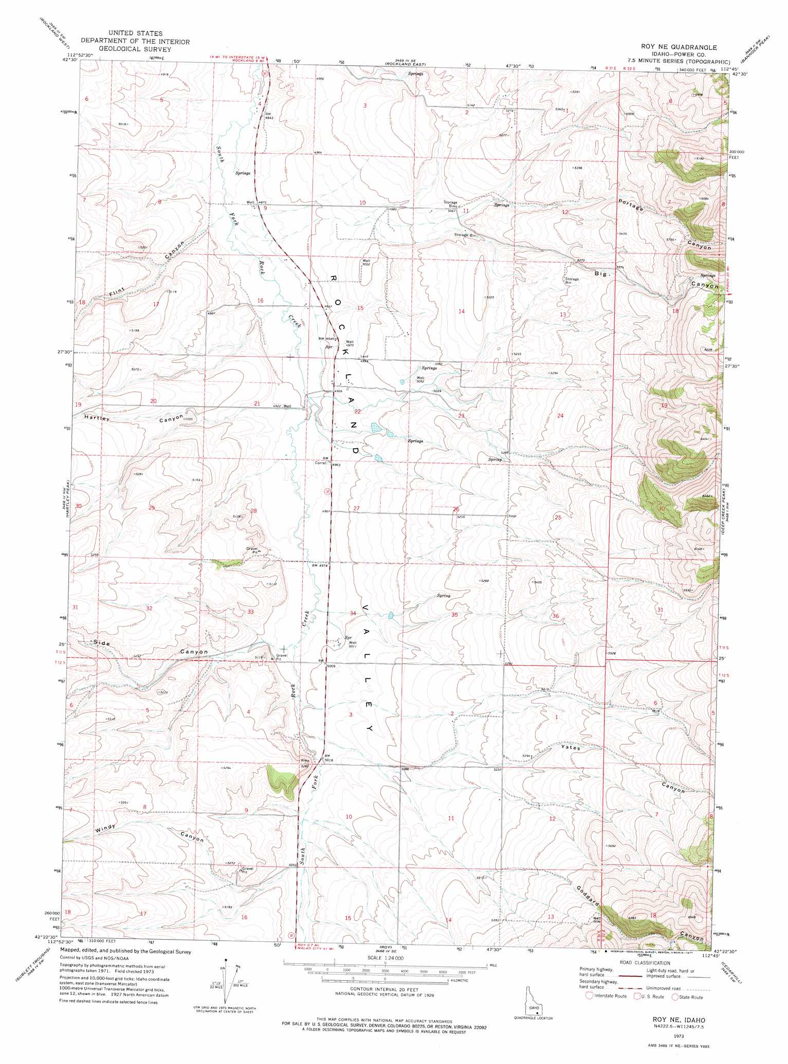
Roy Ne Topo Map Idaho
To zoom in, hover over the map of Roy Ne
USGS Topo Quad 42112d7 - 1:24,000 scale
| Topo Map Name: | Roy Ne |
| USGS Topo Quad ID: | 42112d7 |
| Print Size: | ca. 21 1/4" wide x 27" high |
| Southeast Coordinates: | 42.375° N latitude / 112.75° W longitude |
| Map Center Coordinates: | 42.4375° N latitude / 112.8125° W longitude |
| U.S. State: | ID |
| Filename: | o42112d7.jpg |
| Download Map JPG Image: | Roy Ne topo map 1:24,000 scale |
| Map Type: | Topographic |
| Topo Series: | 7.5´ |
| Map Scale: | 1:24,000 |
| Source of Map Images: | United States Geological Survey (USGS) |
| Alternate Map Versions: |
Roy NE ID 1973, updated 1977 Download PDF Buy paper map Roy NE ID 2010 Download PDF Buy paper map Roy NE ID 2013 Download PDF Buy paper map |
1:24,000 Topo Quads surrounding Roy Ne
Register Rock |
Neeley |
Indian Springs |
Sawmill Creek |
Flatiron Hill |
Badger Peak |
Rockland West |
Rockland East |
Bannock Peak |
Pauline |
North Heglar Canyon |
Hartley Peak |
Roy Ne |
Deep Creek Peak |
Arbon |
Sublett Reservoir |
Sublett Troughs |
Roy |
Cedarhill |
Buist |
Sweetzer Canyon |
Juniper |
Badger Hole Spring |
Holbrook |
Sheep Creek Spring |
> Back to 42112a1 at 1:100,000 scale
> Back to 42112a1 at 1:250,000 scale
> Back to U.S. Topo Maps home
Roy Ne topo map: Gazetteer
Roy Ne: Valleys
Big Canyon elevation 1537m 5042′Flint Canyon elevation 1484m 4868′
Goddard Canyon elevation 1547m 5075′
Hartley Canyon elevation 1506m 4940′
Portage Canyon elevation 1543m 5062′
Side Canyon elevation 1522m 4993′
Windy Canyon elevation 1543m 5062′
Yates Canyon elevation 1525m 5003′
Roy Ne digital topo map on disk
Buy this Roy Ne topo map showing relief, roads, GPS coordinates and other geographical features, as a high-resolution digital map file on DVD: