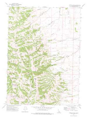
Hartley Peak Topo Map Idaho
To zoom in, hover over the map of Hartley Peak
USGS Topo Quad 42112d8 - 1:24,000 scale
| Topo Map Name: | Hartley Peak |
| USGS Topo Quad ID: | 42112d8 |
| Print Size: | ca. 21 1/4" wide x 27" high |
| Southeast Coordinates: | 42.375° N latitude / 112.875° W longitude |
| Map Center Coordinates: | 42.4375° N latitude / 112.9375° W longitude |
| U.S. State: | ID |
| Filename: | o42112d8.jpg |
| Download Map JPG Image: | Hartley Peak topo map 1:24,000 scale |
| Map Type: | Topographic |
| Topo Series: | 7.5´ |
| Map Scale: | 1:24,000 |
| Source of Map Images: | United States Geological Survey (USGS) |
| Alternate Map Versions: |
Hartley Peak ID 1973, updated 1976 Download PDF Buy paper map Hartley Peak ID 2011 Download PDF Buy paper map Hartley Peak ID 2013 Download PDF Buy paper map |
| FStopo: | US Forest Service topo Hartley Peak is available: Download FStopo PDF Download FStopo TIF |
1:24,000 Topo Quads surrounding Hartley Peak
> Back to 42112a1 at 1:100,000 scale
> Back to 42112a1 at 1:250,000 scale
> Back to U.S. Topo Maps home
Hartley Peak topo map: Gazetteer
Hartley Peak: Ridges
Cedar Ridge elevation 1708m 5603′Hartley Peak: Summits
Hartley Peak elevation 2269m 7444′Hartley Peak: Valleys
Big Canyon elevation 1936m 6351′Cone Canyon elevation 1916m 6286′
Donkey Canyon elevation 1920m 6299′
Flat Canyon elevation 1942m 6371′
Last Chance Gulch elevation 1938m 6358′
Long Canyon elevation 1959m 6427′
Mistletow Canyon elevation 1848m 6062′
North Fork Sheep Canyon elevation 1875m 6151′
Pine Canyon elevation 1973m 6473′
Red Ledge Canyon elevation 1630m 5347′
Sawpit Canyon elevation 1804m 5918′
Section Corner Canyon elevation 1901m 6236′
South Summit Canyon elevation 1802m 5912′
Warner Canyon elevation 1610m 5282′
Hartley Peak digital topo map on disk
Buy this Hartley Peak topo map showing relief, roads, GPS coordinates and other geographical features, as a high-resolution digital map file on DVD:


