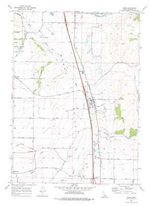
Arimo Topo Map Idaho
To zoom in, hover over the map of Arimo
USGS Topo Quad 42112e2 - 1:24,000 scale
| Topo Map Name: | Arimo |
| USGS Topo Quad ID: | 42112e2 |
| Print Size: | ca. 21 1/4" wide x 27" high |
| Southeast Coordinates: | 42.5° N latitude / 112.125° W longitude |
| Map Center Coordinates: | 42.5625° N latitude / 112.1875° W longitude |
| U.S. State: | ID |
| Filename: | o42112e2.jpg |
| Download Map JPG Image: | Arimo topo map 1:24,000 scale |
| Map Type: | Topographic |
| Topo Series: | 7.5´ |
| Map Scale: | 1:24,000 |
| Source of Map Images: | United States Geological Survey (USGS) |
| Alternate Map Versions: |
Arimo ID 1968, updated 1972 Download PDF Buy paper map Arimo ID 1968, updated 1978 Download PDF Buy paper map Arimo ID 2010 Download PDF Buy paper map Arimo ID 2013 Download PDF Buy paper map |
1:24,000 Topo Quads surrounding Arimo
> Back to 42112e1 at 1:100,000 scale
> Back to 42112a1 at 1:250,000 scale
> Back to U.S. Topo Maps home
Arimo topo map: Gazetteer
Arimo: Canals
Arimo Ditch elevation 1474m 4835′Arimo: Populated Places
Arimo elevation 1446m 4744′Marsh Valley elevation 1486m 4875′
Robin elevation 1489m 4885′
Arimo: Streams
Arkansas Creek elevation 1417m 4648′Birch Creek elevation 1409m 4622′
Cottonwood Creek elevation 1410m 4625′
Ellis Creek elevation 1443m 4734′
Garden Creek elevation 1415m 4642′
Hawkins Creek elevation 1421m 4662′
Lost Creek elevation 1435m 4708′
Peck Creek elevation 1419m 4655′
Pilot Spring Creek elevation 1446m 4744′
Arimo: Valleys
Nats Canyon elevation 1579m 5180′Rough Canyon elevation 1604m 5262′
Arimo digital topo map on disk
Buy this Arimo topo map showing relief, roads, GPS coordinates and other geographical features, as a high-resolution digital map file on DVD:


