South Putnam Mountain Topo Map Idaho
To zoom in, hover over the map of South Putnam Mountain
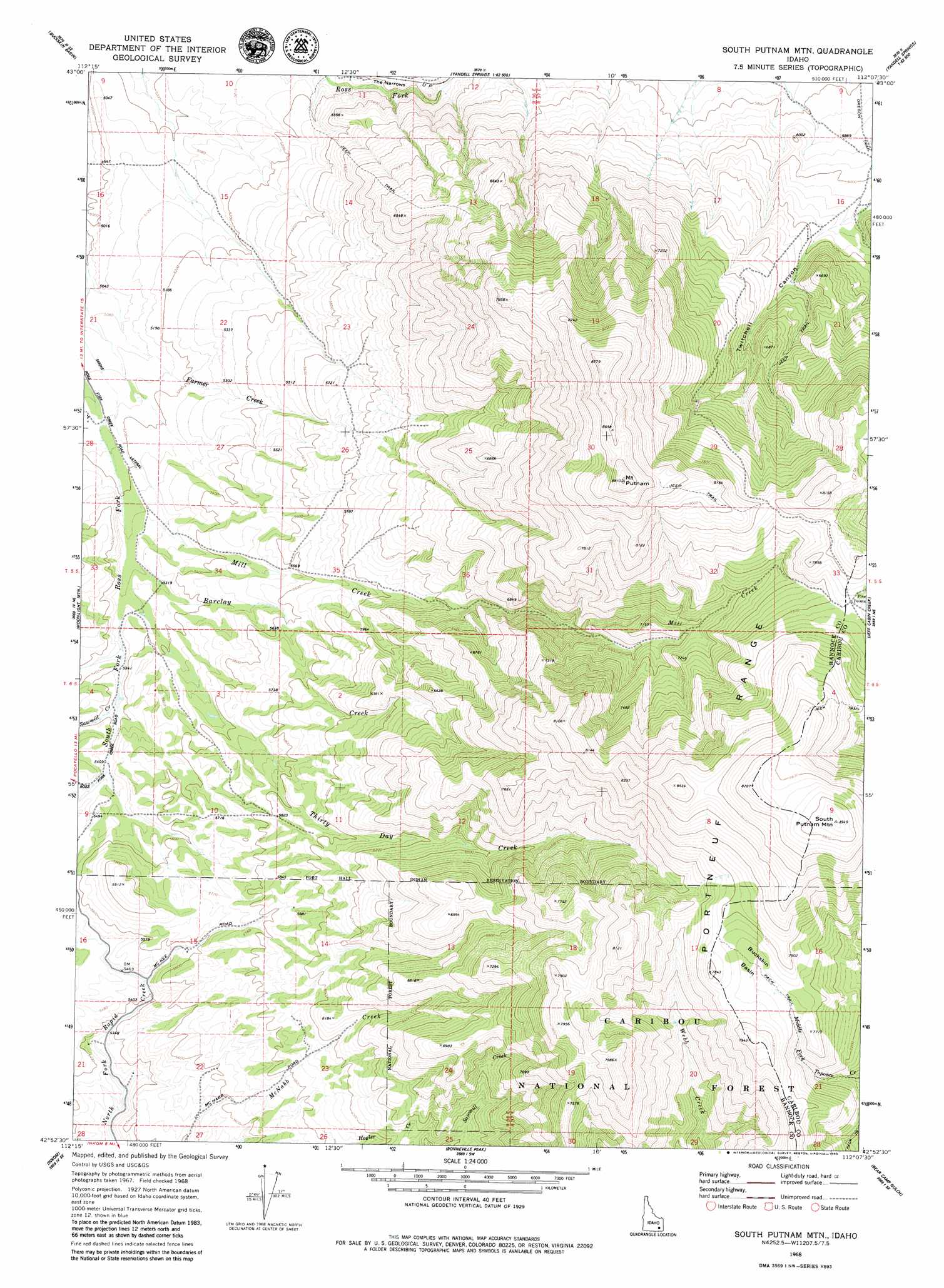
USGS Topo Quad 42112h2 - 1:24,000 scale
| Topo Map Name: | South Putnam Mountain |
| USGS Topo Quad ID: | 42112h2 |
| Print Size: | ca. 21 1/4" wide x 27" high |
| Southeast Coordinates: | 42.875° N latitude / 112.125° W longitude |
| Map Center Coordinates: | 42.9375° N latitude / 112.1875° W longitude |
| U.S. State: | ID |
| Filename: | o42112h2.jpg |
| Download Map JPG Image: | South Putnam Mountain topo map 1:24,000 scale |
| Map Type: | Topographic |
| Topo Series: | 7.5´ |
| Map Scale: | 1:24,000 |
| Source of Map Images: | United States Geological Survey (USGS) |
| Alternate Map Versions: |
South Putnam Mtn ID 1968, updated 1972 Download PDF Buy paper map South Putnam Mountain ID 2011 Download PDF Buy paper map South Putnam Mountain ID 2013 Download PDF Buy paper map |
| FStopo: | US Forest Service topo South Putnam Mountain is available: Download FStopo PDF Download FStopo TIF |
1:24,000 Topo Quads surrounding South Putnam Mountain
Moreland |
Blackfoot |
Lincoln Creek |
Higham Peak |
Miner Creek |
Fort Hall |
Buckskin Basin |
Yandell Springs |
Lincoln Peak |
Dunn Basin |
Pocatello North |
Moonlight Mountain |
South Putnam Mountain |
Jeff Cabin Creek |
Chesterfield Res |
Pocatello South |
Inkom |
Bonneville Peak |
Bear Camp Gulch |
Chesterfield |
Clifton Creek |
Scout Mountain |
Mccammon |
Haystack Mountain |
Bancroft |
> Back to 42112e1 at 1:100,000 scale
> Back to 42112a1 at 1:250,000 scale
> Back to U.S. Topo Maps home
South Putnam Mountain topo map: Gazetteer
South Putnam Mountain: Basins
Buckskin Basin elevation 2327m 7634′South Putnam Mountain: Crossings
Five Points elevation 2335m 7660′South Putnam Mountain: Streams
Barclay Creek elevation 1603m 5259′Mill Creek elevation 1588m 5209′
Sawmill Creek elevation 1634m 5360′
Thirty Day Creek elevation 1610m 5282′
South Putnam Mountain: Summits
Mount Putnam elevation 2685m 8809′South Putnam Mountain elevation 2724m 8937′
South Putnam Mountain: Valleys
Bear Canyon elevation 1844m 6049′The Narrows elevation 1553m 5095′
Twitchell Canyon elevation 1878m 6161′
South Putnam Mountain digital topo map on disk
Buy this South Putnam Mountain topo map showing relief, roads, GPS coordinates and other geographical features, as a high-resolution digital map file on DVD: