Bridge Topo Map Idaho
To zoom in, hover over the map of Bridge
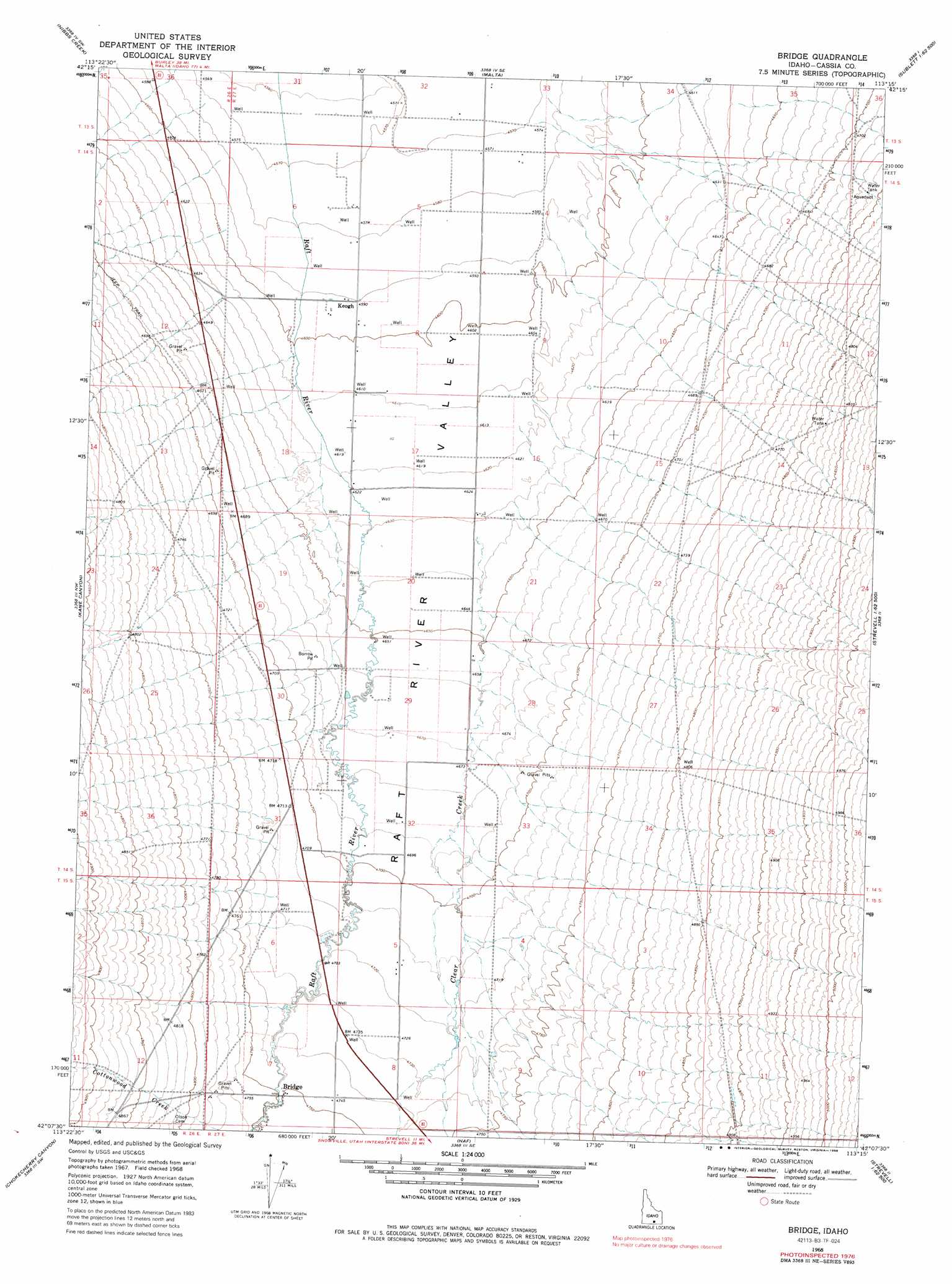
USGS Topo Quad 42113b3 - 1:24,000 scale
| Topo Map Name: | Bridge |
| USGS Topo Quad ID: | 42113b3 |
| Print Size: | ca. 21 1/4" wide x 27" high |
| Southeast Coordinates: | 42.125° N latitude / 113.25° W longitude |
| Map Center Coordinates: | 42.1875° N latitude / 113.3125° W longitude |
| U.S. State: | ID |
| Filename: | o42113b3.jpg |
| Download Map JPG Image: | Bridge topo map 1:24,000 scale |
| Map Type: | Topographic |
| Topo Series: | 7.5´ |
| Map Scale: | 1:24,000 |
| Source of Map Images: | United States Geological Survey (USGS) |
| Alternate Map Versions: |
Bridge ID 1968, updated 1986 Download PDF Buy paper map Bridge ID 2010 Download PDF Buy paper map Bridge ID 2013 Download PDF Buy paper map |
1:24,000 Topo Quads surrounding Bridge
Albion |
Idahome |
Malta Ne |
South Chapin Mountain |
North Heglar Canyon |
Connor Ridge |
Nibbs Creek |
Malta |
Sublett |
Sublett Reservoir |
Elba |
Kane Canyon |
Bridge |
Sandrock Canyon |
Sweetzer Canyon |
Jim Sage Canyon |
Chokecherry Canyon |
Naf |
Strevell |
Black Pine Peak |
Yost |
Standrod |
Rosevere Point |
Kelton Pass |
Curlew Junction |
> Back to 42113a1 at 1:100,000 scale
> Back to 42112a1 at 1:250,000 scale
> Back to U.S. Topo Maps home
Bridge topo map: Gazetteer
Bridge: Populated Places
Bridge elevation 1447m 4747′Keogh elevation 1400m 4593′
Bridge: Streams
Clear Creek elevation 1413m 4635′Cottonwood Creek elevation 1449m 4753′
Bridge: Valleys
Christy Canyon elevation 1413m 4635′Bridge digital topo map on disk
Buy this Bridge topo map showing relief, roads, GPS coordinates and other geographical features, as a high-resolution digital map file on DVD: