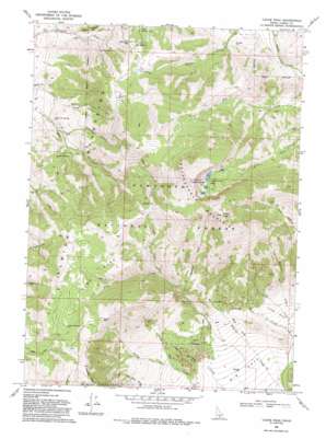
Cache Peak Topo Map Idaho
To zoom in, hover over the map of Cache Peak
USGS Topo Quad 42113b6 - 1:24,000 scale
| Topo Map Name: | Cache Peak |
| USGS Topo Quad ID: | 42113b6 |
| Print Size: | ca. 21 1/4" wide x 27" high |
| Southeast Coordinates: | 42.125° N latitude / 113.625° W longitude |
| Map Center Coordinates: | 42.1875° N latitude / 113.6875° W longitude |
| U.S. State: | ID |
| Filename: | o42113b6.jpg |
| Download Map JPG Image: | Cache Peak topo map 1:24,000 scale |
| Map Type: | Topographic |
| Topo Series: | 7.5´ |
| Map Scale: | 1:24,000 |
| Source of Map Images: | United States Geological Survey (USGS) |
| Alternate Map Versions: |
Cache Peak ID 1968, updated 1972 Download PDF Buy paper map Cache Peak ID 1968, updated 1980 Download PDF Buy paper map Cache Peak ID 1968, updated 1993 Download PDF Buy paper map Cache Peak ID 2001, updated 2006 Download PDF Buy paper map Cache Peak ID 2011 Download PDF Buy paper map Cache Peak ID 2013 Download PDF Buy paper map |
| FStopo: | US Forest Service topo Cache Peak is available: Download FStopo PDF Download FStopo TIF |
1:24,000 Topo Quads surrounding Cache Peak
> Back to 42113a1 at 1:100,000 scale
> Back to 42112a1 at 1:250,000 scale
> Back to U.S. Topo Maps home
Cache Peak topo map: Gazetteer
Cache Peak: Gaps
Basin-Elba Pass elevation 2159m 7083′Stines Pass elevation 2530m 8300′
Cache Peak: Lakes
Independence Lakes elevation 2774m 9101′Pot Holes elevation 2232m 7322′
Cache Peak: Parks
Almo Park elevation 2428m 7965′Castle Rocks State Park elevation 1981m 6499′
Cache Peak: Ranges
Albion Mountains elevation 2275m 7463′Castle Rocks elevation 2060m 6758′
Cache Peak: Springs
Bull Spring elevation 2127m 6978′Cold Spring elevation 2054m 6738′
Heath Spring elevation 1939m 6361′
Logger Spring elevation 2473m 8113′
Salt Lick Spring elevation 1802m 5912′
Sanford Spring elevation 1981m 6499′
Cache Peak: Streams
Aspen Creek elevation 2144m 7034′Black Creek elevation 1843m 6046′
Heath Creek elevation 1801m 5908′
Johnson Creek elevation 1883m 6177′
Cache Peak: Summits
Cache Peak elevation 3136m 10288′Independence Mountain elevation 2966m 9730′
Mount Independence elevation 3010m 9875′
Cache Peak: Trails
Rangers Trail elevation 2380m 7808′Cache Peak: Valleys
Myers Canyon elevation 1755m 5757′Slide Canyon elevation 1709m 5606′
Spring Canyon elevation 1844m 6049′
Cache Peak digital topo map on disk
Buy this Cache Peak topo map showing relief, roads, GPS coordinates and other geographical features, as a high-resolution digital map file on DVD:


