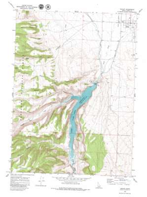
Oakley Topo Map Idaho
To zoom in, hover over the map of Oakley
USGS Topo Quad 42113b8 - 1:24,000 scale
| Topo Map Name: | Oakley |
| USGS Topo Quad ID: | 42113b8 |
| Print Size: | ca. 21 1/4" wide x 27" high |
| Southeast Coordinates: | 42.125° N latitude / 113.875° W longitude |
| Map Center Coordinates: | 42.1875° N latitude / 113.9375° W longitude |
| U.S. State: | ID |
| Filename: | o42113b8.jpg |
| Download Map JPG Image: | Oakley topo map 1:24,000 scale |
| Map Type: | Topographic |
| Topo Series: | 7.5´ |
| Map Scale: | 1:24,000 |
| Source of Map Images: | United States Geological Survey (USGS) |
| Alternate Map Versions: |
Oakley ID 1968, updated 1972 Download PDF Buy paper map Oakley ID 1968, updated 1979 Download PDF Buy paper map Oakley ID 2001, updated 2006 Download PDF Buy paper map Oakley ID 2011 Download PDF Buy paper map Oakley ID 2013 Download PDF Buy paper map |
| FStopo: | US Forest Service topo Oakley is available: Download FStopo PDF Download FStopo TIF |
1:24,000 Topo Quads surrounding Oakley
> Back to 42113a1 at 1:100,000 scale
> Back to 42112a1 at 1:250,000 scale
> Back to U.S. Topo Maps home
Oakley topo map: Gazetteer
Oakley: Airports
Oakley Municipal Airport elevation 1409m 4622′Oakley: Canals
West Canal elevation 1403m 4603′Oakley: Dams
Oakley Dam elevation 1443m 4734′Oakley: Populated Places
Oakley elevation 1393m 4570′Oakley: Reservoirs
Lower Goose Creek Reservoir elevation 1443m 4734′Oakley: Springs
Cowboy Spring elevation 1600m 5249′Fourmile Spring elevation 1684m 5524′
Oakley: Streams
Lone Cedar Creek elevation 1438m 4717′Sawmill Creek elevation 1406m 4612′
South Cottonwood Creek elevation 1502m 4927′
Trapper Creek elevation 1436m 4711′
Oakley: Valleys
Mackey Canyon elevation 1551m 5088′Walker Hollow elevation 1451m 4760′
Oakley digital topo map on disk
Buy this Oakley topo map showing relief, roads, GPS coordinates and other geographical features, as a high-resolution digital map file on DVD:


