Marion Se Topo Map Idaho
To zoom in, hover over the map of Marion Se
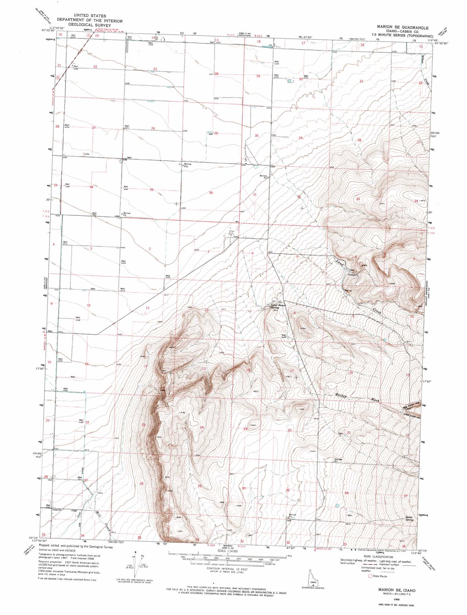
USGS Topo Quad 42113c7 - 1:24,000 scale
| Topo Map Name: | Marion Se |
| USGS Topo Quad ID: | 42113c7 |
| Print Size: | ca. 21 1/4" wide x 27" high |
| Southeast Coordinates: | 42.25° N latitude / 113.75° W longitude |
| Map Center Coordinates: | 42.3125° N latitude / 113.8125° W longitude |
| U.S. State: | ID |
| Filename: | o42113c7.jpg |
| Download Map JPG Image: | Marion Se topo map 1:24,000 scale |
| Map Type: | Topographic |
| Topo Series: | 7.5´ |
| Map Scale: | 1:24,000 |
| Source of Map Images: | United States Geological Survey (USGS) |
| Alternate Map Versions: |
Marion SE ID 1968, updated 1972 Download PDF Buy paper map Marion SE ID 2010 Download PDF Buy paper map Marion SE ID 2013 Download PDF Buy paper map |
1:24,000 Topo Quads surrounding Marion Se
Milner |
Burley Sw |
Burley |
Rupert |
Rupert Se |
Milner Butte |
Burley Butte |
Kenyon |
View |
Albion |
Buckhorn Canyon |
Marion |
Marion Se |
Mount Harrison |
Connor Ridge |
Severe Spring |
Oakley |
Basin |
Cache Peak |
Elba |
Ibex Peak |
Blue Hill |
Lyman Pass |
Almo |
Jim Sage Canyon |
> Back to 42113a1 at 1:100,000 scale
> Back to 42112a1 at 1:250,000 scale
> Back to U.S. Topo Maps home
Marion Se topo map: Gazetteer
Marion Se: Springs
Bedke Spring elevation 1606m 5269′Land Ranch Spring elevation 1396m 4580′
Marion Se: Streams
Land Creek elevation 1360m 4461′Mill Creek elevation 1391m 4563′
Marion Se: Valleys
Bedke Canyon elevation 1621m 5318′Big Cedar Canyon elevation 1547m 5075′
Little Cedar Canyon elevation 1543m 5062′
Mackey Wash elevation 1451m 4760′
Marion Se digital topo map on disk
Buy this Marion Se topo map showing relief, roads, GPS coordinates and other geographical features, as a high-resolution digital map file on DVD: