Lake Walcott Se Topo Map Idaho
To zoom in, hover over the map of Lake Walcott Se
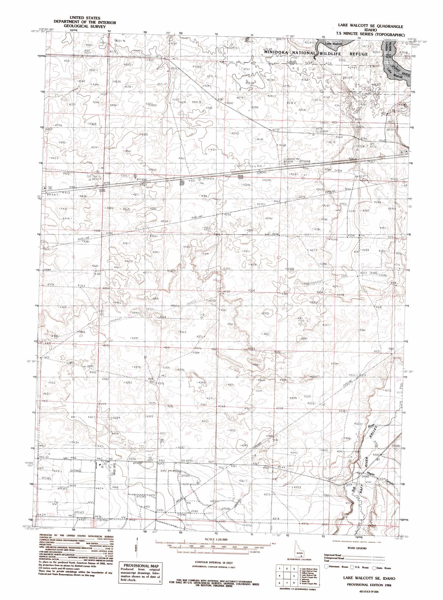
USGS Topo Quad 42113e3 - 1:24,000 scale
| Topo Map Name: | Lake Walcott Se |
| USGS Topo Quad ID: | 42113e3 |
| Print Size: | ca. 21 1/4" wide x 27" high |
| Southeast Coordinates: | 42.5° N latitude / 113.25° W longitude |
| Map Center Coordinates: | 42.5625° N latitude / 113.3125° W longitude |
| U.S. State: | ID |
| Filename: | o42113e3.jpg |
| Download Map JPG Image: | Lake Walcott Se topo map 1:24,000 scale |
| Map Type: | Topographic |
| Topo Series: | 7.5´ |
| Map Scale: | 1:24,000 |
| Source of Map Images: | United States Geological Survey (USGS) |
| Alternate Map Versions: |
Lake Walcott SE ID 1984, updated 1984 Download PDF Buy paper map Lake Walcott SE ID 2010 Download PDF Buy paper map Lake Walcott SE ID 2013 Download PDF Buy paper map |
1:24,000 Topo Quads surrounding Lake Walcott Se
Max |
Minidoka |
Schodde Well |
Rattlesnake Butte |
Pillar Butte Se |
Acequia |
Lake Walcott West |
Lake Walcott East |
Gifford Spring |
Register Rock |
Rupert Se |
Lake Walcott Sw |
Lake Walcott Se |
North Chapin Mountain |
Badger Peak |
Albion |
Idahome |
Malta Ne |
South Chapin Mountain |
North Heglar Canyon |
Connor Ridge |
Nibbs Creek |
Malta |
Sublett |
Sublett Reservoir |
> Back to 42113e1 at 1:100,000 scale
> Back to 42112a1 at 1:250,000 scale
> Back to U.S. Topo Maps home
Lake Walcott Se digital topo map on disk
Buy this Lake Walcott Se topo map showing relief, roads, GPS coordinates and other geographical features, as a high-resolution digital map file on DVD: