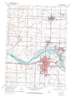
Burley Topo Map Idaho
To zoom in, hover over the map of Burley
USGS Topo Quad 42113e7 - 1:24,000 scale
| Topo Map Name: | Burley |
| USGS Topo Quad ID: | 42113e7 |
| Print Size: | ca. 21 1/4" wide x 27" high |
| Southeast Coordinates: | 42.5° N latitude / 113.75° W longitude |
| Map Center Coordinates: | 42.5625° N latitude / 113.8125° W longitude |
| U.S. State: | ID |
| Filename: | o42113e7.jpg |
| Download Map JPG Image: | Burley topo map 1:24,000 scale |
| Map Type: | Topographic |
| Topo Series: | 7.5´ |
| Map Scale: | 1:24,000 |
| Source of Map Images: | United States Geological Survey (USGS) |
| Alternate Map Versions: |
Burley SE ID 1964, updated 1966 Download PDF Buy paper map Burley SE ID 1964, updated 1979 Download PDF Buy paper map Burley ID 2010 Download PDF Buy paper map Burley ID 2013 Download PDF Buy paper map |
1:24,000 Topo Quads surrounding Burley
> Back to 42113e1 at 1:100,000 scale
> Back to 42112a1 at 1:250,000 scale
> Back to U.S. Topo Maps home
Burley topo map: Gazetteer
Burley: Airports
Burley Municipal Airport elevation 1264m 4146′Burley: Canals
B-4 Canal elevation 1266m 4153′Canal Number 20 elevation 1270m 4166′
D-Fourteen Drain elevation 1264m 4146′
D-q Drain elevation 1265m 4150′
D-Seventeen Drain elevation 1262m 4140′
D-Twelve Drain elevation 1264m 4146′
G 12 1/2 Lateral elevation 1278m 4192′
G 12 1/2 Pipeline elevation 1276m 4186′
G 14 Lateral elevation 1274m 4179′
G 15 A Pipeline elevation 1273m 4176′
G 15 B Lateral elevation 1275m 4183′
G 15 B Pipeline elevation 1275m 4183′
G 15 D Lateral elevation 1268m 4160′
G 15 Lateral elevation 1268m 4160′
G 15 Overland Pipeline elevation 1265m 4150′
G 15 Pipeline elevation 1273m 4176′
G 152 Lateral elevation 1268m 4160′
G 16 B Lateral elevation 1266m 4153′
G 16 Lateral elevation 1275m 4183′
G 17 Lateral elevation 1274m 4179′
G 18 A Lateral elevation 1273m 4176′
G 18 D Lateral elevation 1266m 4153′
G 18 Lateral elevation 1271m 4169′
G 19 B Lateral elevation 1267m 4156′
G 19 Lateral elevation 1266m 4153′
H 17 E Lateral elevation 1280m 4199′
H 17 E Pipeline elevation 1281m 4202′
H 17 G Lateral elevation 1277m 4189′
H 17 H Lateral elevation 1278m 4192′
H 17 M Lateral elevation 1278m 4192′
H 17 Rail Road Pipeline elevation 1278m 4192′
H 17 Spill Pipeline elevation 1266m 4153′
H 17 Spill Pipeline elevation 1263m 4143′
H 20 Lateral elevation 1281m 4202′
H 22 A Lateral elevation 1281m 4202′
H 22 B Lateral elevation 1281m 4202′
H 22 B Pipeline elevation 1275m 4183′
H 22 Lateral elevation 1282m 4206′
H 23 Lateral elevation 1282m 4206′
H 24 Pipeline elevation 1282m 4206′
H 25 Pipeline elevation 1279m 4196′
H 26 H Lateral elevation 1281m 4202′
H 27 Lateral elevation 1279m 4196′
H 29 Lateral elevation 1275m 4183′
H 30 Lateral elevation 1279m 4196′
H Waste elevation 1274m 4179′
J 27 F Pipeline elevation 1284m 4212′
J 27 F Waste elevation 1284m 4212′
J 27 F Waste Pipeline elevation 1284m 4212′
J 27 M Lateral elevation 1285m 4215′
J 32 G Lateral elevation 1282m 4206′
J 32 H Lateral elevation 1283m 4209′
J 32 I Lateral elevation 1282m 4206′
J 35 Lateral elevation 1284m 4212′
J 36 Drain elevation 1284m 4212′
J 36 Lateral elevation 1284m 4212′
J 37 Pipeline elevation 1287m 4222′
J 38 Lateral elevation 1284m 4212′
Snipe Drain elevation 1274m 4179′
Burley: Islands
Crow Island elevation 1261m 4137′Custer Island elevation 1261m 4137′
Goat Island elevation 1261m 4137′
Hog Island elevation 1261m 4137′
Burley: Parks
East Park elevation 1267m 4156′Freedom Park elevation 1263m 4143′
West Park elevation 1270m 4166′
Burley: Populated Places
Budge elevation 1267m 4156′Burley elevation 1269m 4163′
Heyburn elevation 1266m 4153′
Myers elevation 1266m 4153′
Paul elevation 1265m 4150′
Ruby elevation 1284m 4212′
Burley: Streams
Goose Creek elevation 1265m 4150′Goose Creek elevation 1264m 4146′
Goose Creek elevation 1265m 4150′
Burley: Wells
Hogan Well elevation 1269m 4163′Burley digital topo map on disk
Buy this Burley topo map showing relief, roads, GPS coordinates and other geographical features, as a high-resolution digital map file on DVD:


