Acequia Topo Map Idaho
To zoom in, hover over the map of Acequia
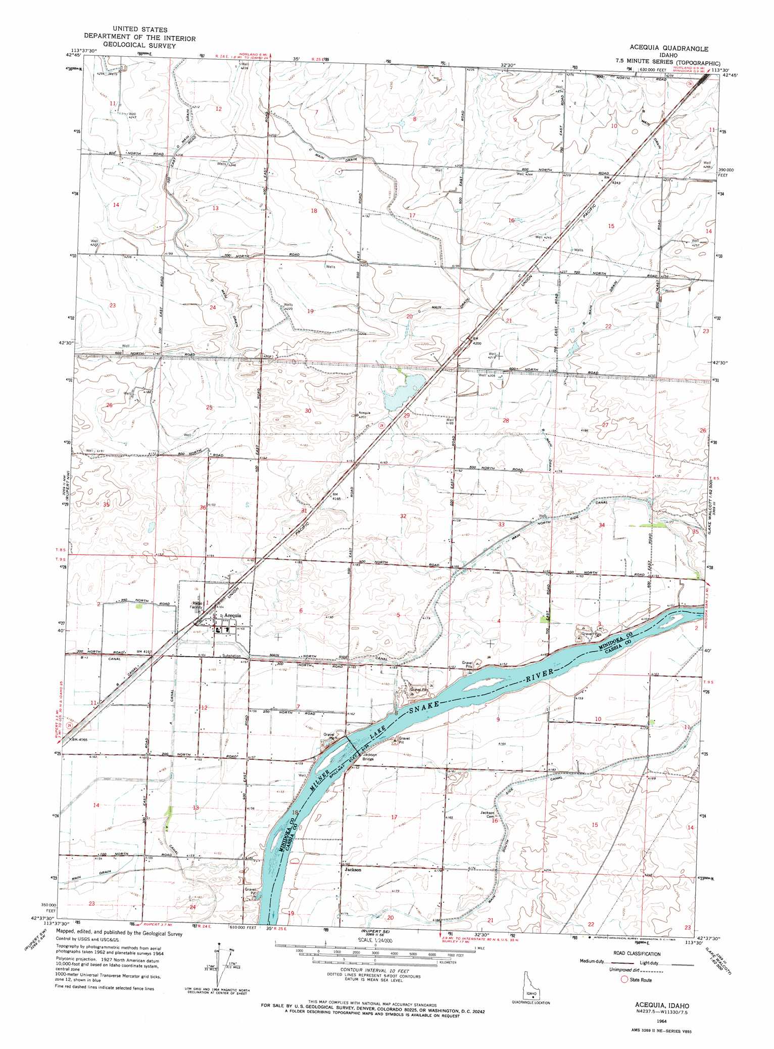
USGS Topo Quad 42113f5 - 1:24,000 scale
| Topo Map Name: | Acequia |
| USGS Topo Quad ID: | 42113f5 |
| Print Size: | ca. 21 1/4" wide x 27" high |
| Southeast Coordinates: | 42.625° N latitude / 113.5° W longitude |
| Map Center Coordinates: | 42.6875° N latitude / 113.5625° W longitude |
| U.S. State: | ID |
| Filename: | o42113f5.jpg |
| Download Map JPG Image: | Acequia topo map 1:24,000 scale |
| Map Type: | Topographic |
| Topo Series: | 7.5´ |
| Map Scale: | 1:24,000 |
| Source of Map Images: | United States Geological Survey (USGS) |
| Alternate Map Versions: |
Acequia ID 1964, updated 1965 Download PDF Buy paper map Acequia ID 2010 Download PDF Buy paper map Acequia ID 2013 Download PDF Buy paper map |
1:24,000 Topo Quads surrounding Acequia
Shale Butte |
Community Lake |
Larkspur Park |
Brigham Point |
Bear Trap Cave |
Kimama |
Norland |
Max |
Minidoka |
Schodde Well |
Burley Ne |
Rupert Nw |
Acequia |
Lake Walcott West |
Lake Walcott East |
Burley |
Rupert |
Rupert Se |
Lake Walcott Sw |
Lake Walcott Se |
Kenyon |
View |
Albion |
Idahome |
Malta Ne |
> Back to 42113e1 at 1:100,000 scale
> Back to 42112a1 at 1:250,000 scale
> Back to U.S. Topo Maps home
Acequia topo map: Gazetteer
Acequia: Bridges
Jackson Bridge elevation 1262m 4140′Acequia: Canals
B Main Drain elevation 1285m 4215′C Main Drain elevation 1279m 4196′
E Canal elevation 1269m 4163′
Main North Side Canal elevation 1273m 4176′
Acequia: Populated Places
Acequia elevation 1270m 4166′Jackson elevation 1269m 4163′
Acequia digital topo map on disk
Buy this Acequia topo map showing relief, roads, GPS coordinates and other geographical features, as a high-resolution digital map file on DVD: