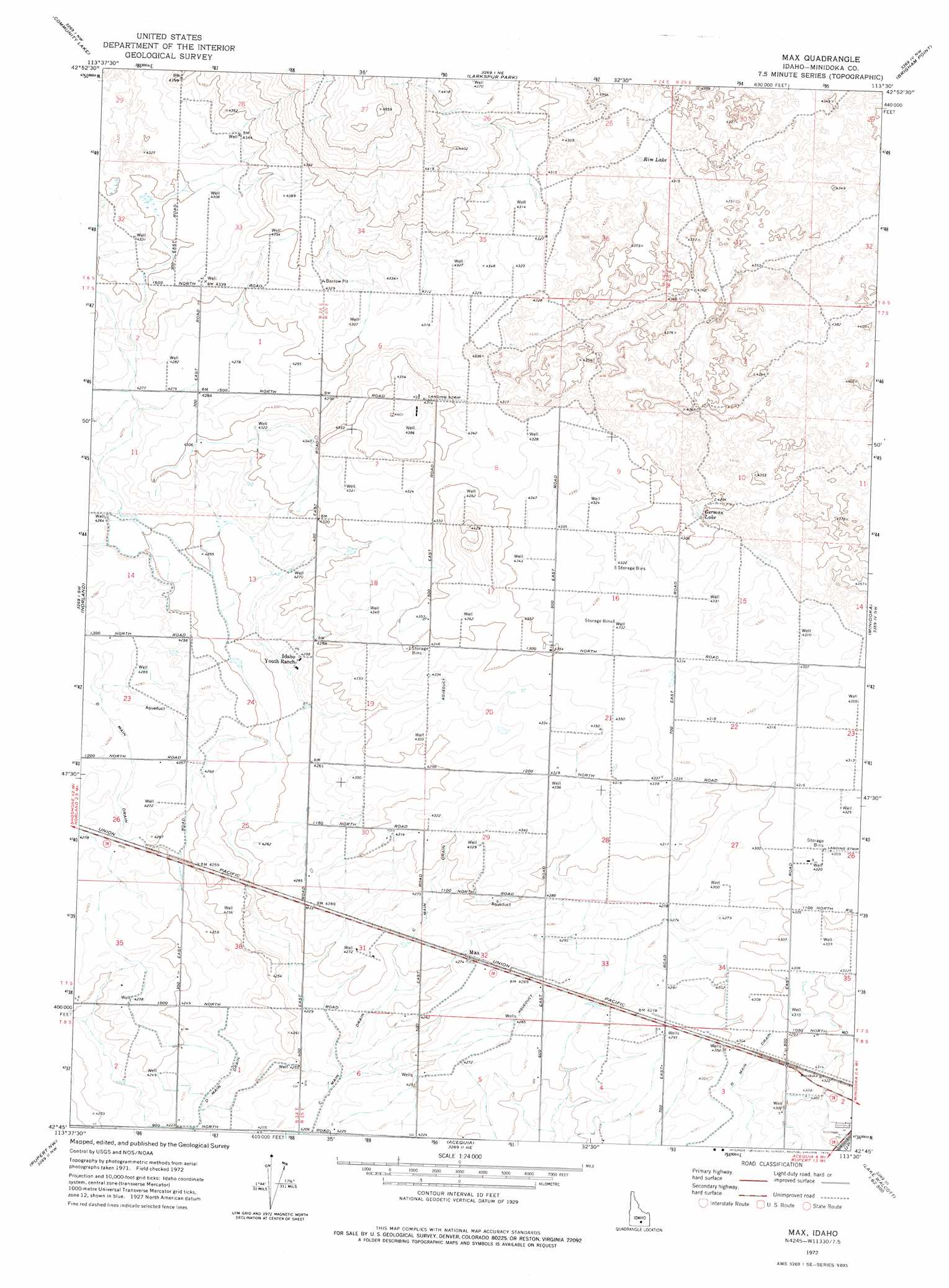
Max Topo Map Idaho
To zoom in, hover over the map of Max
USGS Topo Quad 42113g5 - 1:24,000 scale
| Topo Map Name: | Max |
| USGS Topo Quad ID: | 42113g5 |
| Print Size: | ca. 21 1/4" wide x 27" high |
| Southeast Coordinates: | 42.75° N latitude / 113.5° W longitude |
| Map Center Coordinates: | 42.8125° N latitude / 113.5625° W longitude |
| U.S. State: | ID |
| Filename: | o42113g5.jpg |
| Download Map JPG Image: | Max topo map 1:24,000 scale |
| Map Type: | Topographic |
| Topo Series: | 7.5´ |
| Map Scale: | 1:24,000 |
| Source of Map Images: | United States Geological Survey (USGS) |
| Alternate Map Versions: |
Max ID 1972, updated 1976 Download PDF Buy paper map Max ID 2010 Download PDF Buy paper map Max ID 2013 Download PDF Buy paper map |
1:24,000 Topo Quads surrounding Max
Halfway Lake |
Laidlaw Lake |
Bottleneck Lake |
Bear Park Sw |
Mule Butte |
Shale Butte |
Community Lake |
Larkspur Park |
Brigham Point |
Bear Trap Cave |
Kimama |
Norland |
Max |
Minidoka |
Schodde Well |
Burley Ne |
Rupert Nw |
Acequia |
Lake Walcott West |
Lake Walcott East |
Burley |
Rupert |
Rupert Se |
Lake Walcott Sw |
Lake Walcott Se |
> Back to 42113e1 at 1:100,000 scale
> Back to 42112a1 at 1:250,000 scale
> Back to U.S. Topo Maps home
Max topo map: Gazetteer
Max: Canals
D Main Drain elevation 1287m 4222′Max: Lakes
German Lake elevation 1315m 4314′Rim Lake elevation 1320m 4330′
Max digital topo map on disk
Buy this Max topo map showing relief, roads, GPS coordinates and other geographical features, as a high-resolution digital map file on DVD: