Bear Trap Cave Topo Map Idaho
To zoom in, hover over the map of Bear Trap Cave
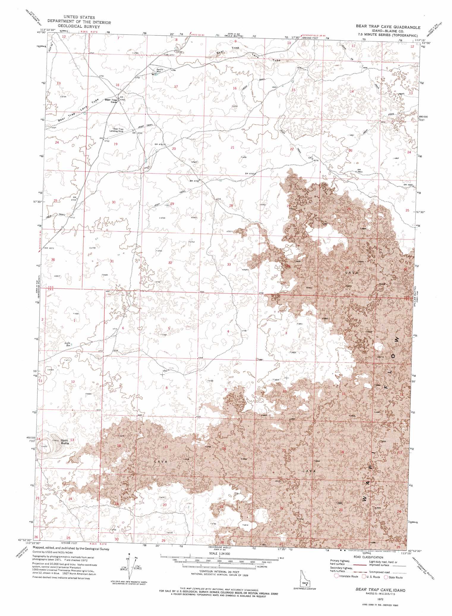
USGS Topo Quad 42113h3 - 1:24,000 scale
| Topo Map Name: | Bear Trap Cave |
| USGS Topo Quad ID: | 42113h3 |
| Print Size: | ca. 21 1/4" wide x 27" high |
| Southeast Coordinates: | 42.875° N latitude / 113.25° W longitude |
| Map Center Coordinates: | 42.9375° N latitude / 113.3125° W longitude |
| U.S. State: | ID |
| Filename: | o42113h3.jpg |
| Download Map JPG Image: | Bear Trap Cave topo map 1:24,000 scale |
| Map Type: | Topographic |
| Topo Series: | 7.5´ |
| Map Scale: | 1:24,000 |
| Source of Map Images: | United States Geological Survey (USGS) |
| Alternate Map Versions: |
Bear Trap Cave ID 1972, updated 1975 Download PDF Buy paper map Bear Trap Cave ID 2010 Download PDF Buy paper map Bear Trap Cave ID 2013 Download PDF Buy paper map |
1:24,000 Topo Quads surrounding Bear Trap Cave
Bear Den Butte |
Bear Park West |
Bear Park East |
Antelope Lake |
Split Top |
Bottleneck Lake |
Bear Park Sw |
Mule Butte |
Mosby Butte |
Mosby Well |
Larkspur Park |
Brigham Point |
Bear Trap Cave |
Pillar Butte |
Pillar Butte Ne |
Max |
Minidoka |
Schodde Well |
Rattlesnake Butte |
Pillar Butte Se |
Acequia |
Lake Walcott West |
Lake Walcott East |
Gifford Spring |
Register Rock |
> Back to 42113e1 at 1:100,000 scale
> Back to 42112a1 at 1:250,000 scale
> Back to U.S. Topo Maps home
Bear Trap Cave topo map: Gazetteer
Bear Trap Cave: Airports
Bear Trap Airport elevation 1439m 4721′Bear Trap Cave: Lavas
Bear Trap Lava Tube elevation 1458m 4783′Bear Trap Cave: Reservoirs
Lulu Reservoir elevation 1429m 4688′Bear Trap Cave: Summits
Split Butte elevation 1435m 4708′Bear Trap Cave digital topo map on disk
Buy this Bear Trap Cave topo map showing relief, roads, GPS coordinates and other geographical features, as a high-resolution digital map file on DVD: