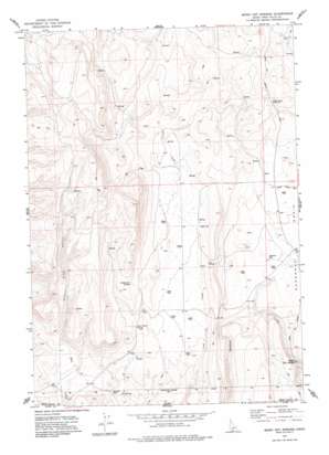
Magic Hot Springs Topo Map Idaho
To zoom in, hover over the map of Magic Hot Springs
USGS Topo Quad 42114a5 - 1:24,000 scale
| Topo Map Name: | Magic Hot Springs |
| USGS Topo Quad ID: | 42114a5 |
| Print Size: | ca. 21 1/4" wide x 27" high |
| Southeast Coordinates: | 42° N latitude / 114.5° W longitude |
| Map Center Coordinates: | 42.0625° N latitude / 114.5625° W longitude |
| U.S. State: | ID |
| Filename: | o42114a5.jpg |
| Download Map JPG Image: | Magic Hot Springs topo map 1:24,000 scale |
| Map Type: | Topographic |
| Topo Series: | 7.5´ |
| Map Scale: | 1:24,000 |
| Source of Map Images: | United States Geological Survey (USGS) |
| Alternate Map Versions: |
Magic Hot Springs ID 1977, updated 1978 Download PDF Buy paper map Magic Hot Springs ID 2010 Download PDF Buy paper map Magic Hot Springs ID 2013 Download PDF Buy paper map |
1:24,000 Topo Quads surrounding Magic Hot Springs
> Back to 42114a1 at 1:100,000 scale
> Back to 42114a1 at 1:250,000 scale
> Back to U.S. Topo Maps home
Magic Hot Springs topo map: Gazetteer
Magic Hot Springs: Springs
Magic Hot Springs elevation 1665m 5462′Mule Creek Springs elevation 1836m 6023′
Rattlesnake Springs elevation 1825m 5987′
Rock Cabin Spring elevation 1754m 5754′
Winter Spring elevation 1790m 5872′
Magic Hot Springs: Valleys
Mule Creek Canyon elevation 1737m 5698′Magic Hot Springs: Wells
Whiterock Well elevation 1690m 5544′Magic Hot Springs digital topo map on disk
Buy this Magic Hot Springs topo map showing relief, roads, GPS coordinates and other geographical features, as a high-resolution digital map file on DVD:


