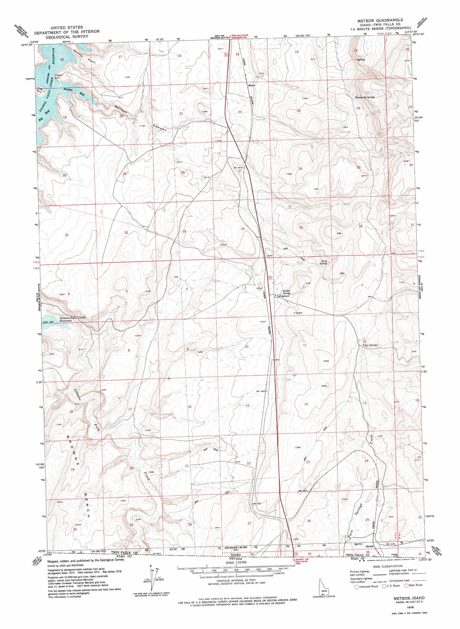
Norton Canyon Topo Map Idaho
To zoom in, hover over the map of Norton Canyon
USGS Topo Quad 42114a6 - 1:24,000 scale
| Topo Map Name: | Norton Canyon |
| USGS Topo Quad ID: | 42114a6 |
| Print Size: | ca. 21 1/4" wide x 27" high |
| Southeast Coordinates: | 42° N latitude / 114.625° W longitude |
| Map Center Coordinates: | 42.0625° N latitude / 114.6875° W longitude |
| U.S. State: | ID |
| Filename: | o42114a6.jpg |
| Download Map JPG Image: | Norton Canyon topo map 1:24,000 scale |
| Map Type: | Topographic |
| Topo Series: | 7.5´ |
| Map Scale: | 1:24,000 |
| Source of Map Images: | United States Geological Survey (USGS) |
| Alternate Map Versions: |
Meteor ID 1978, updated 1978 Download PDF Buy paper map Norton Canyon ID 2010 Download PDF Buy paper map Norton Canyon ID 2013 Download PDF Buy paper map |
1:24,000 Topo Quads surrounding Norton Canyon
Roseworth |
Roseworth Se |
Hollister Sw |
Hollister |
Mcmullen Basin |
Cedar Creek Reservoir |
Browns Bench North |
Salmon Butte |
Rogerson |
Hopper Gulch |
Taylor Canyon |
Browns Bench South |
Norton Canyon |
Magic Hot Springs |
Big Creek Ranch |
Bear Mountain |
Browns Bench Ranch |
Jackpot |
East Of Jackpot |
Gollaher Mountain |
Twin Meadows Ranch |
Contact |
Middle Stack Mountain |
Tijuana John Peak |
Devils Pass |
> Back to 42114a1 at 1:100,000 scale
> Back to 42114a1 at 1:250,000 scale
> Back to U.S. Topo Maps home
Norton Canyon topo map: Gazetteer
Norton Canyon: Bays
Nortons Bay elevation 1527m 5009′Norton Canyon: Capes
Crappie Point elevation 1544m 5065′Luds Point elevation 1549m 5082′
Saddle Point elevation 1553m 5095′
Norton Canyon: Springs
Rabbit Spring elevation 1680m 5511′Sand Spring elevation 1731m 5679′
Threemile Spring elevation 1895m 6217′
Threemile Spring elevation 1753m 5751′
Twin Springs elevation 1735m 5692′
Norton Canyon: Valleys
Norton Canyon elevation 1527m 5009′Norton Canyon digital topo map on disk
Buy this Norton Canyon topo map showing relief, roads, GPS coordinates and other geographical features, as a high-resolution digital map file on DVD: