Taylor Canyon Topo Map Idaho
To zoom in, hover over the map of Taylor Canyon
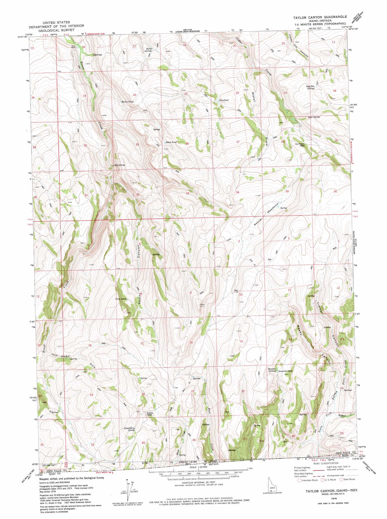
USGS Topo Quad 42114a8 - 1:24,000 scale
| Topo Map Name: | Taylor Canyon |
| USGS Topo Quad ID: | 42114a8 |
| Print Size: | ca. 21 1/4" wide x 27" high |
| Southeast Coordinates: | 42° N latitude / 114.875° W longitude |
| Map Center Coordinates: | 42.0625° N latitude / 114.9375° W longitude |
| U.S. States: | ID, NV |
| Filename: | o42114a8.jpg |
| Download Map JPG Image: | Taylor Canyon topo map 1:24,000 scale |
| Map Type: | Topographic |
| Topo Series: | 7.5´ |
| Map Scale: | 1:24,000 |
| Source of Map Images: | United States Geological Survey (USGS) |
| Alternate Map Versions: |
Taylor Canyon ID 1978, updated 1978 Download PDF Buy paper map Taylor Canyon ID 2010 Download PDF Buy paper map Taylor Canyon ID 2013 Download PDF Buy paper map |
1:24,000 Topo Quads surrounding Taylor Canyon
Coonskin Butte |
Big Bend Crossing |
Roseworth |
Roseworth Se |
Hollister Sw |
Salls Crossing |
Grassy Hills |
Cedar Creek Reservoir |
Browns Bench North |
Salmon Butte |
Three Creek |
Curtis Draw |
Taylor Canyon |
Browns Bench South |
Norton Canyon |
Caudle Creek |
Elk Mountain |
Bear Mountain |
Browns Bench Ranch |
Jackpot |
Goat Creek |
Buckhorn Ridge |
Twin Meadows Ranch |
Contact |
Middle Stack Mountain |
> Back to 42114a1 at 1:100,000 scale
> Back to 42114a1 at 1:250,000 scale
> Back to U.S. Topo Maps home
Taylor Canyon topo map: Gazetteer
Taylor Canyon: Flats
Beaver Meadows elevation 2158m 7080′Taylor Canyon: Lakes
Dry Pond elevation 2003m 6571′Johns Pond elevation 2027m 6650′
Merles Pond elevation 1898m 6227′
Twin Lakes elevation 2161m 7089′
Taylor Canyon: Springs
Big Spring elevation 1857m 6092′Dove Spring elevation 2080m 6824′
Horse Springs elevation 1898m 6227′
Meadow Springs elevation 2182m 7158′
Sage Hen Springs elevation 2102m 6896′
Strawberry Spring elevation 2275m 7463′
Taylor Canyon: Streams
Barbour Creek elevation 1970m 6463′Taylor Creek elevation 1849m 6066′
Taylor Canyon: Valleys
Jack Walker Draw elevation 2085m 6840′Malat Draw elevation 1945m 6381′
Rocky Canyon elevation 1982m 6502′
Taylor Canyon elevation 1865m 6118′
Timber Canyon elevation 1982m 6502′
Taylor Canyon digital topo map on disk
Buy this Taylor Canyon topo map showing relief, roads, GPS coordinates and other geographical features, as a high-resolution digital map file on DVD: