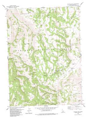
Trapper Peak Topo Map Idaho
To zoom in, hover over the map of Trapper Peak
USGS Topo Quad 42114b2 - 1:24,000 scale
| Topo Map Name: | Trapper Peak |
| USGS Topo Quad ID: | 42114b2 |
| Print Size: | ca. 21 1/4" wide x 27" high |
| Southeast Coordinates: | 42.125° N latitude / 114.125° W longitude |
| Map Center Coordinates: | 42.1875° N latitude / 114.1875° W longitude |
| U.S. State: | ID |
| Filename: | o42114b2.jpg |
| Download Map JPG Image: | Trapper Peak topo map 1:24,000 scale |
| Map Type: | Topographic |
| Topo Series: | 7.5´ |
| Map Scale: | 1:24,000 |
| Source of Map Images: | United States Geological Survey (USGS) |
| Alternate Map Versions: |
Trapper Peak ID 1979, updated 1979 Download PDF Buy paper map Trapper Peak ID 2001, updated 2006 Download PDF Buy paper map Trapper Peak ID 2011 Download PDF Buy paper map Trapper Peak ID 2013 Download PDF Buy paper map |
| FStopo: | US Forest Service topo Trapper Peak is available: Download FStopo PDF Download FStopo TIF |
1:24,000 Topo Quads surrounding Trapper Peak
> Back to 42114a1 at 1:100,000 scale
> Back to 42114a1 at 1:250,000 scale
> Back to U.S. Topo Maps home
Trapper Peak topo map: Gazetteer
Trapper Peak: Flats
Bear Flat elevation 2228m 7309′Fuller Pasture elevation 2147m 7043′
Trapper Peak: Pillars
Pinnacle elevation 2325m 7627′Trapper Peak: Ridges
Cotton Ridge elevation 2218m 7276′Hudson Ridge elevation 2210m 7250′
Trapper Peak: Springs
Badger Mountain Spring elevation 1932m 6338′Bear Gulch Spring elevation 2187m 7175′
Bed Spring elevation 1978m 6489′
Bostetter Pasture Spring elevation 2169m 7116′
Bostetter Spring elevation 2193m 7194′
Briggs Spring elevation 2160m 7086′
Buttars Spring elevation 2091m 6860′
Cabin Spring elevation 2239m 7345′
Cabin Spring Number Two elevation 2184m 7165′
Chicken Spring elevation 2245m 7365′
Coal Pit Spring elevation 2166m 7106′
Cotton Spring elevation 2126m 6975′
Counting Chute Spring elevation 2240m 7349′
Cow Spring elevation 1987m 6519′
Cow-S Spring elevation 1991m 6532′
Coyote Spring elevation 2165m 7103′
Cranny Spring elevation 2137m 7011′
Dry Flat Spring elevation 2065m 6774′
Flatiron Spring elevation 2258m 7408′
Grouse Spring elevation 2236m 7335′
Hudson Ridge Spring elevation 2188m 7178′
Jarvis Spring elevation 2233m 7326′
Jones Spring elevation 2157m 7076′
Ledge Rock Spring elevation 2135m 7004′
Martindale Spring elevation 2024m 6640′
Picketts Upper Trough Spring elevation 2286m 7500′
Pocket Spring elevation 2251m 7385′
Telephone Spring elevation 2163m 7096′
Terrells Spring elevation 2194m 7198′
Upper Coal Pit Spring elevation 2179m 7148′
Worm Corral Spring elevation 2191m 7188′
Trapper Peak: Streams
A H Creek elevation 1824m 5984′Bear Flat Creek elevation 2090m 6856′
Cabin Spring Creek elevation 2077m 6814′
Cotton Creek elevation 1711m 5613′
Coyote Creek elevation 2068m 6784′
Dry Fork elevation 1964m 6443′
Ecklund Creek elevation 2046m 6712′
First Fork Rock Creek elevation 1884m 6181′
Flatiron Creek elevation 1979m 6492′
Little Fork Third Fork Rock Creek elevation 1866m 6122′
Martindale Fork elevation 1864m 6115′
Pickett Spring Creek elevation 2076m 6811′
Pole Creek elevation 2195m 7201′
Sawmill Creek elevation 2007m 6584′
Second Fork Rock Creek elevation 1653m 5423′
Trail Creek elevation 1726m 5662′
White Stump Creek elevation 2134m 7001′
Trapper Peak: Summits
Badger Mountain elevation 2303m 7555′Flatiron Mountain elevation 2377m 7798′
Freds Mound elevation 2314m 7591′
Fuller Peak elevation 2274m 7460′
Harrington Peak elevation 2219m 7280′
Monument Peak elevation 2451m 8041′
Trapper Peak elevation 2400m 7874′
Trapper Peak: Valleys
Bear Gulch elevation 1977m 6486′Poison Gulch elevation 2028m 6653′
Telephone Canyon elevation 2026m 6646′
Worm Corral Hollow elevation 1997m 6551′
Trapper Peak digital topo map on disk
Buy this Trapper Peak topo map showing relief, roads, GPS coordinates and other geographical features, as a high-resolution digital map file on DVD:


